Glenridding Dodd, Sheffield Pike, Greenside Mine & Operation Orpheus
What connects an Ancient Greek legend about a lovelorn musician and his snake-bitten sweetheart, an American scientist with an explosive theory, an international initiative to stem the nuclear arms race, and an old lead mine in the hills above Ullswater? I trek over Glenridding Dodd and Sheffield Pike to find out.
In Greek mythology, Orpheus was a musician so accomplished that his playing could charm all living things. When his lover, Eurydice, fell into a viper’s nest and died of snake bites, Orpheus descended into the underworld where his song induced the god, Hades, to release Eurydice back into the land of the living. Her freedom came with a condition, however: Orpheus was to walk in front and not to look around until they were both out in the upper world. But Orpheus turned too soon, and Eurydice was lost to the underworld forever.

Orpheus was to return to the underworld in 1960, in Cumbria, and sadly, the objective of his endeavours would again fail to make it out alive. This time, the underworld was Greenside Mine near Glenridding, Orpheus was Operation Orpheus, and the object of his endeavour was not Eurydice, but the ratification of a nuclear weapons test ban treaty between the West and the Soviet Union.
The years following the end of WWII saw the West and the Eastern Bloc embroiled in the Cold War; a period of mounting political tension and mutual distrust that led both sides to amass nuclear arsenals in the hope that Mutually Assured Destruction would deter attack. By the 1950’s, the cost of this arms race had become unsustainable, and both sides were looking for some form of non-proliferation agreement. In 1958, negotiations began towards a test ban treaty.
Unfortunately, an American scientist, named Albert Latter, lobbed a large spanner into the works. Latter theorised that if a subterranean explosion was suspended in an empty chamber roughly the size of the hole that would have been created by the blast had it been detonated in tightly packed rock, then the explosion would register as many times smaller than it actually was on seismographs located above ground. If Latter was right, either side might be able to cheat a ban by testing underground.

Proving or disproving Latter’s theory became a matter of international urgency, and joint Anglo-American research projects were launched. The British initiative, code-named, Operation Orpheus, was the work of scientists from the Atomic Weapons Research Establishment (AWRE). Underground explosions were tested in Cornwall, but the second phase of the investigation required a larger chamber, and AWRE turned its attention to Greenside Mine.

Stybarrow Dodd is a prominent peak on the Helvellyn massif. Its western slopes fall to Thirlmere, and it is closely bounded by Raise to the south and by Watson Dodd and Great Dodd to the north-west and north-east, but to the south-east it extends a long shoulder over Greenside and Sheffield Pike to Glenridding Dodd above Ullswater. Greenside Mine nestles in the col where Greenside, Raise and Sheffield Pike meet. Between 1825 and 1962, it was one of England’s most successful lead mines, extracting large amounts of the metal along with smaller quantities of silver. It spearheaded the use of hydroelectric power, harnessing the natural resources of Swart Beck and Glenridding Beck, the latter fed by Helvellyn’s Red Tarn and Kepple Cove Tarn, both of which were dammed to provide greater capacity. Its main tunnel ran deep below Greenside’s eastern ridge, but by the end of the 1950’s, its lead seams were exhausted, and the mine was in the process of closing down. Operation Orpheus was to be its swan song.

Once AWRE had reassured anxious Glenridding residents that no fissile material would be involved in the experiment, months were spent putting everything in place. The tests would comprise two explosions: the first, a large detonation “decoupled” from the rock by its suspension in a large empty chamber; the second, a smaller explosion “coupled” to the rock by packing the explosives into a narrow cross shaft. The decoupled detonation would require 3000 lb of explosive, arranged in 7 layers of 36 boxes, each weighing 12 lb. The coupled explosion would be approximately 3 times smaller. If Latter’s theory was correct, the recording equipment would register each as roughly the same size. Six recording stations were set up, the nearest half a mile from the mine, the furthest, 47 miles away in Malham, Yorkshire.

On Saturday 19th December 1959, the button was pressed and the decoupled explosive detonated. Significantly, a recording station in Sedbergh failed to register any seismic activity at all, suggesting decoupling might be even more effective than Latter had anticipated. Below the surface, however, the blast was so powerful it destroyed some of the electrical equipment that had been set up to trigger the second detonation with the result that it had to be postponed until after Christmas.

Tragically, preparations for the second test claimed two lives. The first explosion released large quantities of carbon monoxide and smaller amounts of cyanide. Blowers were installed to disperse the gas, and a mix of high-tech detection equipment, and old school methods (mice and canaries) were used to identify its lingering presence. Despite all the precautions, two mine workers, William Sinkinson and Alex Santamara, wandered into a stope that was still contaminated. When shift boss, John Pattinson Brown, realised they were missing, he went in search of the men with the help of Arnold Lewis and Fred Dawes. Dawes climbed the ladder to the stope where he saw Santamara’s body slumped. While Brown went for help, Dawes and Lewis entered the stope, holding their breath for protection, and managed to pull Santamara to the edge by the ladder, but could get him no further. When Brown returned with a rescue team and a doctor, Dawes and Lewis had passed out too. Luckily, they recovered, but the help had come too late for Santamara and Sinkinson.
With the second detonation, hopes of ratifying the treaty died too. Albert Latter’s theory had been proven right. Both sides temporarily resumed nuclear weapons tests, but they returned to the table in 1963 when a partial test ban was agreed. This treaty excluded underground testing, which, as Operation Orpheus had helped demonstrate, could too easily be disguised.

~
Beyond Troutbeck, mist fills the roadside hollows, and the tops are hidden, but as the car crests the brow of the Kirkstone Pass and begins the winding descent to Patterdale, the cloud-line is a little higher. As I drive through the village, the eastern shoulder of Birks stands proud, and as I approach Glenridding, Glenridding Dodd has a narrow band of clear sky above.
In the carpark, a woman who looks exactly like the Queen is examining the pebbles that line the top of the drystone wall. I can’t tell if she’s pinching some to augment the rockery at Balmoral, or whether she’s donating specimens from the royal collection—a spot of benefactory community service perhaps, before zipping off to Carlisle for the races.
On Greenside Road, I get talking to a lad who’s heading for Helvellyn; he’s a little concerned at the lack wind and the prospect of spending all day with his head in the clouds. When I say I’m heading for Glenridding Dodd and Sheffield Pike, he tells me he did those a couple weeks ago. We look up at the craggy drama of the Pike, perched above the sheer screes that line the old mine road.
“There is a path,” he assures me. “Not that you’d guess it from here.”

We part company when I leave the road to climb behind the old miners’ cottages and join the rake that runs up to the col between Glenridding Dodd and Sheffield Pike. It’s unrelentingly steep, especially in the lower reaches, and my calves complain all the way up to the wall that runs across the saddle.
In Wainwright’s time, Glenridding Dodd had fallen from public favour. “Fashions change”, he writes. “When people climbed hills only for the sake of the views, the heathery summit of Glenridding Dodd must have been more frequented than it is today, for once-popular paths of ascent are now overgrown and neglected.”
While still a lesser-trodden fell, the legacy of AW’s Pictorial Guide has ensured a steady stream of Wainwright baggers so the path is now easier to pick out. He’s not wrong about the views. The summit grants a grand vista north-eastward over the lake.
Ullswater changes her mood to match the seasons: on long summer days she’s joyful and uplifting; in autumn, brooding and mysterious; today, she’s sullen and reflective, as if pondering the folly of humans who spend lifetimes perfecting weaponry powerful enough to destroy themselves and the planet with them.

Footsteps break my thoughts, and a man from Egremont joins me at the cairn. As we chat, he says he’s heard of another cairn, further down on the south-eastern side, that commands magnificent views over Glenridding and the southern end of the lake. I follow him down through the heather to a small stone beacon, perched above a plunging drop. The aspect is brooding and dramatic. Across the water, Place Fell hides in mist and the water below is the steely grey of armour plate.
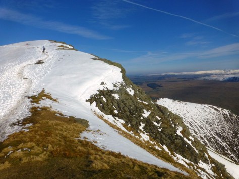
This gentleman is heading for Sheffield Pike too. On the way back down to the col, he tells me how he lost the path on Grange Fell, the other day, and had to make a tricky, improvised descent to get down before dark. When we reach the col, he opts not to join me on the crags of Heron Pike—apparently last time he tried it, he lost the path here too.
I’m not so easily deterred, the ridge that leads to the subsidiary summit of Heron Pike promises to be the best bit, and I’m up for a bit of semi-scrambling, if needed. His words strike a note of caution, all the same. In the event, the trod is narrow but well-defined. It picks such a canny line between the steep craggy outcrops that (despite appearances) three points of contact are never required. I start to wonder if losing paths is a regular affliction for my new acquaintance, but then I note the ubiquitous heather, now winter-brown and died-back; in late summer, I’ll warrant the way is easily lost under foliage.

The top of Heron Pike yields yet more arresting vistas over Ullswater. Filtered through the cloud, the light is subdued but ethereal. To the south, the spectral outline of Catstye Cam is slowly emerging from veils of mist. It’s a scene far more evocative of Greek mysteries than the harsh realities of the Cold War. Perhaps because the deeper truths of mythology are timeless, whereas the Cold War tensions should long ago have been confined to the history books.


But of course they haven’t. I was born six years after Operation Orpheus, and I grew up in Salisbury, the quaint market town that has now become a symbol of renewed distrust between Russia and the West. The Bishop’s Mill—the pub where the Skripals stopped for a drink before collapsing on a nearby bench—was a favourite haunt in my late teens. It was the venue for many a near alcohol poisoning, but it’s galling to imagine it as the backdrop to an assassination attempt. It’s such a shame. I visited St Petersburg with work a few years ago. It’s a beautiful city, and I was made very welcome. I was there to meet doctors, pharmacists and biomedical scientists: men and women dedicated to saving lives, not taking them.
The ground changes beyond the top of Heron Pike, the rock and heather give way to a soggy depression before climbing again to the stony outcrop that forms the summit of Sheffield Pike. Wainwright loses interest at this point and gets positively hostile about Greenside mine below: “westwards the fell is drab and, in the environs of a vast lead mine, hideously scarred and downright ugly. Its rich mineral deposits have, paradoxically, caused its ruin: it has been robbed not only of its lead but of its appeal and attractiveness to walkers.”


My friend from Egremont has arrived already. He’s planning to follow the path around the prettier northern slopes back to Glencoyne, avoiding the mine. But industrial heritage holds its own fascination for me, especially as nearly sixty years of disuse has allowed nature to soften lines. The old mine buildings are now hostels and camping barns. For all its spoil heaps and scars, the hill is slowly healing itself. In a million years, there’ll be no trace of its wounds. There may no longer be any trace of humans either, but the hills will still be here. Such a timescale seems an eternity to us, but in mountain years, it’s a matter of weeks, and that’s only if these fells are middle-aged. For all we know, they might be in the first flush of youth, or barely out of the cradle.

The cloud is slowly lifting. The tops of Raise and Stybarrow Dodd are still concealed, but Greenside’s summit (known as White Stones) has emerged; shafts of sunlight break through to illuminate its grassy eastern ridge. If Wainwright thought these slopes drab, he must never have seen them emerge from shadow like this. I’m seized by the urge to stride on up Greenside and on to the Helvellyn massif, but I don’t have time. I have family coming around later, and I’ve promised them roast chicken, Yorkshire pudding, roast potatoes—the whole nine yards. I glance at my watch, but in my mind’s eye, I see hungry expectant faces turning to indignation and disappointment as they discover their chef was last seen ascending into the clouds with a head full of Greek tragedy and Cold War drama.

So instead, I descend to the track between the spoil heaps—the road to the underworld. The sun intensifies, and above, Greenside is a golden green ramp leading through the mists to a finer realm—a world where you can leave behind Wainwright’s “hideous scarring” and the perennial power struggles of human politics and gain fresh perspectives, learn nobler truths—just so long as you take heed of Orpheus and don’t look back too soon.

Further Reading
Murphy, Samuel. 2015: Grey Gold: Men, Mining and Metallurgy at the Greenside Lead Mine in Cumbria, England, 1825 to 1962.
Moiety Publishing, 1996. Extract available at:
http://www.subbrit.org.uk/rsg/features/operation_orpheus/index.html
Havis, Michael. (2017) ‘REVEALED: Britain’s lost nuclear test tunnels that survived a REAL blast’, The Daily Star, 10 March. Available at:
https://www.dailystar.co.uk/news/latest-news/595495/excelsior-tunnel-operation-orpheus-nuclear-uk-cold-war-ussr-usa-russia-cornwall/amp