Tag Archives: mountain

The Awesome Power of Pillar Rock

First scaled by a shepherd and eulogised by Wordsworth, Pillar Rock is a mountain cathedral that lured a Victorian vicar to his demise. It holds an enduring allure for climbers, but Wainwright declares it out-of-bounds for walkers. I enlist the help of a mountaineering & climbing instructor to get me to the top.

Mariner’s Mourning

In his poem, The Brothers, William Wordsworth tells the tragic tale of a mariner named Leonard, who returns to his home in Ennerdale to discover his beloved brother, James has died after falling from the top of Pillar Rock. Flushed with the success of his ascent, James had stretched out on the summit heath and fallen asleep, but his tendency to sleepwalk—a habit developed many years before, while pining for his seafaring brother—proved his literal downfall.

The poem was published in 1800, in Vol II of the Lyrical Ballads. In his notes, Wordsworth claims his inspiration came from a story told to him in the valley. If true, it would be the first known ascent of Pillar Rock, the dramatic freestanding outcrop from which Pillar Mountain takes its name.  Sadly, Wordsworth’s ballad is the only written record. 

Shepherd’s Delight

 “An isolated crag on the breast of a mountain flanking one of the most desolate of our Lake District dales. The very remoteness of its surroundings, as well as the apparent inaccessibility of its summit, no doubt fascinated as well as awed the shepherds.” So wrote H. M. Kelly in the 1923 guide to Pillar Rock he produced for the Fell and Rock Climbing Club. The first verified ascent, in 1826, was indeed by a shepherd and cooper, named John Atkinson. Rock climbing had long been a technique used by mountaineers to reach a summit, but during the nineteenth century, it evolved into a sport in its own right. Kelly recognises Atkinson’s feat as “the first seed”.

Pillar Rock

And that seed bore fruit. The same year, three more shepherds, J. Colebank, W. Tyson, and J. Braithwaite followed in Atkinson’s footsteps, and in 1870, Miss A. Barker became the first woman to make the climb. The second was Mary Westmorland, who climbed the rock in 1873 with her brothers, Thomas and Edward (best known for building the Westmorland Cairn on Great Gable). But Thomas’s subsequent report in the Whitehaven News provoked a sniffy but anonymous rebuttal:

“(I read) With incredulous amazement, the rhythmical account of an alleged ascent of the Pillar by two gentlemen and a lady, that in all probability what the Westmorland party climbed was not the Pillar Rock but Pillar Mountain a route which did not involve rock climbing to the summit”.

The Westmorlands were incensed, but their claim was soon verified when their friend and accomplished climber, George Seatree performed his own ascent. Seatree found a bottle on the summit containing the names of those distinguished individuals who had reached the spot before him. Thomas, Edward, and Mary were on the list.

The Patriarch of The Pillarites

The anonymous correspondent consequently broke cover and retracted his remark. He was a retired clergyman and veteran of the Battle of Waterloo, named James Jackson. Jackson was an enthusiastic fellwalker with a talent was for self-aggrandisement. Some years before, while serving as Vicar of Rivington, he gained a level of local fame (or notoriety) when the weather cock blew off the church. Local steeple jacks refused to make the climb, so Jackson took it on himself to do so, successfully scaling the spire and repairing the weathervane. The act divided his congregation, some applauded his courage while others condemned it as foolhardy. Jackson of course subscribed to the former view and penned a short verse for the local paper:

“Who has not heard of Steeple Jack,
That lion-hearted Saxon,
Though I am not he, he was my sire,
For I am Steeple Jackson”

Jackson had set his heart on Pillar Rock but must have imagined it beyond his abilities. As an incorrigible chauvinist, he clearly took umbrage at being upstaged by Mary, but now saw an opportunity to distinguish himself as the eldest person to conquer the Pillar. He wrote to George Seatree asking him to be his guide, but Seatree refused. Undeterred, Jackson sought the guidance of a climber named John Hodgson, who took the seventy-nine-year-old to the summit via the Slab and Notch route. Jackson duly proclaimed himself, to anyone who would listen, The Patriarch of the Pillarites.

Pillar Rock from the path to Pillar summit
Hallowed Ground

By the late 1800’s, rock climbing had gained significant popularity, spearheaded by such notable pioneers as W P Haskett Smith, John Robinson, and Owen Glynne Jones. Jones’s book, Rock-Climbing in the English Lake District became a bestseller.  The book was published and illustrated by climbers and photographers, George and Ashley Abraham, who accompanied Jones on many of his exploits.  In the W. M. Crook memoir that prefaces the second edition, George Abraham recalls:

“Two climbs with Mr. Jones are most strongly impressed on our memories, and these two would probably rank as the two finest rock climbs made in our district. These are the Scawfell Pinnacle from the second pitch in Deep Ghyll in 1896, and the conquest of the well known Walker’s Gully on the Pillar Rock in January 1899. Both of these were generally considered impossible.”

Graham leads the way up on to Pisgah from Jordan Gap
Graham Uney climbing out of Pisgah (on Pillar) the hard way, from Jordan Gap

Scafell Pinnacle and Pillar Rock demand a similar reverence. Jones said of Pillar Rock, “It springs up vertically from the steep fellside like a cathedral-front 500 feet high”. Wainwright described Scafell Pinnacle and its surrounding crags as a great cathedral. Each is buttressed by an easily scrambled rock called Pisgah, which takes the aspiring climber to within spitting distance of the true prize, only to find they are separated from it by a sheer drop, called the Jordan Gap.  The common names for these distinct features are inspired by the book of Deuteronomy, where God leads Moses to the top of Mount Pisgah and points across the River Jordan to the Promised Land.

Pisgah in front of Pillar Rock
Out of Bounds

Pillar Rock exerts an enduring allure for climbers and scramblers, but Wainwright declares it out-of-bounds for walkers—which presents a problem for anyone hoping to complete the Birketts. Bill Birkett’s guidebook, The Complete Lakeland Fells presents a list of Lakeland peaks over 1000 feet. They include 211 of the Wainwrights and 330 additional smaller summits. But there’s a sting in the tail. Birkett was a mountaineer who thought nothing of including Pillar Rock.

Fortunately, mountaineering & climbing instructors like Graham Uney offer roped and guided scrambles to fellwalkers who are ready to step out of their comfort zone. Last year, I climbed Pinnacle Ridge on St Sunday Crag with Graham, and this year, I signed up for Pillar Rock.

Plans seldom survive contact with the weather, and the persistent threat of thunderstorms has meant we have had to reschedule three times. Sadly, my friend Nikki Knappett, who accompanied us on Pinnacle Ridge, has had to drop out. Finally, with the first week of September heralding the return of warm sunshine, we are able to fix a date for the Wednesday.

Pillar Rock – The Mountain Cathedral

In the meantime, my friend, John Fleetwood gets in touch.  John is an accomplished scrambler, who has revised the Cicerone scrambling guides to the Lakes.  He is also a brilliant photographer who deeply understands the spiritual rapport we develop with wild places. He has just published a book called Beyond the View, in which he gives full expression to this sense of rapture. It contains a chapter which presents mountains as nature’s cathedrals. John knows I am due to climb Pillar Rock with Graham and asks if I would like to go and have a look at it in advance. To him, like Owen Glynne Jones, it is a mountain cathedral, but to fully appreciate its awe-inspiring countenance, we should approach it the way Jones and Wordsworth describe. From below. From Ennerdale.

John looking toward Ennerdale Water

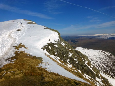
We park at Gatesgarth and climb Scarth Gap in early sun, Buttermere a tranquil mirror reflecting the chiselled majesty of Goat Crag. As we start to descend into Ennerdale, we fork right on a well-maintained path to cross the River Liza at a footbridge. As we enter the trees to start our ascent, the upward slope is severe, and the countenance of the walk abruptly changes from an amiable summer ramble to unforgiving slog. Pillar Rock is over 1000 ft above us, and to reach its foot is itself a challenge.

Buttermere and Goat Crag

John is a natural mountain hare. His pace doesn’t slacken. I fall behind and the order of the day is established—the hare’s swift legs will carry him far ahead, only to pause periodically to let his tortoise companion catch up.

Beyond the trees are stiff slopes of scree and stone, but with necks craned, the Rock towers into view above, an intimidating and awesome spectacle. Nervous anticipation serves as fuel to twinging calves, and the demanding terrain begins to feel like a quest or a pilgrimage—a test of our commitment.

Eventually, we reach its foot. A low rampart hugs the foot of the sheer northern cliff. Kelly calls it The Green Ledge. Above the ledge, slender plates of jagged slate rise skyward in a vertical array of niches and jutting icons, abstract and organic, vast and awe-inspiring, reinforcing the impression of an immense savage cathedral. It is daunting and humbling, and I feel my pulse quicken. And we can’t even see the top! This is the muscular buttress of Low Man. High Man, the summit, is set further back and not visible from this angle.

North Face of Pillar Rock
Walker’s Gully

We track round to the left where dolorous cleft of Walker’s Gully splits Pillar Rock from Shamrock, so named as from the east it appears to be part of the Pillar but is divided from it from it by a hollowed amphitheatre, a wide funnel of scree dropping into this sheer, narrow, dark and dank gully. Walker’s Gully is a highly misleading moniker. Could anywhere be less walker-friendly? Indeed, it is named after an unfortunate young man who fell here in 1883. Jones made this ascent in 1899, deep in winter and after days of torrential rain. His party were obliged to stand under an icy waterfall, and Jones had to remove his boots to climb out of a cave through a narrow hole in the roof. Standing barefoot in the snow nearly gave him frostbite. Despite his immense achievement, Jones’s chief account of Pillar Rock is of seconding John Robinson on an assault of the formidable north face. The Walker’s Gully report is included as an appendix, penned by George Abraham. Jones never got the chance to write it himself. He died some months later in an accident on Dent Blanche in the Swiss Alps. The second edition of his book was published posthumously.

Walker's Gully
Walker’s Gully
The Old West Route (as a Spectator)

We track beneath the Green Ledge and climb the steep slopes on the western side on a sketchy sheep trod. John perches on a rock and gazes up at the west face, High Man now towering above us like a jagged pyramid.

“Are you going up?” I ask.

“Thinking about it,” he replies. “Do you want to give it a go?”

He points out the line of the Old West Route (the way Atkinson ascended nearly 200 years ago). It looks doable, but it disappears on to Low Man, and John tells me it gets trickier after that. We don’t have a rope, so I would have to be sure I could get down again. Eventually, I decide discretion is the better part of valour and decline. John picks his way up the diagonal rake, and I watch conflicted, my heart desperate to follow, but my legs relishing the rest. I watch climbers on the northern corner of the west face and soak up the astonishing power of this vast natural edifice. Eventually, I hear a shout and look up to see John waving from the top. His descent is more circumspect, and when he reaches the bottom, he tells me I made a good decision. The rock on this side has escaped the morning sun. It’s still very wet and much trickier than anticipated.

Climbers on the corner of the West Face
Slab and Notch

We work up the stiff scree beside Pisgah and make the comparatively easy scramble to its top. The top feels tantalisingly close to High Man, but a sheer drop to Jordan Gap and the formidable wall beyond bar progress. Down to the east, we watch climbers traversing a crack in a large sloping slab. John tells me this is the slab of the Slab and Notch route and points out the notch some way above it. This is the route I’ll be taking with Graham. It looks dry, and suddenly I can’t wait for Wednesday.

Pisgah with Pillar Rock behind
Looking down to the Slab and Notch route
Climbers at the start of Slab and Notch
Mountain Memorials

When the day arrives, I meet Graham in the car park at Wasdale Head and we climb the path to Black Sail Pass, deep in conversation. The sky is clear, the sun is beating down, and it feels more like June than September. I’m parched by the time we reach Looking Stead, where we leave the main path to Pillar Summit and descend on to the High Level Traverse. This was the route popularised by John Robinson and his fellow Victorian climbers. Two thirds of the away along stands the Robinson Cairn, built in 1907 as a memorial to the great man by 100 of his comrades and friends.

Pillar Rock from the Robinson Cairn

At the eleventh hour, Jen Hellier has stepped in to take Nikki’s place, and she’s arranged to meet us here. She’s beaten us to it and is waiting when we arrive. After a brief chat, we set off for Great Doup (Pillar Cove on OS maps). Jen and Graham have both served with Mountain Rescue and are soon swapping anecdotes. I listen with deep interest and a burgeoning respect for the dedication involved. With the heat, our water bottles are already half depleted. Fortunately, Graham knows of a half-hidden spring. As he replenishes our supplies, I look around. Somewhere near here, there is an unobtrusive cross carved into the rock with the initials JJ. It was commissioned by John Robinson, Charles Baumgartner and one other in 1906. It commemorates James Jackson, who having succeeded in a second attempt to climb Pillar Rock, tragically fell to his death on a third. A cairn and iron cross erected on the spot where he was found were destroyed by storms, so the cross was conceived as an enduring memorial. The third commissioner was George Seatree, who, despite his initial misgivings, maintained a regular correspondence with Jackson and clearly warmed to him.

James Jackson's Memorial Cross (photo by Jen Hellier)
James Jackson’s Memorial Cross (photo by Jenny Hellier)
James Jackson's Memorial Cross (photo by Jen Hellier)
James Jackson’s Memorial Cross (photo by Jenny Hellier)
Hand to Rock

Ahead the cliffs of Shamrock rise like a wall, as yet indistinguishable from Pillar Rock itself. A broad sloping pavement cuts across, rising diagonally. This is the Shamrock Traverse. When we reach the far end, the sham is revealed. The broad sloping dish of the amphitheatre separates Shamrock from the much larger Pillar, which now looms above.

East Face of Pillar Rock from Shamrock

We stash our rucksacks at the base of Pisgah, refuel with a quick snack, and retrieve the rope, climbing racks and harnesses. It’s time to tackle Slab and Notch.

Scrambling up to the start of Slab & Notch

We descend into the amphitheatre. The way is steep and loose, and I accidentally dislodge a stone, prompting a tongue-in-cheek rebuke from Jen. When, to my shame, I do it again, she names me the Phantom Rock Slinger. We scramble up to the start of our climb. There are two ways on to the Slab. The first is easier, but then requires working down the Slab. Graham would find it hard to protect us with a rope this way, so he opts for climbing an 8 ft cleft in the wall. It’s somewhat daunting as to the right is a sheer drop, but we rope up and once on belay, we follow his lead, Jen going second and me last. As soon as we put hand to rock, the sense of exhilaration soars, and we’re already buzzing as we step out on to the Slab and start to traverse the crack, now performing the manoeuvre I watched from Pisgah, four days earlier.

Graham climbing up on to the Slab
Graham climbing up to the Slab
Jen and George on the Slab - photo by Graham
Jen and George on the Slab (photo by Graham Uney)

The Notch is high above us, and we watch Graham scale the rocky shoulder that leads up to it. Jen has a little climbing experience, which makes me the out-and-out novice. I relish the opportunity to learn and watch how Jen deftly tackles the same moves. Hand and foot holds are plentiful and soon, we are climbing through the gap to join Graham on the ledge beyond. We traverse around a corner to a smooth rock beneath a vertical wall. Graham walks straight over it, while Jen tracks below for better handholds—it takes her right out on the edge. Lacking Graham’s balance and Jen’s courage, I opt for walking over, my palms pressed against the wall in the hope of staying stable. The next pitch is a rocky ladder. We attach ourselves to the cam Graham has wedged in the rock and watch as he climbs and disappears from view.

Graham below the Notch
Graham climbing towards the Notch
Graham crossing the Notch
Jen after being lowered into Jordan Gap
Jen in Jordan Gap towards the end of our adventure
Jen climbing a rocky ladder

A minute or two later, we hear him exclaim, “Oh no, oh no!”

We look at each other in alarm, but Jen is perceptive, and her expression changes to one of recognition.

“That’s not ‘oh no, there’s something wrong’”, she suggests. “It’s ‘oh no, there’s something unpleasant’”.

A minute later, we hear Graham’s voice, “Someone’s had a poo up here!”

I don’t know whether I’m relieved or revulsed. Then I realise it’s both simultaneously. We climb the rocks above with an uneasy sense of anticipation and arrive at a natural alcove, big enough for the three of us to stand in a circle, only there is a tiny cairn in its midst—Graham’s commendable attempt to bury the unwelcome human offering—presumably an involuntary reaction to the significant exposure. I clamber onto a rocky shelf to give us all more room and look up. The contents of the cairn are forgotten instantly as I take in just where we are. Vaulting walls of rock reach skyward, a cavernous gully—the nave of the great savage cathedral.

Walls of rock vaulting skyward
Jen on the rocky staircase to the summit

Our onward route lies along a narrow ledge and up the final craggy staircase to the summit. As Jen seeks out holds for the final climb, she turns to me and says exactly what is going through my own mind, “I don’t want this to end”.

Approaching the summit - photo Graham
Approaching the summit (photo by Graham Uney)

The summit is unexpectedly broad and grassy, and the views are utterly edifying. Wispy strands of cirrus fleck a deep blue sky over the mottled green of High Stile and the darker distant peaks of Newlands and Coledale. While Graham secures a rope to lower us into Jordan Gap before our final scramble up and over Pisgah, Jen and I wander round enrapt, drinking it all in. It would take a lot of bottles to hold the names of all those who’ve made this ascent since Seatree’s time, but it still feels as if we’ve joined a select band; and the experience, though tame by the standards of Atkinson or Jones, or Fleetwood and Uney, is something that will stick with me forever.

The author on the summit

Info / Sources / Further Reading

Find Graham Uney on Facebook at:

https://www.facebook.com/grahamuneymountaineering

… or through his website:

https://www.grahamuneymountaineering.co.uk/classic-scrambles

John Fleetwood’s book, Beyond the View is a beautiful and thought-provoking exploration of our spiritual rapport with wild places. It is available here:

https://payhip.com/b/ghKFq

H. M. Kelly’s guide to Pillar Rock and Neighbouring Climbs can be found in PDF form here:

Frank Grant on Footless Crow and Raymond Greenhow on Scafell Hike have both written fascinating and detailed pieces on the Reverend James Jackson. Both are well worth a read:

Footless Crow:

http://footlesscrow.blogspot.com/2015/03/the-pillarite-patriarch.html?m=1

Scafell Hike:

https://scafellhike.blogspot.com/2019/06/reverend-james-jackson-memorial-cross.html?m=1

The Savage Temple at the Heart of Scafell

Wainwright compared Scafell Crag to a great cathedral where a man may lose all his conceit. I set off for Lord’s Rake and the West Wall Traverse with Wainwright archivist, Chris Butterfield and Lakeland Routes author, Richard Jennings to rediscover a sense of awe, experience the spiritual power of savage places and ponder whether we all need to reconnect with the sublime.

Cults of Nature

Norman Nicholson called it a cult of nature. Even at this early hour, a long line of pilgrims snakes up the grassy zig zags to Lingmell Col, above which the boulder field awaits: the desolate rocky desert at the summit of England’s highest mountain—Scafell Pike.

The author looking up at Mickledore Pikes Crag, Great Gable and the Lingmell Col path in the background - photo by Chris Butterfield
The author looking up at Mickledore; Pikes Crag, Great Gable & the Lingmell Col path in the background – photo by Chris Butterfield

All this began with a book. Until the late 1700’s, no-one visited Lakeland for pleasure. It was seen as a savage wilderness. Then in 1756, Edmund Burke published A Philosophical Enquiry into the Origin of our Ideas of the Sublime and Beautiful, in which he ascribed aesthetic taste to two fundamental instincts: self-propagation and self-preservation. All objects perceived by the senses appealed in some degree to one or other of these. Objects that were pleasing and gentle, suggesting comfort and safety, appealed to the instinct of self-propagation, those that were great and vast, suggesting fear and wonder aroused the instinct of self-preservation. The category of things that appealed significantly to the instinct of self-propagation, he called the Beautiful; the category that aroused the instinct of self-preservation, he called The Sublime.

The Sublime inspired the Picturesque movement in art. Suddenly, gentle pastoral scenes and sylvan idylls were out of fashion and savage wildernesses were in vogue. Apostles of the Picturesque like William Gilpin and Thomas Gray visited Lakeland and published accounts of their travels, exaggerating the height of the mountains and peppering their prose with heady hyperbole—the crags were terrible (in the literal sense of terror-inducing), and the towering heights were awful. They had found a sublime landscape—one that could shock and awe, and their early guidebooks fanned flames of interest.

Then came the Romantics. For the Lake Poet, William Wordsworth, the rugged integrity of the dalesmen and their close harmony with nature offered a panacea for all the ills industrialisation and urban living had inflicted on society. Gray never ventured much further than the Jaws of Borrowdale and thought the idea of climbing Skiddaw comically impossible, but Coleridge narrowly escaped death descending Scafell’s hazardous Broad Stand and experienced a religious-like rapture at having survived. William Hutchinson had described Wasdale as a valley infested by wildcats, foxes, martins, and eagles, but for Wordsworth, “no part of the country is more distinguished by sublimity”.

As the Victorians flocked to Lakeland so their relationship with the fells became more physical. Climbing Skiddaw became a must, and the more adventurous embraced rock-climbing. Owen Glynne Jones published a hugely popular book, Rock Climbing in the English Lake District, which remains a vibrant distillation of the dashing spirit of the age.

For Nicholson, these cults of nature are “symptoms of a diseased society, a consumptive gasp for fresh air”. They have arisen “because modern man has locked himself off from the natural life of the land, because he has tried to break away from the life-bringing, life-supporting rhythms of nature, to remove himself from the element that sustains him, in fact, he has become a fish out of nature.” But this is not only a sign of disease, “it is also a sign of health—a sign, at least, that man guesses where the remedy might be found.”

Krampus

It’s nearly 50 years since Nicholson published The Lakers, his insightful history of those early Lakeland writers, yet hordes still flock to these hills. Scafell Pike has become a bucket list must for YouTubers, Instagram photo op’ers, and charity-eventers, all faithfully following the crowd, checking social media as they go, some streaming Spotify, some carrying beers and disposable BBQ’s for summit parties… and amid this hubbub, I can’t help wondering whether we’ve forgotten what it is we came here for.

Deep Gill Buttress
Deep Gill Buttress/Symonds Knott

My misgivings run deeper than the litter and the wildfire risk, although these are increasingly alarming. In On Sacred Ground, the second of two beautifully written books documenting a genuinely awe-inspiring walk of 7000 miles through from the southern tip of Italy to Norway’s northern cape, Andrew Terrill describes how, in Salzburg, he stumbles on Krampusnacht, a gruesome Halloween-like parade of horned monsters roaming the streets, striking delighted terror into the crowds of wide-eyed children.

“Krampus has inhabited Austrian folklore for centuries. The creature originated thousands of years ago in pagan rituals as a horned wilderness god. In medieval times, Christianity appropriated them, inserting them into religious plays as servants of the Devil. By the seventeenth century, Krampusse found themselves paired inextricably with Saint Nicholas, and celebrations on Saint Nicholas Day soon featured saint and monster side by side, the evil Krampus a useful tool for convincing doubters to follow a righteous path.”

“I found myself wondering what effect Krampus would have had on my own childhood. I hadn’t thought much about wild nature while growing up in suburban London. I’d barely known it existed…

“The culture I’d been raised within insisted that I was separate from nature and above it; that it existed for my use. But the threat of Krampus might have helped me question that, might have hinted at my true place in the natural order of things. It might have reminded me that nature could never be controlled. That it deserved great respect. Perhaps it was something the human race needed too, and desperately; a critical reminder that wild nature would run rampage and devour us all if we stepped too far out of line.”

The Roaring Silence

The sublime is all about escaping the trappings of civilisation and facing the savage grandeur of the wilderness, reminding ourselves we are a tiny grain of sand on a vast shore with towering cliffs and pounding waves; it means feeling humbled and insignificant in the face of something so ancient and immense. And yet, here we are venturing into it brandishing all the trappings of the modern world like shields to keep Krampus at bay.

As John Pepper writes in Cockley Beck, one of the keys to fully engaging with the exhilarating wonders of nature is to shut off the noise of everyday living, and yet (even in 1984) we’d come to think of such a roaring silence as an existential threat.

‘”Anything for a quiet life,’ we sighed, and filled it with noise. The racket we engineered to escape from ourselves was more too than the relentless product of transistors, hi-fis, TVs, videos, one-arm bandits, space invaders, pubs, parties, theatres, musical events, football matches and all the other forms of popular entertainment. It was the shrieking of newspaper headlines and advertisement hoardings, high fashion, low fashion, modern architecture, paperback jackets and political panaceas.

“It was the ‘buzz’ we got from alcohol, drugs, coffee, tea and flattery; from gurus and meditation. The excitement of screaming at one’s wife, of gossip, and watching our cities in flames. The sound of our wheels and wings speeding us from nowhere to nowhere but sparing us the exigencies of having to be somewhere. It was the garbled silences administered by Valium. The graffiti over our walls, the two fingers everywhere thrust in the air… A man on the top of Scafell, plugged into ‘The Archers’”.

Wainwright: an Apostle of the Sublime

Yet awe is all around on the path to the Roof of England. We just need to put our phones in airplane mode, leave our earbuds at home, step away from the crowd, fall silent, and drink it all in. And if you really want spiritual transcendence, take a detour off the beaten path where it veers left for Lingmell Col…

“By going forward, a profound hollow is entered amongst a litter of boulders and scree fallen from the enclosing crags. The surroundings are awesome. Pikes Crag soars into the sky on the left, ahead is the gap of Mickledore, topping long fans of scree and rocky debris, and towering on the right the tilted cliffs of Scafell Crag dominate the scene and seem to threaten collapse. This grim fastness is Hollow Stones, and its deep confinement between high and near-vertical walls of rock will make sufferers from claustrophobia and others of timid disposition decidedly uncomfortable.”

Scafell Crag and Shamrock from across the scree of Hollow Stones

The words are those of Alfred Wainwright, whose Pictorial Guides continue to inspire legions of fellwalkers. Of Hollow Stones, Wainwright penned perhaps the perfect expression of the Sublime…

“A man may stand on the lofty ridge of Mickledore, or in the green hollow beneath the precipice amidst the littered debris and boulders fallen from it, and witness the sublime architecture of buttresses and pinnacles soaring into the sky, silhouetted against racing clouds or, often, tormented by writhing mists, and, as in a great cathedral, lose all his conceit. It does a man good to realise his own insignificance in the general scheme of things, and that is his experience here.”

The Pinnacle and Pisgah Buttress from the top of Deep Gill
Scafell Crag: The Pinnacle and Pisgah Buttress from the top of Deep Gill

At the conclusion to his final Pictorial Guides, AW lists his six best Lakeland mountains. Number one is Scafell Pike; curiously, its sibling, Scafell doesn’t make the list. And yet for all the magnificence of Pikes Crag and Pulpit Rock, Wainwright wasn’t looking at the Pike when he wrote than beatific paragraph, he was facing Scafell.

“The most formidable of these natural bastions is Scafell Crag which towers in supreme majesty above a stony hollow in the fellside: a vertical wall of clean rock some 500 ft high, divided by gullies into five buttresses, the whole appearing to be totally unassailable…

“The aspect of the Crag from below is intimidating, even frightening, and it is so palpably impossible for common or garden mortals to scale that none dares venture up the rocks from the safe ground at the foot, readily acknowledging that those who do so are a superior breed. But Nature has provided a breach in the defences of the Crag by which active walkers may gain access to its innermost secrets, make intimate acquaintance with magnificent and spectacular rock scenery, and emerge unscathed at the top: an achievement earned only by arduous effort and much expenditure of energy. This is the only route on Scafell Crag where walkers can tread safely without encountering serious climbing and without danger to life and limb. Lord’s Rake and the West Wall Traverse are special privileges of the fellwalker and make him feel that perhaps he is not too inferior after all.” (Fellwalking with Wainwright).

Whatever his head counselled, Wainwright’s heart belonged to Scafell Crag. I’m here with Chris Butterfield, a Wainwright archivist who has amassed a vast collection of the author’s books, letters, sketches, and printing materials, and our friend Richard Jennings, who runs the brilliant Lakeland Routes website. Chris has climbed Scafell before, but never by Lord’s Rake and the West Wall Traverse, and he has come here today in search of awe.

A Pagan Place: Lord’s Rake and the West Wall Traverse

Chris looks puzzled as Richard leaves the rough path to Mickledore and starts up a stiff fan of scree, heading for what looks like an impenetrable wall of crag. Wainwright’s breach in the defences is concealed from view, making the act of striking out for Shamrock a fitting leap of faith. The gradient is steeper than it first appears, and the scree is loose and shifts easily underfoot. Ahead the soaring wall appears to grow taller with every step. At its centre is the Scafell Pinnacle. In 1898, O. G. Jones and G. T. Walker broke climbing convention by shunning cracks and gullies and heading straight up its rock face. Five years later, an attempt to do something similar lead to the deaths of R. W. Broadrick, A. E. W. Garrett, H. L. Jupp, and S. Ridsdale. As we climb beside the foot of Shamrock, an unobtrusive cross carved into the rock comes into focus. It is a humble memorial to these four men, a cenotaph, standing not in a mossy graveyard but on the mountain where they fell—the ground they considered hallowed.

The cross at the foot of Lord's Rake
The cross at the foot of Lord’s Rake

As we near the cross at the base of the Pinnacle, the sham dissolves. Proximity reveals what the angle of approach had kept concealed— like the parting of the Red Sea, a navigable channel appears between these tidal waves of rock—a steep scree and boulder strewn gully separating Scafell Crag from its illusory shoulder, Shamrock. Here is Wainwright’s breach in the defences—this is Lord’s Rake.

Chris and Richard ascending Lord's Rake
Chris and Richard ascending Lord’s Rake

We start up this wild craggy corridor, clinging to its jagged walls in forlorn hope of solid footing. Halfway up, a striking feature appears on the left—a chockstone blocks the entrance to Deep Gill creating a cave, vivid green with moss, flanked with scales of slate, like a gaping reptilian mouth. Deep Gill is the inner sanctum of Wainwright’s great cathedral, and this is its gatehouse, but the way in is a rock climb above the chockstone, mere mortals like us must settle for a side entrance, albeit one of immense grandeur.

The cave at the bottom of Deep Gill
The cave in Deep Gill above the chockstone of the first
A second cave lies above the first in Deep Gill. Its first two pitches are rock climbs

The top of the first section of the Rake is littered with large boulders, the remains of a larger chockstone that fell and shattered in 2016. If you scramble the boulders, you can follow the Rake through four more distinct sections, two descents and two more ascents (all striking though none as dramatic as this first). However, to do so would be to enter the nave of the great cathedral and walk straight out into the cloisters. To approach the altar, means climbing out of the nave into the chancel. A faint trod forms a natural staircase up the left wall. Richard leads the way up on to the West Wall Traverse—a footpath along a slender shelf above Deep Gill, which rises to meet the Traverse.

Chris and Richard pause for breath by the boulders at the top of the 1st section of Lord's Rake
Chris and Richard pause for breath by the boulders at the top of the 1st section of Lord’s Rake
Richard leads the way onto the West Wall Traverse below the towering Pinnacle
Richard leads the way onto the West Wall Traverse below the towering Pinnacle – photo by Chris Butterfield

Here, eyes are compelled upward to the imperious tower of the Pinnacle. Wainwright’s simile of a great cathedral captures the sudden soaring rush of awe and wonder it instils; but to me this is a pagan place—a colossal savage temple. The Pinnacle looks like a vast hooded hawk—an immense stone idol, humbling the beholder. As you steal along the Traverse in hushed reverence, it only appears to grow in stature, until eventually you see how the cleft of Jordon Gap separates it from the muscular mass of Pisgah Buttress.

The Pinnacle and Pisgah Buttress from the top of Deep Gill

The last pitch of Deep Gill is an easy scramble. In trying to maintain three points of contact, I’m given a stinging reminder of why this volcanic rock was highly prized for Stone-Age axe heads. I slice my finger on a razor-sharp stone. It’s a paper cut but enough for Chris to spot my trail of blood on the scree. I hope Krampus will be placated with this offering and not demand a greater sacrifice.

Awe inspiring rock scenery in Deep Gill

The wall at the end of gill is not high but looks green and slippery, only when you’re right in front of it does a hidden exit appear on your left—an easy haul over a rock step and out through a dry channel. We track round the head of the Gill to feast our eyes on the magnificent spectacle of Deep Gill Buttress, the west wall of the gill, rising imperiously from the ravine to the majestic summit of Symonds Knott.

The Pinnacle and Pisgah Buttress from the ground above Deep Gill
The Pinnacle and Pisgah Buttress separated by the Jordan Gap
Deep Gill Buttress rising from the depths of Deep Gill

A slender grassy shoulder leads to Pisgah Buttress, and we pull ourselves up the rocks to its top. Across the plunging ravine, the West Wall looks even more monumental, and to our right across the cleft of Jordan Gap is the summit of the Pinnacle. I lack the climbing skills to make the sheer descent and re-ascent, but it is thrilling to stand so close. I spy the modest cairn on its summit and recall O. G. Jones’s mention of a tobacco tin stashed discretely below it, in which Victorian climbers left their calling cards. I wonder if it still there. Chris is gazing around enrapt. The view of Great Gable is astounding.

The summit of the Pinnacle from Pisgah Buttress
The author on Pisgah Buttress
The author on Pisgah Buttress – photo by Richard Jennings

The Savage Temple and the Roof of England

Wainwright declared, “The face of Scafell Crag is the grandest sight in the district, and if only the highest point of the fell were situated on the top of Deep Gill Buttress, perched above the tremendous precipices of stone, it would be the best summit of all”. The fact that Symonds Knott is not the summit, and the real summit is offset, somewhat removed from this sublime drama, was a disappointment to him, and the fact that much of the rest of Scafell lacks the awe-inspiring majesty at its heart, is perhaps why Wainwright, the accountant, the objective quantifier, marked it down in relation to its marginally higher sibling. But for Wainwright the poet, the romantic, the eloquent apostle of the sublime, this “towering rampart of shadowed crags” is “the greatest display of natural grandeur in the district, a spectacle of massive strength and savage wildness… an awesome and humbling scene.”

Deep Gill Buttress
Deep Gill Buttress / Symonds Knott

Chris has an early draft of AW’s Fellwalking with a Camera. It contains a page on the West Walk Traverse which was dropped from the final publication (much against Wainwright’s wishes) as the photograph was slightly out of focus. In the text he describes Deep Gill as “the most enthralling place in Lakeland”.

We wander back to the head of the gill from where Wainwright sketched the Pinnacle and Pisgah Buttress, including himself bottom right as “the Oracle”. Last year Chris published a book called Wainwright Memories in which he takes Andrew Nicol, Wainwright’s publisher back to the scenes of several photoshoots and retraces a holiday the pair took with their wives in Scotland. Andrew had the unenviable task of persuading AW to cooperate with publicity initiatives, but he soon learned to broach such matters the right way, and a deep respect and friendship grew between the two men. The book is a warm, touching, and nostalgic insight into that friendship. One of its themes involves recreating old photographs from the Scottish trip and Lakeland locations, with Andrew looking remarkably unchanged and Chris or his wife Priscilla, or her sister, Angela, or Angela’s husband, Glenn standing in for AW or Betty or Andrew’s wife, Bernice. We are certainly not going to let Chris get away without recreating Wainwright’s iconic Deep Gill sketch now. Richard takes charge, fishing out a copy of The Southern Fells and painstakingly arranging Chris’s position.

Chris recreates Wainwright's iconic sketch
Chris recreates Wainwright’s iconic sketch – photo by Richard Jennings

Once done, and after a brief visit to the true summit, we pick our way down the eroded scree of a natural amphitheatre to the puddle that is Foxes Tarn, then scramble down its gully to ascend Mickledore from the Eskdale side. After gazing in hushed reverence at the “the sublime architecture of buttresses and pinnacles soaring into the sky”, we venture back through Hollow Stones, to join the hordes descending the “tourist route” from Scafell Pike.

I understand why AW cited Scafell Pike as number one on his list of six best Lakeland mountains. There is something special about the feeling that you are standing on the Roof of England—the nation’s highest ground. I remember being there in the golden light of a winter afternoon, with snow on the ground and the low sun bathing Yeastyrigg Crags and Bowfell in an ethereal amber glow. Despite the biting cold, everywhere emanated a magical warmth. It felt like hallowed ground.

And yet, it was only when I turned my head that my pulse truly quickened. Scafell had fallen into shadow, and across Mickledore, Scafell Crag reared like a mighty black tower, fierce and intimidating, the realm of Krampus—a savage temple at the sublime heart of Lakeland.

Further Reading:

Chris’s book Wainwright Memories is a must for Wainwright enthusiasts and is available from his website:

Richard’s Lakeland Routes website is a treasure trove of detailed trip reports and local history. Well worth checking out:

https://www.lakelandroutes.uk

Acclaimed nature writer, James Perrin has called Andrew Terrill’s On Sacred Ground, “the newest classic of our outdoor literature”. On Sacred Ground and its prequel, The Ground Beneath My Feet are available from Amazon:

John Pepper’s Cockley Beck – a Celebration of Lakeland in Winter is an enthralling account of the author’s rejuvenating experiences, overwintering in a Spartan Duddon Valley cottage. Robert MacFarlane has called it “one of the great classics of British nature writing”. It is out of print but secondhand copies can be found. First published in 1984 by Element Books Ltd, Shaftesbury. I believe there was also a later edition by the History Press.

Norman Nicholson’s The Lakers is a breathtaking distillation of the work and motivations of all the early Lake District writers, interwoven with Nicholson’s own beautifully evocative prose. It is also out of print, but secondhand copies are relatively easy to find. First published in 1955 by Robert Hale, but a softback edition was published in 1995 by Cicerone.


    Enjoyed this post?

    Like to receive free email alerts when new posts are published?

    Leave your name and email and we'll keep you in the loop. This won't be more than once or twice a month. Alternatively, follow this blog on Facebook by "Liking" our page at https://www.facebook.com/lakelandwalkingtales

    Over The Edge: The Soaring Majesty of Pinnacle Ridge

    Pinnacle Ridge on St Sunday Crag is a head-rush of wonder and adrenaline, but as a grade 3 scramble, I had long imagined it beyond my capabilities. Then something happened, and I found myself on belay on one of Lakeland’s most dramatic arêtes.

    “Somewhere in an old guide-book, published more than fifty years ago, I remember reading: ‘St. Sunday Crag IS the Ullswater mountain,’ and, when you come to think about it, it’s not a bad description. For St. Sunday Crag dominates the western reach of Ullswater far more dramatically than Helvellyn and, in a sense, commands the whole length of the lake better than any other mountain”. So wrote Harry Griffin in The Roof Of England in 1968. He expresses surprise at how walkers and climbers have long overlooked “this long line of crag, as big as several Napes Ridges crowded together” when, “the Grisedale face of the mountain, which drops nearly 2000‘ in half a mile is one of the most dramatic fellsides in the country… Rock climbers had missed it for years and only started making climbs there 12 years ago”.

    These days, walkers are a more regular feature thanks in no small part to a book published eleven years before Griffin’s: Alfred Wainwright’s, The Eastern Fells. Wainwright completists now regularly discover St Sunday Crag by way of Birks or Arnison Crag, or by Deepdale Hause from Grisedale Tarn or Fairfield. Few brave its most dramatic ascent, however, as that lies within the liminal realm where walking ends and climbing begins. Pinnacle Ridge is a grade 3 scramble, much celebrated by those who have experienced its airy drama, but in Wainwright’s view, the grade 1-classified Jack’s Rake on Pavey Ark is “the limit” for fellwalkers, and like many others, I had long imagined Pinnacle Ridge to be beyond my capabilities.

    Looking back down Pinnacle Ridge
    Looking back down Pinnacle Ridge

    Then something happened. On the evening of April 1st, I spotted a Facebook post by Graham Uney Mountaineering offering fellwalkers, who want to step up a level, a guided and roped scramble over this iconic arête. Underneath was a comment from Nikki Knappett saying, “that looks amazing”. I know Nikki. We’ve been Facebook friends for a while but finally met in February when we both attended a three-day winter skills course in the Highlands. Having braved the frozen slopes of Cairngorm together, climbing Pinnacle Ridge seemed an appropriate next step. The offer was for two fellwalkers who would be roped together and share a climbing rack. It would be well outside my comfort zone, but sometimes you have to seize opportunities when they arise, and I was pumped full of Dutch courage, courtesy of a glass or two of Rioja, so I replied, saying, “I’m up for that, if you are”. Nikki messaged me almost immediately to say “Are you serious? YES!!”, and we emailed Graham before either of us could chicken out.

    Our initial date of May 10th had to be abandoned due to high winds and persistent rain. We rescheduled for June 27th, which just gave me longer to contemplate whether this snap decision had been the act of a colossal April Fool. But now the morning has arrived, excitement holds sway over nerves.

    We meet Graham in the car park of the Patterdale Sports Club. He has asked us to bring big rucksacks to accommodate the climbing gear, and promptly hands me a harness and 30m of rope to stow. He offers me a helmet, but I’ve brought my own. It’s currently acting as a makeshift lunch box, but my utilitarian packing is soon disrupted when the heavens open, and I dive to the bottom of my bag for waterproof over trousers.

    The author and Nikki (photo by Graham Uney)

    Nikki roars with laughter as my Gore-Tex over trousers are still patched with pink duct tape replete with unicorns, courtesy of misstep with a crampon on Cairngorm, and trusting Hayley Webb, a Winter Mountain Leader with a wicked sense of humour, to “fix” them for me.  No sooner are they on than the rain stops. Such is the power of the pink unicorns. Now, Graham and Nikki won’t let me take them off.

    We walk through Grisedale to the end of the Elmhow plantation, then leave the main path to zig zag steeply up hill, roughly following a beck. As we approach Blind Cove, the gradient eases and we track right below the crags. Across the valley, the east ridge of Nethermost Pike rears sharply upward to meet the summit plateau. Just a little further south, the Tongue makes a similar upward thrust to the top of Dollywagon Pike. These are stiff ascents: I’ve made both in recent weeks to try and build fitness in preparation for today. Each is rich in wild mountain drama, yet from each, my eyes wandered across the valley trying to pick out Pinnacle Ridge. I failed on both occasions. Graham assures me this is not unusual. The ridge is hard to spot from a distance, and the initial challenge that faces most scramblers is finding the start.

    Dollywagon Pike
    Dollywagon Pike

    In his classic book, Scrambles in the Lake District: North, Brian Evans instructs you to cross two small scree shoots and then a larger one, then look out for a rowan tree about 45m up on the right hand side. Graham tells me the rowan tree blew down some years back. Furthermore, what counts as a small scree shoot seems somewhat open to interpretation. We all agree when we reach the larger one but depending on your definition, we’ve crossed anything from zero to about eight of the smaller kind. Luckily Evans’ final landmark, “a prominent gun-like block higher up the ridge” is a more reliable clue. Graham points it out, and we walk up to a small grassy ledge below a wall of blocks and boulders. To the right, the ground banks down into a gully.

    The climb to the start of Pinnacle Ridge
    The climb to the start of Pinnacle Ridge

    Here, rope and harnesses are retrieved, and Graham talks us through the gear we’ll be using: slings, nuts, and cams or friends will provide temporary means of attaching carabiners to the rock to create belays for the rope which he now ties to our harnesses. Graham will lead and create these secure anchors. When he shouts, “you’re on belay”, that is our cue to move. Nikki will go second. I will go last and remove whichever nut, cam or sling we were hitherto attached to, twist it to compact, and clip it to my harness, then return it to Graham when we next converge. He will inspect my work like a sergeant-major offering the slightest of nods if it passes muster or a rueful, “that’s a right dog’s dinner” if I present him with a tangled mess.

    Roping Up on Pinnacle Ridge
    Roping Up on Pinnacle Ridge

    He shows us how to tie a clove hitch in the rope to attach to a carabiner, providing a secure hold when taut, and easy adjustment when slack. Then he cheerfully exclaims “this way” and disappears into a groove in the wall of boulder, his head emerging seconds later a few feet higher. Nikki and I hasten into the breach to see where he’s putting his hands and feet. He disappears over a parapet and a minute or two later, we hear, “You’re on belay”.

    Graham twisting a nut (so to speak)
    Graham twisting a nut (so to speak)

    Nikki smiles then turns to face the rock, but there’s a problem. Nikki has much shorter legs than Graham and can’t reach the footholds he used. At first, she laughs, but after three or four abortive attempts, she turns to me with a look of genuine concern and whispers, “I’m not sure I can do this”.

    I try to sound encouraging when I say, “of course you can”, but I needn’t have worried. Before the words have left my lips, Nikki’s expression hardens into a steely determination, and she looks again, this time spotting less-obvious options. She can’t get her foot over the parapet like Graham did, but she can get a knee on to it, and it’s enough purchase to haul herself over.

    Nikki and Graham starting up the jumbled blocks
    Nikki and Graham starting up the jumbled blocks

    The rope between us goes taut, and I’m reminded of the obvious: when Nikki moves, I must move too. I feel a guilty relief that the holds aren’t quite such a stretch for me. As we converge, Graham grins and asks, “what kept you?”. Nikki laughs and exclaims indignantly, “I’ve only got short legs!” It’s an exchange that will become something of a refrain.

    Learning to move in synch has its teething problems. I have to anticipate when Nikki’s next move is going to be successful (which it usually is), or when she’s going to step back down and reconsider. My initial failure to do so results in an inadvertent kick in the head. Nikki apologises profusely and reminds me she only has short legs. The mistake was all mine, but thanks to Graham’s insistence on helmets I scarcely felt the knock. With my attention duly sharpened, I read the next abortive attempt correctly and move my fingers before they get trodden on. Nikki succeeds on her third attempt, and suddenly I’m obliged to move quickly to avoid pulling her back down.

    As we reconvene at the top of the step, the ridge opens out before us, and we survey the scene with a head-rush of wonder and adrenaline. The next section is an erratic jumble of blocks, rising like toppled dominos to the gun-like boulder we spotted from below. Beyond, the ridge tapers to a slender spine above the plunging cleft of the gully. The spine is spiked with pinnacles, like the plates on the back of a stegosaurus.

    Graham climbing the jumbled blocks on Pinnacle Ridge
    Graham climbing the jumbled blocks on Pinnacle Ridge
    Graham climbing the jumbled blocks on Pinnacle Ridge
    Graham climbing the jumbled blocks on Pinnacle Ridge

    Under Graham’s supervision, Nikki ties us on to the carabiner and we watch Graham pick a route up over the blocks and boulders. Once on belay, we follow his line. Our next resting point affords a vista over the foot of Ullswater, an “L” shaped oasis of muted blue amid the forest green of its banks. The dappled fells are lighter shades, a dancing ephemera of sunlight and shadow.

    Ullswater over Grisedale
    Ullswater over Grisedale

    When we reach the top of the jumbled blocks, it looks as though the onward path is barred. The pinnacles sit atop a castle wall of rock. It looks unbreachable. Graham leads on and stops at the foot of a chimney which looks as unassailable as the walls we have passed. This is what Evans calls The Crux, and this is where he advises the use of rope even to those with climbing experience. Earlier, Graham had explained how climbing grades like Diff (Difficult) and V Diff (Very Difficult) are considered relatively moderate these days, but they were named by early pioneers who lacked the equipment we have now. Pioneers like Owen Glynne Jones, whose book, Rock climbing in the English Lake District did much to popularise the sport.  Indeed, Jones’s book is illustrated by the Abraham Brothers’, who produced iconic photographs of Victorian climbers standing proudly atop Scafell Pinnacle or Pillar Rock in nailed boots and tweed suits. Apparently, there was a surge in demand for “grippy” tweed to tailor such garments. Nikki looks up at the Crux and exclaims, “we could do with grippy tweeds!” Graham laughs and says, “It’s funny you should say that as at one point in his book, O G Jones says, ‘imagine a foothold that isn’t there, and put your foot on it’. That’s what we’re going to have to do here!”

    The Castle Wall
    The Castle Wall
    Heading for the Crux on Pinnacle Ridge
    Heading for the Crux on Pinnacle Ridge

    He points to a crack in the wall, and then to a couple of small footholds on the wall opposite. Using these as a springboard, he jams a fist into a fissure in the sidewall, steps across the gap and places a foot into the crack. It doesn’t appear to be resting on anything, but it supports him well enough to pull himself up an over the crest. When he gives us the go-ahead, Nikki attempts to follow.

    The Crux on Pinnacle Ridge
    The Crux on Pinnacle Ridge

    Such is the height of the wall in proportion to the length of rope separating us, that I must follow too before she reaches the top. Nikki can’t reach the fist jam that Graham used but throws her weight across the gap and relies on momentum to carry her across to the foothold that isn’t there. It works well, and as she gets a handhold over the parapet, I follow suit. The crack must narrow inside as the toe of my left boot finds a secure hold. I want to push up and use the momentum trick to get my belly over the top of the wall, but Nikki has stalled. Her short legs are struggling to reach the higher footholds that Graham used to propel himself over. I’ve nothing to hold on to, so I lurch right getting my fingers over the ledge and the sole of my right boot balanced on the slightest of rocky knuckles. I have an uneasy sensation of being suspended in mid air. At this point, Nikki asks if I can take a step back. It’s impossible from this angle with no other handholds, and a worried silence ensues. We appear stuck in a stalemate where neither of us can move.

    The Crux on Pinnacle Ridge
    The Crux on Pinnacle Ridge

    Then, that look of steely determination returns to Nikki’s face. She looks up and shouts, “have you got me, Graham?”

    “I’ve always got you, Nikki, you’re tied to my rope”, comes the reply, but Nikki hasn’t waited for it. From nowhere, she summons a burst of upward energy that carries her knee over the top. There’s a lot of grappling around, but she’s laughing now and asking if she looks like a “graceful walrus”. Soon she’s over and safe, and it’s my turn to worry. I’m not in the ideal position to push off, but, inspired by Nikki, I just go for it and happily, it works. I pull myself up, getting my right knee over the edge and my left foot onto a rocky spur which gives me the purchase I need to complete the move, albeit no more gracefully.

    Contemplating the Crux (photo by Graham Uney)

    We’re now on top of the castle wall, below which the grassy bank drops abruptly into the gully. The next challenge is to negotiate the crenellations. Graham grins, “You’ve done the hardest part, all of you have to do now is walk along the top of the pointy bits.”

    The Pinnacles on Pinnacle Ridge
    The Pinnacles

    It’s easier than it looks, yet just as exhilarating. Graham was slightly economical with the truth, however, in suggesting that all the hard bits were over. The spine culminates in the largest pinnacle and we regroup on top. The way off lies down a sloping slab which looks a little too smooth for comfort. There’s a large drop to the right. To ensure we are all secure during this traverse, Graham says we must change the order. I will go first, still belayed from the pinnacle. He’ll feed out just enough rope to get me over while negating the risk of falling far should I slip. He then hands me a sling to place over a boulder at the other end so we can belay him.

    Just walk over the pointy bits (photo by Graham Uney)

    We survey the slab together. Graham points out that the direct route down to the rocky platform at the base is over the smoothest part of the slab, but by veering right, the rock is more broken and a couple of angled boulders act as steps off the face and on to the platform. There is no room for error here, however, as this way lies right above the chasm.

    The Pinnacles on Pinnacle Ridge
    The Pinnacles on Pinnacle Ridge

    I turn in and, gripping tight with both hands, start to down climb, feeling around with my feet for holds. They prove hardest to find above the boulders. Persistence discovers the slightest of ledges, but the last reach backward on to the boulder is uncomfortably far, and I’m filled with the uneasy feeling of stepping off the rock into the void. After seconds that feel like minutes, my foot reaches the reassurance of solid rock, and I step down on to the boulder. From here, a simple sideways step gains the platform.

    Nikki has watched and concluded that the boulder is a step too far for her, so she opts instead to tackle the smooth face head on. She must have donned her imaginary grippy tweeds, either that or the rock face is more finely ridged than it looks, as she affects what amounts to a very well controlled slide. Graham is impressed, and once we have secured the sling, he follows her route.

    Between here and the top is another tower of irregular blocks, but hand and footholds abound, and the exposure is less extreme. This final section feels like child’s play compared to what we have just done.

    The final blocks on Pinnacle Ridge
    The final blocks on Pinnacle Ridge

    At the top, I look back over the spiky magnificence of the ridge, rising like a fossilised dinosaur from the gully, and a warm radiance of elation washes over me. I have always thought the phrase, “conquering a mountain” reeks of misplaced arrogance, but I get it now. It’s not the physical mountain we are conquering, but the mental one born of our own doubts and misgivings. With expert guidance and shared know-how, with technique, teamwork, a little trial-and-error, and the invaluable assistance of imaginary footholds and grippy tweeds, such conquests are possible. Even for those with short legs, which apparently includes Nikki, although she can’t remember whether she’s mentioned it.

    The final blocks (photo by Graham Uney)
    The final blocks – Nethermost Cove as a backdrop (photo by Graham Uney)

    More Info / Further Reading

    Find out more about Graham’s courses at:

    https://www.grahamuneymountaineering.co.uk/

    … or find him on Facebook:

    https://www.facebook.com/grahamuneymountaineering

    Read about our Cairngorm adventures, learning Winter Skills with Hayley Webb Mountaineering:

    Postcard from the Edge

    Blencathra via Sharp Edge

    Sharp Edge is a razor sharp arête on Blencathra and something of a challenge for fell walkers. Is it as terrifying as some claim, or the finest day out in Lakeland? I set off to find out.

    From Watson Dodd to Clough Head, from Bow Fell, Causey Pike, Castlerigg or Castle Crag, by the waters of St John’s Beck or the asphalt of the A66, one landmark unerringly arrests the eye, an inspiration to painters, poets, filmmakers and fell-walkers alike—the magnificent scalloped profile of Blencathra.

    “The mountain is almost guardian to the locals,” notes Terry Abraham in his beautiful cinematic eulogy, Blencathra—Life of a Mountain. “It is like a benign friend; always there”. According to Abraham, locals believe that climbing Blencathra is something best left to the tourists, but for those who so aspire, the mountain offers a rich array of ascents: from the gentle to the dramatic, the easy to the unnerving. One way stands out, however, for its ability to strike fear and awe in equal measure. It is, of course, the knife-blade arête of Sharp Edge.

    Sharp Edge

    Sharp Edge is something of a rite-of-passage for fell-walkers; but it’s not for everyone, and the question of its difficulty divides opinion. In the BBC Series, Wainwright’s Walks, Julia Bradbury appears to cross it à cheval, as Wainwright advises, albeit “at some risk of damage to tender parts”. In Abraham’s film, the ridge leaves Stuart Maconie quaking, while fellow traveller, Ed Byrne, is the epitome of a phlegmatic mountain goat. I’ve been told it’s the most terrifying experience in Lakeland and that it’s the most fun you can have with your clothes on. So who is right?

    Well, I suppose, they all are.  In part, this is down to conditions—in the wet, its smooth Skiddaw slate is notoriously slippery; but even in the dry, what should be technically straightforward is complicated by steep drops of over 400 feet. How you cope with those may say more about your genetic makeup than it does about your bravery. If you’re uncomfortable with exposure, Sharp Edge is clearly not for you. But what if (like me) you’re uneasy around truly vertical drops (like the roof edge of a tall building), but you’re OK when there’s some kind of gradient? At what angle does sensible caution give way to irrational dread, and on which side of that divide is Sharp Edge? There’s really only one way to find out, and it’s high time I did.

    A few weeks ago, I watched a YouTube video filmed by my friend, Richard Jennings. It showed his dog, Frankie, making Sharp Edge look easy. “Proper showing off”, as Richard puts it.  When I messaged him to say Frankie had inspired me to try, Richard offered to come with me.  Well that wasn’t an offer I was about to pass up.  Richard and I have been friends on Facebook for a while. Richard authors the Lakeland Routes website, a treasure trove of route maps, walk reports, ideas and stunning photography. More recently, he has started researching local history and blogging about Lakeland stories. With his wife Jaclyn, he has spent many long hours knocking on doors, talking to locals and scouring the fell sides for lost artefacts. His findings make compelling reading, and I’m really keen to meet him in person.

    Richard Jennings

    We arrange to meet outside Booths in Keswick (sans Frankie unfortunately, but I’m probably too much of an amateur for him). We set off along the A66 to Scales, deep in conversation. By the time we’ve climbed the bracken-clad slopes to Scales Tarn, I’ve learnt that Richard used to run a walking group called Lakeland Meet Ups, and that five years ago, he got involved with the Friends of Blencathra.

    Blencathra had belonged to the Earls of Lonsdale for four centuries. But in 2014, to help cover £9 million worth of death duties, the 8th earl, put it up for sale. The announcement sent shock waves through the local community. Many feared the mountain would become a private playground for a billionaire, and when the earl casually remarked that he hoped to offload it on “some daft Russian”, it did little to assuage concern. The Friends of Blencathra formed to try and buy the mountain on behalf of the people. The charity scored a minor victory when it persuaded the council to list Blencathra as an “asset of community value”, which bought them a six-month moratorium to raise funds. Sir Chris Bonington was nominated patron and made a statement setting forth their aims:

     “While all mountains are special, Blencathra is often seen as the gateway to the Lake District and sharing ownership for those that love the mountain is much more than about the right to roam. It means conservation, enhancing the landscape and involves working with farmers who use the land’s grazing rights.”

    Richard brought to the Friends the experience he’d already gained raising money for the Calvert Trust. The Calvert Trust arranges outdoor activities for people with disabilities, and when Richard moved to the Lakes in 2013, it was a cause he embraced. He’d met more than enough fell-walkers to know that we’re easily seduced by kit; when readies allow, we’re tempted to buy new gear even though our old stuff is still perfectly serviceable. To help the Trust raise funds, Richard proposed a group walk up over Sharp Edge at the end of which everyone would auction off their old gear. The idea proved popular, and interest swelled when Chris Bonington put his name down.  Sir Chris was as a good as his word and turned up on the day (apologising profusely for being late, even though it was scarcely five minutes past the stated time).

    As we sit down for a snack beside the waters of Scales Tarn, I quiz Richard about Sir Chris. What is he like in person? Humble, genial and a lot of fun, comes the reply, then Richard grins,

    “He was sitting right where you are, and I was right here. When I opened my lunchbox, Chris leapt up and said, ‘Richard, that’s the biggest growler I’ve ever set eyes on!”

    I raise my eyebrows, but Richard is ahead of me,

    “No, George! I know you lived in the north-east for several years, but in Yorkshire a ‘growler’ means a pork pie, so whatever it is you’re thinking, stop it now.”

    Richard and Scales Tarn

    When the group started up Sharp Edge, Chris fell into line as an ordinary member of the party, insisting Richard lead. He had a surprise up his sleeve for the auction, however. He’d brought a battered old hold-all from which he pulled a number of brand-new Berghaus jackets. Bonington is sponsored by Berghaus, so he receives a lot of items that he is obliged to wear once for a photoshoot but ever after just hang in his wardrobe. As you can imagine, brand new Berghaus jackets modelled by Chris Bonington soon had the bids rolling in. Meanwhile, Richard’s attention was drawn to the hold-all. It was covered in badges from places like Nepal, and it was salt streaked from perspiration.

    “Oh that’s been all over the world with me,” explained Chris. When he saw Richard’s eyes light up, he smiled. “Go on, you can auction that too”.

    I could sit all day by these dark mountain waters, listening to Richard’s stories and the songs of the skylarks. But we’re here for something a little more challenging. As we talk, my eyes are drawn to the brutal wall of blue slate that rises to our right. It looks the stuff of gothic fantasy—a dolorous fortification, rough-hewn by dark forces, its plunging buttresses and erratic crenellations designed to repel and intimidate. And yet I’m not repelled or overly intimidated, at least not beyond a natural nervous excitement. When Richard follows my gaze and asks if I’m ready, I leap to my feet.

    Sharp Edge from Scales Tarn
    Sharp Edge from Scales Tarn

    Wainwright describes Sharp Edge as “a rising crest of naked rock of sensational and spectacular appearance, a breaking wave carved in stone. The sight of it at close quarters is sufficient to make a beholder about to tackle it forget all other worries, even a raging toothache”. As we ascend the path that curves up from the tarn to the start of the ridge, an inner voice says, “this is it”, and suddenly, I’m aware that this is a moment I’ve been building up to for some time.

    Richard calls the first rocky outcrop, “The Shark’s Teeth”, for its opposing rows of jagged points. He explains that a path runs to the right below the ridge line, but if you follow it, you’re forced back on to the ridge, further along, in a move that is arguably harder than scrambling along the crest from the start. Scrambling the crest would be my choice anyway.

    Approaching the Shark’s Teeth

    As the ground drops away, the sense of exhilaration soars, and the heart performs a double somersault skyward, propelled by a rush of adrenaline and a tidal wave of wonder at this unfurling mountain majesty. But almost immediately, a sobering note chimes. A man sits hunched on top of the next pinnacle staring down at Scales Tarn (now a considerable distance below). Richard says hello, but the man blanks him. When I reach him and ask if he’s OK, he turns around and nods, but his mouth is fixed in an unnatural grin, and he looks quickly away, reluctant to talk. When I catch up with Richard, we look at each other inquiringly.

    “I think he’s in shock,” he’s says.

    As we’re wondering whether to offer help, he moves, shuffling on his bottom towards The Shark’s Teeth. We watch until he reaches safe ground. It’s not uncommon for people to get to the start and think better of it, but he must have ventured a little too far out of his comfort zone before the fear overwhelmed him. Mountain Rescue call this becoming crag fast. He’s managed to overcome it, but only just.

    Richard on the crest

    Beyond the next outcrop, the ridge turns into a narrow pavement, devoid of rocky handrails. Photos tend to exaggerate the slope, making it look like a tightrope. In reality, this is the easy bit. The crest is flatter and wider than it looks, but for all that there’s no denying the sensation that you’re walking in the air. It’s invigorating, and if you’re not phased by the exposure, it’ll make your spirit soar. Richard speeds ahead so he can take pictures of me crossing the Bad Step, a sloping slab dropping on to a knife edge. Wainwright warns, “countless posteriors have imparted a high polish to this spot”. I’m quite prepared to cross it on my bottom, but in the event, that isn’t necessary. It would be precarious when wet or coated in verglas, but today, my boots grip the surface easily enough, and a rocky bannister provides unexpected support. The subsequent knife-edge is just that, but it’s mercifully short: a momentary lapse of concentration might cost you dearly, but remain focused, and you’re over in an instant.

    Author on the Edge (photo by Richard Jennings)
    The author on the Bad Step (photo by Richard Jennings)

    Thus far, the Edge has been roughly horizontal, but from here on it starts to climb. I catch up with Richard where Sharp Edge ends, and the much steeper scramble up Foule Crag begins. From Doddick Fell Top, this section looks almost vertical, but it’s a little less daunting at close quarters. A narrow gully runs up to our right. In wet or winter conditions, this is the only choice, but today we can safely scale the sloping slabs in front. Hand and footholds multiply with height, and sooner than I’d imagined, the gradient eases.

    Foule Crag
    Richard on Foule Crag

    The top of Foule Crag is the summit of Atkinson Pike, one of the six distinct fells that comprise Blencathra. Atkinson Pike joins hands with Hall’s Fell Top (the true summit) over a wide grassy ridge that dips in the middle to create the saddle, which gives the mountain its Victorian name of Saddleback.

    Sharp Edge and Scales Tarn from Atkinson Pike

    We walk towards Hall’s Fell Top with a mind to descend Hall’s Fell Ridge, a longer but easier scramble and the route Wainwright rates as “the finest way to any mountain-top in the district”. But first, we have something to find.

    Hall’s Fell Ridge

    In the dip of the saddle lies a large cross of white stones. It’s a well-known feature, and many make the short walk from the summit to look at it. Like many, I had always understood the cross to be a one-off, but Richard tells me there are others. We find a second one in no time: it’s right beside the first, but its stones are grey, and it’s smaller and a little set back, so you don’t notice it unless you leave the path. Richard is adamant there is a third. This is something he heard about years ago. Supposedly, the cross sits right beside the trod where it climbs to Hall’s Fell Top, but by all accounts, it’s overgrown and far from obvious. We start to scour the grass.

    The well-known cross
    A lesser known cross

    “Do you think this is it?”, shouts Richard.

    We stare long and hard, then shake our heads in unison. It’s just a pile of stones. Before long, I’m seeing crosses everywhere, but they all prove illusory, and I start to wonder whether we’re on a wild goose chase. But Richard has form for this sort thing. He found the lost boot of Frederick Cadham, a Canadian pilot who crashed into Stone Cove, between Great and Green Gable, in 1942, and he rediscovered an all but forgotten wooden cross commemorating Maria Antoine Löchle, a German au pair, who took a fatal fall from Dale Head in the late sixties. Both stories are on his web site, and the latter reads like a detective novel.

    “It’s here”, he exclaims. And true to form, he’s found it. It’s right next to the path. The stones that form the main shaft have grassed over, but you can still make out the shape. No-one is quite sure what the crosses signify, but one theory suggests they honour perished fell walkers. That there are three, at least, is slightly chilling.

    The Earl of Lonsdale never did accept the Friends of Blencathra’s offer (it fell well below his asking price), but neither did he sell to a Russian oligarch or any other private individual. In 2016, he withdrew the mountain from sale. It seems a shame that Blencathra isn’t now owned by the community it watches over, especially if the mountain’s iconic saddle is, in truth, a memorial to its fallen.

    As we climb toward the summit, I look back over our route, and a line from a modern folk song seeps into mind. It appears in the soundtrack to Terry Abraham’s film. Over a picked guitar arpeggio, Lee Maddison’s soft-spun vocal sounds a note of caution, “Step lightly on Sharp Edge my son”.

    Further Reading

    If you’re interested in reading more of Richard’s local history detective work, here are links to the two stories mentioned above (keep checking his site for more).

    Maria Antonie Löchle’s Cross

    https://www.lakelandroutes.uk/local-history/maria-antonie-lochles-cross/

    The Lost Boot of Frederick Cadham

    https://www.lakelandroutes.uk/local-history/the-lost-boot-of-frederick-cadham

    If you’d like to read my accounts of ascending Blencathra via Hall’s Fell Ridge (Wainwright’s favourite route) or Doddick Fell Ridge (his third favourite—Sharp Edge came second), here are the links:

    Blencathra via Hall’s Fell Ridge
    Blencathra via Doddick Fell, Mungrisedale Common, Bannerdale Crags & Bowscale Fell


      Enjoyed this post?

      Like to receive free email alerts when new posts are published?

      Leave your name and email and we'll keep you in the loop. This won't be more than once or twice a month. Alternatively, follow this blog on Facebook by "Liking" our page at https://www.facebook.com/lakelandwalkingtales

      Reconstruction of a Fable

      The Fairfield Horseshoe and the Skulls of Calgarth

      In which I walk the fine mountain ridges of Fairfield Horseshoe, tell the spooky story of the Calgarth skulls, bag a free beer in Rydal, become a social pariah in Ambleside, and  learn a life lesson from Laurence Fishburne.

      The Skulls of Calgarth

      As I drive through Troutbeck Bridge, I pass a sign for Calgarth Park, offering two-bedroom supported retirement apartments. Viewings are available.  I’m sure both my age and my bank balance disqualify me (although one is depressingly nearer than the other). All the same, I’d be tempted to have a peek—the building has an interesting history, and a sinister backstory.

      The house is an elegant lakeside villa—all Georgian pillars and neatly manicured lawns—overlooking Windermere. It was built by Bishop Richard Watson in 1790. In its early years, it played host to such eminent neighbours as Wordsworth, Southey and Coleridge. During the First World War, it was transformed into a hospital, and later became a children’s orthopaedic unit, specialising in TB and polio.

      When Bishop Watson bought the estate, it already had a hall, but he didn’t much like the look of it. Perhaps it was the cold and austere demeanour. Perhaps he was a forerunner of Kevin McCloud’s Grand Designers and fancied something modern, handsome and hospitable. Or perhaps, he knew about the skulls.

      In the sixteenth century, a humble cottage stood on the spot. It was the home of Kraster and Dorothy Cook. They weren’t rich, but they worked hard, and they ran a productive and profitable farm.

      Living and working in such an idyllic location should have brought endless happiness, but there was a fly in the ointment. Their land was coveted by a rich and influential justice of the peace, named Myles Philipson. He was a greedy man. His estate was substantial, but it wasn’t enough. The Cooks had something he wanted, and it consumed him. He swore he’d acquire the land by any means.

      It proved harder than he thought. Money didn’t work: the Cooks were simple, honest folk, who appreciated what they had and wanted nothing more. Philipson tried bullying, but the Cooks were strong and stood firm.

      In the end, their steadfastness paid off. Philipson backed down. Indeed, it seemed he’d had a complete change of heart and deeply regretted his behaviour. To make amends, he invited them round for dinner on Christmas Eve.

      Dorothy and Kraster must have felt their troubles were over, but they were rudely awakened the next morning by soldiers demanding to search their cottage—Philipson had accused them of stealing a silver goblet. It was soon found in Dorothy’s bag—precisely where the maleficent magistrate had snuck it.

      The Cooks were arrested and imprisoned, awaiting trial. They must have been scared stiff, but they had faith in their own innocence and in the British justice system. Imagine their dismay when they entered the courtroom to find Philipson presiding.

      Philipson declared them guilty and sentenced them to death, decreeing that all their land be signed over to him as compensation. He quickly set about demolishing their cottage and building a hall on the same spot.

      From the gallows, Dorothy uttered a terrible curse: for as long as the Philipson family remained in residence, Kraster and she would haunt them night and day, and their business affairs would never prosper.

      One year later, the hall was complete and the Philipsons moved in, but any celebrations were derailed when they found two skulls on the bottom stair. They had their servants throw them out and retired to bed, but they were kept awake by a terrible screaming and wailing. When they rose in the morning, the skulls were back.

      Over the coming months, Myles had the skulls crushed, burned, buried and thrown in the lake. Whatever he tried failed: the infernal screams persisted, and every morning the skulls returned.

      Living under such a curse quickly put paid to visitors; the family became reclusive and their business affairs suffered. In the end, Myles had to sell everything but the hall to cover his debts. He bequeathed the hall to his son, but the curse remained. Only once the Philipson family quit the hall for good, did Kraster and Dorothy lie quietly in their graves.

      The Fairfield Horseshoe

      Each lake has its own character: Wastwater is feral and fiercely beautiful; Coniston, tranquil; Ullswater dark and mysterious (especially when cloud envelopes the fell tops); but Windermere has grandeur. It’s a grandeur that has little to do with her flotillas of yachts or the moneyed mansions that line her eastern shore. A daunting profile dominates her northern skyline, her head cradled by a ring of high fells, a vision of strength and drama. Dressed in snow and reflected in the long mirror of the lake, the Fairfield Horseshoe is a sight to stir the blood and quicken the heart; in the spring sunshine of this May Day Bank Holiday, its slopes are gold and green, softer than in winter but every bit as inspiring.

      I park in Ambleside and head up Nook Lane to Low Sweden Bridge, following a wide track that then winds its way up the lower reaches of Low Pike. A dry-stone wall meanders in from the left. The track swings right in search of a gentler ascent, but a narrow path handrails the wall, heading up over steeper ground to Low Brock Crag. This way signals greater adventure.

      A short and easy scramble brings me to the crest of Low Brock Crag. Windermere commands the backward view, nestling languidly in a glacial groove—long cool and periwinkle blue.

      Low Brock Crag
      Low Brock Crag

      The summit of Low Pike is further half-scramble, rising in a rocky outcrop like a bouldered earthwork, wedded to the wall, which curves away below like a castle’s outer curtain. Dropping down from this little tower, I land in its shallow moat. The ground between here and High Pike is a soggy morass. In the weeks to come, an extended heatwave will dry Lakelands’ most pervasive bogs, but for now, I have to pick my path with care.

      By the time I reach the top of High Pike, the wall is broken down in places, blending ever more closely with the crag, as if born of the mountain, it aspires to revert.

      Windermere from High Pike
      Windermere from High Pike

      High Pike
      High Pike

      After a long grassy rise, I reach Dove Crag’s summit cairn, and gaze out again over Windermere—its further reaches now visible beyond the headland, stretching out toward a white sheen of Irish Sea, blurring the distinction between earth and sky.  In February, I stood on this very spot, when snow, cloud and soft light conspired to blend lake, sky and fellside in an ambient glow of pink and white. Now the soft blue haze of imminent summer inflects the lowland, and the slopes are olive green with young bracken; shafts of sun stage shadow plays across the crags ahead.

      Windermere from Dove Crag in snow
      Windermere from Dove Crag in snow

      This ancient landscape of immutable rock is in a constant state of flux. Pinnacles, crevices, crags and gullies are thrown into sharp relief, then retreat into shadow; hues of red and yellow, mauve and purple streak fleetingly across the slopes, then blur and are swallowed again by dark recesses of green. It’s an animated impressionist painting of ever-shifting ephemera.

      Mountains are restless chameleons. As John Berger expresses it so beautifully, in Hold Everything Dear: “There are moments of looking at a familiar mountain which are unrepeatable. A question of a particular light, an exact temperature, the wind, the season. You could live seven lives and never see the mountain quite like that again; its face is as specific as a momentary glance across the table at breakfast. A mountain stays in the same place, and can almost be considered immortal, but to those who are familiar with the mountain, it never repeats itself. It has another timescale.”

      From Hart Crag and over Link Hawse to Fairfield’s rocky shoulder, the terrain grows more rugged and dramatic; precipitous crags plunge to Dovedale and Deepdale and I’m compelled to make small diversions to gain a better view.

      On reaching one of Fairfield’s summit shelters, I sip coffee from a thermos and stare over at St Sunday Crag, rising like a dinosaur across Deepdale Hause. In sun, its livery is flecked with gold and purple, and streaked with stripes of exposed stone like strips of armour plate. Captured on canvas and hung in a gallery, critics would think it a stylised exaggeration, and yet the reality is more intense.

      I head south, following the cairns down the western spine of the Horseshoe to the summit of Great Rigg.

      Great Rigg summit
      Great Rigg summit

      Between 1955 and 1966, Alfred Wainwright published his Pictorial Guides to the Lake District, a series of seven books that document 214 peaks with hand-drawn maps, pen and ink drawings, practical direction and poetic description. The series has been continuously in print, and to climb all 214 has become known as “bagging the Wainwrights”.

      The desire to bag Wainwrights now infects my judgement. Where once, I’d have been content to continue directly down the main ridge, the prospect of ticking off Stone Arthur waylays me, and I make a detour to the right, descending rapidly over ground that will all have to be regained.

      It’s not obvious where the summit is as it isn’t really summit at all, just an outcrop on the ridge—and there are several. I meet a couple who are asking themselves the same question. We alight hopefully on the first contender (hopefully, because it’s not too far down the slope—but somehow, we know this would be too easy). They check their GPS and confirm the elevation is too high. We carry on together down the incline.

       Approaching Stone Arthur
      Approaching Stone Arthur

       Approaching Stone Arthur
      Approaching Stone Arthur

      They tell me they’re attempting all the Wainwrights in a year, so the Horseshoe, with the addition of Stone Arthur, is like concocting several syllables from all the high-ranking Scrabble letters and landing on a triple word score—a grand total of nine ticked off for about eleven miles of effort.

      When we reach the proper “summit”, the vivid blue of Grasmere beguiles below.

      It’s a slog back up the slope to Great Rigg and a great relief to finally descend toward Heron Pike, with the forget-me-not fingers of Windermere and Coniston Water outstretched below. The final stretch down the pitched zigzags of Nab Scar overlooks Rydal Water, glittering like a teardrop in the green of the valley.

      Rydal Water from Nab Scar
      Rydal Water from Nab Scar

      When I reach the bottom, fatigue kicks in, and I sit on a wall above Rydal Mount, looking at a sign for the Coffin route to Grasmere (and trying not to read it as a suggestion).

      I walk on through the grounds of Rydal Hall where a girl is emptying paper plates into a bin. She looks up and smiles and says, “Do help yourself to a beer if you’d like one.”

      I pinch myself to make sure I’m not dreaming, but she’s still here, and she’s gesturing behind me, where three kegs are perched on the wall.

      “We’ve had a wedding reception but there’s some beer left over, so we thought we’d offer it to walkers. We’ve no glasses so you’ll have to make do with a jam jar—they’ve all been washed”, she explains brightly.

      I thank her and pour myself a sparkling jam jar of Jennings Cocker Hoop. We chit chat for a minute or two, then she heads back inside. As she reaches the door, she turns and says, “take it with you if you want—we don’t need the jam jar back.”

      A good cool hoppy ale never tastes better than after a long walk. Sipping this unexpected trophy, I head on down the wide Rydal-to-Ambleside path, where I pass several groups of strollers: not sweaty fell walkers now, but smartly dressed, respectable types, out for a gentle Bank Holiday peramble.

      And they’re giving me decidedly funny looks. The third time it happens, I check my flies. Then it dawns on me—I’m carrying a jam jar that’s now about a quarter full of frothy amber liquid. They think it’s a urine sample. And I’m swigging it.

      Cocker Hoop
      Cocker Hoop

      To Have or to Be

      As I drive back past Calgarth Park, I notice that the next lane is called Old Hall Road. Out of curiosity, I turn down it. After a few hundred yards the road narrows and a large sign warns, “Private Road—Keep out”.  I wonder about continuing and try to think of a cover story, but better judgement prevails.

      Later, I’ll wonder if it actually said “no access”, but “keep out” is the message I get, loud and clear, and right now this feels hostile. Perhaps it’s the apparent terseness of the wording or just the abrupt end to the freedom of the fells; or perhaps it’s the recollection of a newspaper article about the scandal of London councils selling social housing to luxury property developers. Perhaps it’s because She Drew the Gun’s Poem has been playing on the car stereo, “How long before they put up a wall and call it a private city?” But all of a sudden, the story of the Calgarth skulls seems very real.

      This is when I realise it’s not a ghost story at all but a morality tale about a man haunted to the edge of insanity by his conscience.

      In the 1970’s Erich Fromm wrote a book called To Have or to Be. He suggested people are governed by a having orientation—the desire to possess things—or a being orientation—the desire to experience things. Those of us who tread the fells have our walking boots firmly in the being camp.  (That said, perhaps our desire to bag summits and tick off Wainwrights betrays an underlying having orientation. Here, I should probably confess I got all this from an episode of CSI. I did buy the book, but I haven’t read it yet, so for now, this is coming via Laurence Fishburne.)

      While the being orientation is the likelier path to happiness, Fromm predicts that our western obsession with consumerism means the having orientation will predominate. Forty years on, we’ve already travelled a long way down that road.

      Beware the skulls.

      Find a route map and directions for this walk at https://www.walklakes.co.uk/walk_42.html


        Enjoyed this post?

        Like to receive free email alerts when new posts are published?

        Leave your name and email and we'll keep you in the loop. This won't be more than once or twice a month. Alternatively, follow this blog on Facebook by "Liking" our page at https://www.facebook.com/lakelandwalkingtales

        Away from the Numbers

        Grey Friar, Great Carrs, & Dow Crag from Seathwaite

        It was to be my 100th Wainwright. Not quite halfway, but a minor milestone nevertheless. The day begins inauspiciously with a series of farcical calamities worthy of Basil Fawlty, but en route to the Seathwaite reservoir, the disarming beauty of the Duddon valley works its magic. After a splendid ridge walk, I celebrate in the rural charm of the Newfield Inn—the scene of a violent riot, 114 years ago, which ended in the fatal shooting of a navvy. Hard to believe these days, but I’m on my best behaviour just in case.

        It’s not as if I was expecting fanfares, a red carpet and a Champagne breakfast on the terrace. That would be ridiculous—we haven’t got a terrace. But on a morning that marked a minor milestone in my fell walking career, I did, at least, want things to go smoothly.

        It wasn’t to be. I awoke to find the cat had thrown up over the sofa cushions. He’d even managed to hit a car rug perched over the arm. The scatter pattern suggested he’d been projectile vomiting while spinning like a whirling dervish. Was he violently ill or possessed by a legion of demons? It didn’t look like it.

        I’ve seen enough episodes of CSI to know how to work a crime scene, and here I found grass and a sizeable clump of matted fur (quite possibly not his own). Cat lovers will know that grass is an emetic which cats imbibe deliberately to shift fur balls. The ensuing upchuck is relatively controlled, so this extravagant distribution was clearly a matter of choice. The proud perpetrator was now standing by his bowl, demanding his breakfast.

        After half an hour of intensive fabric cleaning, I stuffed Wainwright’s Pictorial Guide to the Southern Fells into my rucksack and set off for Seathwaite.

        I’ve lived in Cumbria for twenty years and I’d never been into the heart of the Duddon valley. I’ve gazed down on it many times from the tops of the Coniston fells, ever struck by its lonely beauty. In autumn, the Seathwaite reservoir had shone like a sapphire on a baize of burnished gold. Today, the fields and trees are a swatch of fresh June green, licked into life by the early morning sun. I could easily lose myself in carefree reverie, but I need to concentrate because I’m not entirely sure where I’m going.

        The Duddon valley
        The Duddon valley

        Herdwick lamb in the Duddon valley
        Herdwick lamb in the Duddon valley

        After Seathwaite, the map shows a fork in the road, with the right-hand prong giving way to the old quarry track that leads up to the Walna Scar Pass and on to Coniston. The reservoir track starts from the same point. Sure enough, the road forks where expected and there is even a sign saying “Coniston, unfit for cars”. But as the winding single-track road narrows to no more than my car width, I start to question why it is I think there is off-road parking at the end of it.

        The road ends abruptly in a gate—with no parking space anywhere to be seen. A farmer on a quad bike is approaching from the other side. He clearly wants to come this way. I recall a distinct lack of passing places and the road is too narrow for a three-point turn. There’s nothing for it but to reverse back to the farm I passed quarter of a mile back.

        Parking sensors are wonderful things, but they don’t know the difference between dry stone walls and cow parsley. Given the abundance of foliage overhanging the verges, my dashboard is lit up like a Christmas tree and my ears are ringing from the continuous high-pitched beep. I reach the farm, but I’m too close to the opposite wall to back in. I effect a painfully faffing five-point manoeuvre, while trying to avoid the eye of the farmer, who I sense is laughing heartily. Eventually, I manage to let him past. He gives a cheery wave and speeds off down the lane, no doubt dying to get home and tell his wife all about his encounter with Mr Bean.

        I follow him back to the Seathwaite road. On the edge of the village, there are four parking spaces. One is still free. Perhaps my luck is changing.

        It’s a rash hope. I open the hatchback to find the top isn’t properly on one of my water bottles and it’s emptied itself entirely into one of my boots—the one I’d put my socks in. I pour 500ml of water out of the boot and wring out the socks as best I can, then I squelch one and a half miles back up the road to the gate. I go through and just on the other side, I find the parking spaces.

        Then, I step in a cowpat.

        As I tramp up the reservoir track, I feel every bit like Basil Fawlty scouting around for a branch with which to give the day a damn good thrashing… But subconsciously, I start to change gear. There’s a song going around in my head. It’s The Waterboys’ Don’t Bang the Drum—it was playing on the radio on the way here:

        “Here we are in a fabulous place
        What are you gonna dream here?
        We are standing in this fabulous place
        What are you gonna play here?
        I know you love the high life, you love to leap around
        You love to beat your chest and make your sound
        But not here man – this is sacred ground
        With a Power flowing through
        And if know you you’ll bang the drum
        Like monkeys do”

        The song warns of being so pumped up with our own self-importance, or perhaps with peeved indignance at the banana skins life leaves littered in our path, that we can stand in the most astounding of places and fail to realise.

        I stop to apply sun cream, and I wake up to where I am. The epiphany strikes like an earthquake. A minute ago, the Duddon valley was a place of cowpats, frustratingly hidden car parks and wet feet. Now it’s a place of astonishing power and disarming beauty.

        Across the valley, a conspiracy of sun and shadow renders the Scafells as an Art Deco railway poster—broad, flat, angular and stylised.

        The Scafells from the Duddon valley
        The Scafells from the Duddon valley

        To the east, the sheer green slopes of Brim Fell, Dow Crag and Walna Scar form a colossal rampart to rend the valleys of the Duddon and Coniston. And straight ahead, rising over rippling foot hills, is the grassy dome of Grey Friar—the only Coniston fell I’ve yet to set foot on. Except, it isn’t really a Coniston fell at all. As Wainwright points put, Grey Friar belongs entirely to the Duddon.

        Grey Friar from the Seathwaite reservoir track
        Grey Friar from the Seathwaite reservoir track

        Ticking off all the Wainwrights hadn’t been a goal. I was more interested in getting to know my favourites well—experiencing all their ascents and ridge walks. However, some gentle hectoring from my neighbours, Paul and Jeanette, convinced me that tackling the full 214 is a great incentive to explore new ground. They’re right, and since committing to the challenge, my knowledge of the peaks has grown exponentially.

        I’ve climbed all the other mountains in this range at least twice and some (like The Old Man) as many as eight times. But Grey Friar, I’ve been saving. It will be my 100th Wainwright.

        The OS map shows no path, but Wainwright sketches two that wend in parallel up the south western ridge. The first, a grass rake, is clearly visible from the track, but the intervening ground is marshy. AW suggests continuing to the reservoir and starting from just beyond the outtake channel. His second path is more direct and starts from the same place.

        After a mile or so, I crest the hill and the long buttressed curve of the dam wall appears at the foot of dark shadowy slopes. As I reach the walkway that traverses the top, the sun slips behind a cloud, so now over the parapet, the dark waters stretch out—a long black placid pool, cool and inscrutable.

        Seathwaite reservoir
        Seathwaite reservoir

        The reservoir’s tranquillity belies the violence in its construction. The ancient tarn was dammed in 1904, to extend its capacity as a water supply. The summer was a scorcher; the work was hard, and tempers were frayed. In such a small and remote community as Seathwaite, tensions were strained between locals and the labourers drafted in to sweat and toil. It would only take a spark to ignite the tinder.

        In the event, alcohol proved the accelerant. According to Dick Sullivan’s book, Navvyman (Coracle Press, 1983), Owen Cavanagh had been drinking heavily since 9am. By noon, the landlord of the Newfield Hotel (now the Newfield Inn) judged he’d had enough. As Cavanagh’s rowdiness threatened to get out of hand, the landlord demanded he and his mates leave the premises. The men refused. They smashed up the pub and stole bottles of whisky, then they spilled into the street where they pelted the church and the vicarage with rocks. The publican, a barman and an engineer confronted the rioters with firearms. Shots were fired wounding three—fatally in Cavanagh’s case. The gunmen were arrested but later acquitted on the grounds their actions were legally justified in protecting property.

        A primeval peace pervades now. The ghosts of rampaging navvies don’t haunt the fruits of their labours. I follow the walkway along the top of the dam and cross the footbridge over the main and auxiliary tarn outlets.

        Seathwaite reservoir from the walkway
        Seathwaite reservoir from the walkway

        Between the crags of Great and Little Blake Rigg, Grey Friar’s slopes are more forgiving—grassy terraces peppered with rocky outcrops. Where Wainwright shows the start of his direct route, the tiniest of cairns hints at a faint path. I augment the cairn with a couple more stones—now you’ll have to blink a fraction longer to miss it.

        Great Blake Rigg
        Great Blake Rigg

        In places, you have to rely on instinct and common sense to determine the line of the path. In others, it’s more pronounced, but nowhere is there any difficulty. A moderate pull up grassy slopes attains the ridge, and I make for the summit. Two cairns, a little way apart, stake equally convincing claims. Wainwright judges the north-eastern contender to be the true summit but concedes the south-western has the better views. He’s right, I pull myself up a rocky step and hunker down beside it to gaze across at Harter Fell and the Scafells.

        Seathwaite reservoir from Grey Friar
        Seathwaite reservoir from Grey Friar

        Summit cairns, Grey Friar
        Summit cairns, Grey Friar

        South-western summit Cairn, Grey Friar
        South-western summit Cairn, Grey Friar

        A blue haze, like a sea mist, transforms the peaks into a mythical realm, where black spires, full of menace and foreboding, rise above dappled flanks, pretty and beguiling, and dark hollows harbour mysteries, old as the hills themselves.

        One hundred Wainwrights under my belt is still seven short of halfway. Even so, it’s a ton, a nicely rounded sum, and it feels like an accomplishment. Grey Friars was a fine choice. It’s an underrated mountain, but away from the numbers, these are the kind that can reward the most. It’ll be a different story across on Scafell Pike. At this time of year, walkers will be arriving by the coach load. The Let’s Walk the Lakes Facebook group are tackling that today. Three weeks ago, I climbed Skiddaw with them. It was my first outing with the group, and a nicer bunch of like-minded people you couldn’t hope to meet. I wave in their direction and look forward to our next hike together. Then I set off for Great Carrs.

        Just shy of the summit is a memorial cairn to the wreck of a Halifax bomber that crashed here in 1944. I’ve written about that at length in Ghost of Canadian Airmen, so I won’t repeat myself here, but the cairn with its cross and its plaque, together with the little wooden crosses people plant among the stones to commemorate their own departed loved ones, never fail to move me.

        Memorial Cairn on Great Carrs
        Memorial Cairn on Great Carrs

        I don’t know how this looked in Wainwright’s day. It’s been rebuilt, so perhaps its appearance is more poignant now, but I find AW’s casual dismissal of it as a pile of aeroplane wreckage a tad perplexing. I’ve always suspected his curmudgeonly character was a slightly tongue-in-cheek persona: the bonhomie and humour in his writing suggests someone a little better disposed to people than is commonly supposed. But this throwaway line in the Grey Friar chapter does seem to reveal a more damaged individual, either lacking empathy, or perhaps, so used to burying his feelings he found them awkward to deal with when they surfaced.

        I cross the shoulder of Swirl How and head over Brim Fell. The sky darkens, and it spots with rain. The hills are now a solemn grey, the Seathwaite reservoir a sombre sheen. But the dark clouds above Dow Crag are clearing and the ones overhead are insubstantial. They lack the ammunition for a proper downpour. Halfway to Dow Crag’s summit, the sun breaks through in triumph. By the time I reach the top, it’s glorious.

        Brim Fell from Swirl How
        Brim Fell from Swirl How

        I read a number of walking blogs, and I enjoy Tessa Park’s, not only because it’s called Mountains and Malbec (which scores double points in my book), but because she champions the use of the ARSE CRAMPON. The concept is not entirely new, Wainwright remarks on the usefulness of the posterior, particularly in descent, but Tessa coined the phrase and she deserves a shout-out as I make liberal use of this piece of equipment in scrambling off the summit rocks.

        Dow Crag’s buttresses and gullies are some of most dramatic features to be found anywhere in Lakeland. Its top is peppered with plunging vistas of heart-stopping beauty. Intrepid climbers perch on precarious outcrops high above the blue glimmer of Goat Water.

        Dow Crag
        Dow Crag

        Climbers on Dow Crag
        Climbers on Dow Crag

        Goat Water from Dow Crag
        Goat Water from Dow Crag

        Dow Crag
        Dow Crag

        On the way down over Buck Pike and Brown Pike, Coniston Water is a hazy aquamarine wash to the east, while to the west, a band of barley forms a golden heart in the Lincoln green of the Duddon Valley. On reaching the Walna Scar Road, I turn right and descend past the old quarry into the pastoral perfection of Dunnerdale. Harter Fell looms ahead and Tarn Beck burbles over rocks as I meander lazily back to Seathwaite.

        The Duddon valley from the Walna Scar track
        The Duddon valley from the Walna Scar track

        Tarn Beck, Duddon valley
        Tarn Beck, Duddon valley

        The Newfield Inn is the epitome of a charming rural pub. I sit in its pretty beer garden, enjoying the warm sunshine and a cool hoppy pint of Mosaic from the nearby Foxfield brewery. It’s impossible to imagine this was the scene of a violent riot and fatal shootings one hundred and fourteen years ago.

        I’m quite sure the landlord doesn’t keep a loaded firearm behind the bar anymore, but just in case, I return the glass, thank him kindly and take extra care not to break anything on the way out.

        Foxfield Mosaic at the New Field Inn
        Foxfield Mosaic at the New Field Inn


          Enjoyed this post?

          Like to receive free email alerts when new posts are published?

          Leave your name and email and we'll keep you in the loop. This won't be more than once or twice a month. Alternatively, follow this blog on Facebook by "Liking" our page at https://www.facebook.com/lakelandwalkingtales

          Back to Black Sail

          Great Gable, Pillar, Steeple and Black Sail

          Sex, fictional drug dealers and plenty of rolling rocks. Tim and I climb Great Gable and search for the iconic Napes Needle. After a misty but moving moment on the summit and a tricky descent into Ennerdale, we arrive at Black Sail Youth Hostel in time for Mexican Night and a very entertaining evening.  On the way home, we visit Pillar and Steeple, amid some inspiring mountain scenery.

          A Coward You Are, Withnail

          “But the path goes left.”

          “No, that’s Moses Trod. It would take us to Beck Head.

          “Isn’t that where we’re going?”

          “Eventually, but Wainwright says if we carry straight on up we’ll join the South Traverse. We can take a detour right and have a look at Great Napes and the Needle, first. It’s part of the Gable Girdle – the finest mountain walk in the district that doesn’t include a summit, apparently.”

          Tim looks suspiciously at the severe slope of loose stone. “And what does he say about this bit?”

          I delve into the book, locate the paragraph, and read aloud, “at 1500’ Jekyll becomes a monstrous Hyde. Here the grass ends and the scree begins… ahead is a shifting torrent of stones up which palsied limbs must be forced. Only Moses Finger, 100 yards up, gives secure anchorage for clutching hands until a cairn is reached fifty swear words later…”

          He casts a last wistful glance at Moses Trod, shrugs, and starts the painstakingly slow, slip-sliding ascent.

          We’ve exhausted our fifty swear words by the time we reach Moses Finger, the slender middle digit of rock that sticks up insultingly. We pause and look back over Wastwater. It’s already a heart-stealing vista and little diminished by the bank of cloud that has conspired to hide the sun.  It’s rendered in sombre, muted tones, a great beauty lost in melancholy, reflective and subdued. Everything has a blue tinge – although that could just be our language colouring the air. We resume as low-lying cloud descends on the mountain above.

          Tim at Moses Finger
          Tim at Moses Finger

          As the sky darkens, I wonder what qualifications you need to become a weather forecaster. Would an account with William Hill and your own copy of the Racing Post do? Or do they press gang people coming out of Ladbrokes? Arrest them for pinching those little pens and sentence them to five years hard labour with the Met Office. I hope whoever dreamt up today’s hasn’t bet the family silver on Bring Me Sunshine in the twelve-twenty at Aintree. “Dry, with sunny intervals and excellent visibility”, it said. The top of Great Gable is already lost in mist. We trudge on as it starts to rain.

          The Great Napes is a wall of crag that stands slightly apart from Great Gable’s southern face. Wainwright describes it as a castle with side and rear walls. It is riven by gullies into four distinct ridges with names that evoke the Wild West: Arrowhead Ridge, Eagle’s Nest Ridge, Sphinx Ridge. In the Cumbrian drizzle, it’s hard to imagine Comanches hiding in the crevices, waiting to claim our scalps.

          Great Napes, Great Gable
          Great Napes

          Great Napes
          Great Napes

          The Napes are bounded on either side by two big rivers of scree. They go by the formidable names of Great and Little Hell Gate. We reach a cairn of sorts and bear right along the South Traverse. It’s not so much a path as a line of least resistance between boulders. Before long, we arrive at the banks of Little Hell Gate, a torrent of white water turned to stone and frozen in mid flow. The loose scree is easily awakened by the soles of walking boots and ever threatens to start moving again. Halfway across, I look up toward the summit. Little Hell Gate disappears, between pillars, into a realm of mist. Or is it the smoke of hell fire? Alarmingly, a hitherto unknown masochistic side of me thinks a fine challenge for another day would be to tackle the summit this way. I’d have to work on my fitness, and I’d certainly need a larger vocabulary of profanities.

          Across Little Hell Gate, we pick our way along the South Traverse in search of Napes Needle, an iconic freestanding rock pinnacle, oft photographed and a popular challenge for experienced rock climbers. It’s ascent in 1886 by William Walter Parry Haskett-Smith is widely held to have been the moment when rock-climbing was born as a sport, rather than just a means to an end for mountaineers. The trouble is we can’t find it. The OS map confuses us by printing its name below the path. On re-consulting Wainwright, we realise this is simply a convenient place to put the words – they relate to a small dot in the densely hatched area above the path. AW offers a clue to our difficulty: “the Needle is in full view from the Traverse but does not seem its usual self… and on a dull day is not easily distinguished from its background of rock”. I have a begrudging vision of today’s bright forecast scribbled on the back of a betting slip in a Ladbrokes pen.

          Still unconvinced we’re in the right place, we carry on along the path as far as Great Hell Gate. Tim crosses to explore the other side. I indulge my new-found masochistic streak and ascend a little way to see if I can spot the Needle from the side. Progress up the scree is hard won. Every few feet gained are half lost as I slide back repeatedly, but the sheer, intimidating magnificence of the mountain makes it a price worth paying. Suddenly, with Tophet Bastion towering above, I glimpse the Needle. We’d been standing right underneath it.

          Napes Needle from Great Hell Gate
          Napes Needle from Great Hell Gate

          We reconvene on the Traverse and I point out the Needle. It’s easy to miss head on. The classic photographs, some of which adorn the walls of the Wasdale Inn, were taken from a rocky ledge, known as the Dress Circle, on The Needle’s western side. This is where I had wanted to go, but the climb up to the base looks steep and loose, and the rain is turning the rock very slippery. It’s a further scramble to the ledge. From there, I’d planned to make a higher traverse along the bottom of the crags to re-join Little Hell Gate, just below Cat Rock (or Sphinx Rock – depending on your direction of view). Wainwright warns there is a tricky section. He says… well I won’t repeat what he says. His attitudes to women are, at times, shall we say, unreconstructed. There are plenty of brave women who wouldn’t flinch at tackling this route in these conditions, but I’m neither a woman, nor brave, and I resolve to leave it for a drier day. Tim’s not arguing.

          The Cat Rock, Great Gable
          The Cat Rock, Great Gable

          We retrace our steps along the Gable Girdle and continue around the western slopes towards Beck Head. The drizzle is easing off, but the summit is still in cloud. Beck Head is the saddle between Kirk Fell and Great Gable. Our detour to the Napes has taken a lot longer than we’d allowed. Black Sail has a rigid supper-at-seven policy, so to attempt both Kirk Fell and Gable now might be to risk going hungry. Kirk Fell’s summit is cloud-free. In some ways, it’s the more attractive option, but we’ve been warned about the descent from Kirk Fell to Black Sail before…

          We stayed at Black Sail two months ago and sat up chatting with a couple of guys from London. We christened one “Danny” for his uncanny resemblance to Ralph Brown’s character in Withnail and I. Danny is the sleazy, laid-back but dangerous drug dealer who has some of the best lines in the film: “they’re selling hippie wigs in Woolworth’s, man. The greatest decade in the history of mankind is over. And as Presuming Ed here has so consistently pointed out, we have failed to paint it black”. Tim and I love his coolly menacing riposte when Withnail rashly challenges him to a drug taking competition: “very, unwise”, he sneers.

          Let’s be clear, our short-haired, clean-cut acquaintance looked nothing like Ralph Brown, but his voice… his voice was a perfect match… At first, I thought Tim had nodded off. He wouldn’t have been alone – after a hard day’s walk, a good meal and several beers, everyone was heading that way. But, then I noticed the half-smile at the corner of his mouth and I knew exactly what he was doing. He was semi-closing his eyes, so he could imagine it really was Danny sitting opposite, in a long leather coat, smoking a spliff, and recounting his mountain adventure in a laconic nasal drawl, laced with spite and schadenfreude. I started to do the same. It was just so delightfully incongruous that the man who invented the Camberwell Carrot should be here, telling us about Kirk Fell.

          “But then,” continued Danny dramatically, as if describing a drug deal gone bad, “I had to descend through some pretty hairy crags to get down to the Black Sail Pass. I didn’t enjoy that greatly. I kept thinking I’d slip and break me neck.”

          “Not the cleverest choice of route, then?” Asked Tim, if only to prove he was awake.

          “No,” said Danny, “very unwise.”

          Danny’s warning is only half the reason we’re favouring Gable now. Despite being under cloud, it’s still our primary goal for the day, and after exploring its dramatic cliffs, we can hardly leave the summit untouched. Besides, there’s still a chance that Bring Me Sunshine will make a late run and win by a nose.

          Connection

          The ridge that runs beside Gable Crag soon demands hands as well as feet. By the time we’re climbing into cloud, three points of contact are a must and extra care is needed on the slippery surface.  We meet an ashen-faced man coming down. He’s clearly out of his comfort zone, but he’s coping well.  We reassure him he hasn’t far to go before the gradient relaxes, the cloud dissipates, and Beck Head is reached.

          The mist is thick on top and I lose Tim momentarily. As I follow the cairns, a large, finely-chiselled form crystallises.  It’s the Fell and Rock Climbing Club’s memorial to its members lost in The Great War.  In their honour, the survivors bought Great Gable and twelve surrounding fells, and they vested them in the care of the National Trust.  Every year, on Remembrance Sunday, a large crowd assembles to pay their respects. To see this polished slab of black stone emerge from the mist is a haunting experience and intensely moving. A familiar voice expresses the same sentiment. It’s Tim. We stand and read the names.  These men are commemorated here because, in life, they loved these mountains. We have that in common. A connection. That’s all it takes to bring home the horror of what happened to them.

          Great Gable War Memorial
          Great Gable War Memorial

          We take a seat by the summit, looking towards Wasdale (although we can’t see it). We’re not alone and soon we’re joined by several more. We’re all facing the same way.  It’s as if we’re in a theatre, waiting for the curtain to rise.  Then, fleetingly, it does.  A fabulous view of the lake is unveiled, and we cheer in unison. But Wastwater is a fickle leading lady today, and she refuses to entertain us for more than a few seconds. Great Gable is a chorus of deflated sighs as the cloud again descends. With an encore unlikely, we take a compass bearing and head off in search of Windy Gap.

          Mexican Night

          The first part of the descent into Ennerdale is steep scree.  We settle into a sliding rhythm. As the gradient eases, things get harder. The path tracks the stripling river Liza, but the heavy rainfall of recent weeks has rendered the ground a marshy swamp.  To avoid sinking, we stick to the rocks, but these are wet and slippery.  Progress is so painfully slow that the prospect of a pint before supper is receding fast. Tim looks at his watch and picks up the pace, but he’s got two walking poles and longer legs. I can’t keep up.  I slip and almost topple into the stream. “Very unwise”.  Ahead, Ennerdale is an oil painting, but I daren’t lift my eyes from my feet. It’s a long and pleasure-less slog. When the Black Sail hut finally appears, it couldn’t be more welcome. James, the manager, is delighted to see us. I think he’s anticipating a boost in the bar takings.  We manage a swift half before dinner.

          It’s Mexican night – chilli and chocolate fudge cake. We take a seat at one of the communal tables opposite two eleven-year-olds and their grandad. It transpires the “eleven-year-olds” are actually eighteen and on a gap year before university. Grandad (who isn’t really much older than us) doesn’t belong to them. He’s lost in his own thoughts, busily annotating a copy of Wainwright, but the school leavers are very chatty. Tim points out they’re providing a rare service by justifying the “youth” in Youth Hostel. The girl laughs and tells us the YHA keep stats on how many people aged under twenty-five they attract. She knows this because she’s been working in a Youth Hostel, earning the money to go travelling before she starts at Cambridge next September.

          They’re both fiercely intelligent, but what strikes us most is their confidence and self-assurance. Tim and I agree we’d have been nervous and taciturn had we been subjected to small-talk with middle-aged strangers at their age. Tim’s convinced we’ll see the girl on the telly in a few years’ time, interviewed as head of some major corporation or government department. She seems so pleasant and idealistic. I hope she’s famous for something positive: a ground-breaking equal-opportunities scheme, perhaps; or a planet-saving innovation; not for a corporate scandal involving cocaine, supplied by dealer from Camberwell she met while backpacking.

          I ask where they’re heading tomorrow.

          “Coniston,” she answers brightly.

          “On foot?” I say, puzzled.

          “Yes,” she beams, then senses my surprise and adds, “I know it’s a long way, but we can cut the miles down if we stay high”.

          She means altitude – I glance around – Danny’s definitely not here.

          But damn right it’s a long way. They could probably follow the coast-to-coast route for some of it, but that must be nearly thirty miles. I try to picture the high-level alternative, then realise I don’t have to – there’s a large map on the wall. Windy Gap, Esk Hause, Esk Pike, Bow Fell, Crinkle Crags, Red Tarn, Wrynose Pass, Wet Side Edge, Great Carrs, Swirl How, Levers Water… that would take me at least two days!

          Because I always imagine everyone else is better at this than me, I conclude they must be ferociously fit. But, somehow, it doesn’t ring true. They tell us about their walk today. It was remarkably modest. When they reveal they gave up half way, had a pub lunch and called a taxi, the alarm bells go off. I really don’t want their first press appearances to be in the obituaries, so I try to persuade them they’re being a little over-ambitious. James appears from the kitchen and I call on him for a second opinion. He raises an eyebrow at the plan, thinks for a minute, then gently suggests they walk to Rosthwaite, or perhaps Honister, and get the bus from there.

          The guy we took for their grandad finishes his notes, puts down his Wainwright and shuffles along to join in. He clocks our beers and starts extolling the virtues of real ale. He runs a Beers and Books club, apparently. But he’s drinking spring water – I don’t quite trust him. The conversation turns to the surrounding fells. He’s done them all. His walks are all summarised succinctly in his Wainwright. Haystacks, “grey and overcast”; High Stile, “cold and rainy”; Fleetwith Pike, “dull and miserable”. I ask if he was on Great Gable today. He denies it, but I’m not sure I believe him.

          We’re a little concerned to learn that this Pied Piper of Precipitation plans to walk the ridge from Pillar to Haycock tomorrow. We’ll be heading over Pillar to Scoat Fell and Steeple. There is a ray of hope, however. He’s going to make a very early start. If he pulls the cloud behind him, Pillar might be free of it by the time we get up there.

          When they all go off to bed, we join the couple in the corner, Ben and Karen (I’m terrible with names so that probably isn’t what they’re called). When James disappears, they smile sheepishly and sneak a contraband bottle of wine from their rucksack. Karen looks at ours and asks if we bought it here. When we answer yes, she explains they didn’t realise there was a bar. She feels a bit stupid now for lugging it all the way over the fells.

          They’re in their mid-twenties, obviously infatuated with each other, and savouring this time together as Ben is working on an environmental project in the Cairngorms while Karen is in Bristol. They’ve been staying with her aunt, who is a little traditional and has allocated them separate bedrooms. Fortune has smiled tonight, however. The future captains of industry have hired the private room, so Karen has the women’s dorm to herself. We turn in for bed and leave them canoodling on the doorstep.

          I’m awakened at around four by someone going out to the loo. He returns five minutes later, but just as I’m drifting off again, someone else comes in. I can’t see who it is, but I sense it’s Ben, the Cairngorm Canoodler. I can hardly blame him for spending the night in the women’s dorm. What amuses me is that he feels obliged to sneak back here afterwards to maintain appearances. Perhaps it’s residual guilt over the wine bottle.

          Rewilding

          By the time we get up for breakfast, the sun is out, and it has all the makings of a lovely day. A low-lying cloud hangs over Pillar, mind. Beer and Books set off a couple of hours ago. That should place him firmly on the summit.

          Outside, the future captains of industry are putting on their boots and nervously eyeing the big black Galloway cattle that have come right up to the hut to graze. James appears and feeds one of the cows slices of apple, straight from his hand. The teenagers relax. I ask them if they’re going to take James’s advice about Rosthwaite or Honister. It seems they’ve scaled their ambition back further: they’re just going to walk over Scarth Gap and along the lake shore to Buttermere village and get the bus from there.

          Black Sail Youth Hostel
          Black Sail Youth Hostel

          I ask James about the Land Rover emblazoned with the name of the hostel. He says it was a donation and it’s proving a godsend. Delivery trucks can’t make it up here, so they unload everything at Ennerdale Youth Hostel. James uses the Land Rover to collect. Because frozen food can’t be out of the freezer for more than thirty minutes, the drivers give him an hour’s notice so he can be there to meet them. He’s expecting a call later this morning. The teenagers shoot each other opportunistic glances. I think they’re going to ask for a lift. Ben emerges from the men’s dorm and makes a big show of stretching – hoping to imply he’s been there all night. We all wander in for breakfast.

          Two hours later, we’re sitting on top of Pillar as the last of the cloud lifts and drifts along the ridge to Haycock. The breeze has teeth, but a stone shelter shields us long enough to watch shadows play across the slopes.  This entrancing landscape looked like a rolling sea in July. It’s still has spidery fingers of green, but broad-brushed tones of red and brown encroach as we edge into autumn.  The valley is dressed in a mossy, golden velvet, lined with the dark braid of Sitka spruce.

          Scarth Gap, Ennerdale
          Scarth Gap, Ennerdale

          High Stile Range Across Ennerdale
          High Stile Range Across Ennerdale

          Coledale Fells Across Ennerdale and Buttermere
          Coledale Fells Across Ennerdale and Buttermere

          View Across Ennerdale from Pillar
          View Across Ennerdale from Pillar

          The spruce forests were a clumsy, insensitive intrusion.  Dense planting began in the 1920’s and displaced the sparser indigenous flora.  I look across towards Wainwright’s resting place on Haystacks.  He hated the evergreens with a passion.  I haven’t read his Coast to Coast, but Tim assures me he’s still ranting about the “dark funereal shroud of trees” when he’s all the way over in Yorkshire.  He’d be heartened to hear of the Wild Ennerdale project that’s been rewilding the valley since 2003, slowly thinning the conifer and allowing the woodland to diversify naturally.

          Ennerdale Water’s days as a reservoir are also numbered. To ensure the survival of wildlife, including a rare mollusc, United Utilities will desist from drawing water here, altogether, by 2025. West Cumbria’s supply will be pumped instead from Thirlmere. As the damage of past decades is undone, Ennerdale is set to become a triumph of conservation over commerce.

          Across Windgap Cove, Steeple stands like the wild, craggy spire its name suggests; or Poseidon rising from the depths, scattering a tumbling wash of surf and seaweed in the folds of his long flowing beard.  He’s bathed in brilliant light. Bring Me Sunshine has come from the back to win the day. Either that or Beer and Books has gone home early.  I hope not. He deserves to see these slopes, for once, in sunlit splendour.

          For us, now, Steeple is calling, and we have no mind to resist.

          Steeple
          Steeple

          Steeple
          Steeple


            Enjoyed this post?

            Like to receive free email alerts when new posts are published?

            Leave your name and email and we'll keep you in the loop. This won't be more than once or twice a month. Alternatively, follow this blog on Facebook by "Liking" our page at https://www.facebook.com/lakelandwalkingtales

            White Winter Hymnal

            The Old Man and the Raven

            After days wrapped in a Christmas cocoon of lethargy and overeating, the sun returns and I head up the Old Man to savour the snow-capped splendour of the Coniston fells. On Raven Tor, I find my inner pagan.

            Long before a star shone over a stable in Bethlehem, December 25th was the pagan festival of Midwinter – the winter solstice or the shortest day. It celebrated the rebirth of the sun god and an end to his lingering death, manifest in the ever-declining daylight. From here on, the days would lengthen, and warmth and fertility would return.

            A deity who dies and rises again. That sounds somewhat familiar.

            In our secular world, Christmas still bears the trappings of a Christian festival, albeit one at sea in a mass consumer bonanza. But we’re a nation of many faiths, and most of us are agnostic. That’s not to say that Christmas doesn’t mean anything. Even us unbelievers can get behind a season of peace and goodwill, and of course, we enjoy the bank holidays. But it resonates in a profounder way, which has everything to do with its pagan roots. However much our high-tech global reach divorces us from natural cycles, we can’t escape the seasons. We are of the planet and respond to its rhythms in a primal way that daylight bulbs, and strawberries in December, and 24-hour TV can do little to dissipate. Indeed, the December telly guides are full of retrospectives, celebrating the dying year: top 50 news stories, films, records, books, celebrity gaffes, you name it. We look back, take stock, make resolutions for the year to come; let go the stresses of the preceding months; make merry and recharge. Death and rebirth: a spiritual impulse as old as man.

            In our Gregorian calendar, the winter solstice falls on December 21st, but let’s not split hairs. Christmas Day, 2017, is so overcast, it feels like the shortest day. Wrapped in a warm cocoon of family, lethargy and overeating, it’s full of good cheer and comfort and a welcome retreat from the dank, dark drizzle outside.

            The sun god sleeps on through Boxing Day but makes an appearance the day after, when the temperature plummets and the snow falls, causing widespread traffic chaos. Unfortunately, we’re driving home to Cumbria. The roads on our route are clear, but it seems everyone in the country has picked this day to travel. With diversions and roadworks, we spend nine hours in a nationwide traffic jam.

            We arrive back on Wednesday night, unpack, light the fire and put our feet up. I’m due in work on Friday but have tomorrow free. The forecast is clear, cold and sunny. It’s time to break out of the cocoon.

            I wake later than intended, stuff warm layers into a rucksack and head for Coniston. I park in the village and head up the track beside the Sun Inn, a fitting temple to the god who’s very much in evidence today. I make a mental note to pop in later and offer my devotions.

            The path climbs beside the waterfalls of Church Beck, passes Miners’ Bridge, and emerges from the trees into dazzling light at the foot of the Coppermines valley. Straight ahead, beyond the spoil heaps of the slate quarry, stands Raven Tor, the spur that juts out from Brim Fell and separates the two mountain corrie tarns of Low Water and Levers Water. Low Water lies to its left, enclosed by Brim Fell and the Old Man; Levers Water to its right, enclosed by Swirl How and Wetherlam. The mountains are cloaked in snow. It’s enough to make your spirit soar.

            Levers Water over Low Water
            Levers Water over Low Water

            I follow the path to Crowberry Haws and join the quarry track up the Old Man. This is the tourist route. The “back way”, by Goats Water, under the imperial cliffs of Dow Crag, boasts the greater natural splendour. By contrast, this route reveals the scars of industry. Even so, it holds interest. Only the fallen tower of the aerial tramway and its rusting cables, slumped across the path like slain iron snakes, are foreign bodies. Everywhere else, human intervention has simply shaped and rearranged what is naturally here. A neat wall of slate encloses the track on the approach to the old quarry, where stone buildings lie in tumbledown ruin. Slowly the Old Man reclaims what is his, erasing our imprint, and reasserting his natural form. His scars are healing. In a thousand years, there will be little trace of us. For now, there is heritage, softened by the elements and slowly integrating back. This was once a thriving industry that supported the village below; testimony, if you like, to the Old Man’s benevolence to those at his feet.

            Slate quarry ruins - The Old Man Of Coniston
            Slate quarry ruins – The Old Man Of Coniston

            Slate Quarry - Old Man of Coniston
            Slate Quarry – Old Man of Coniston

            Beyond the quarry, a stream has turned the steps to ice. A few of the ill-equipped soldier on, seeking out the snowy edges. Others turn back. The rest of us sit down and pull Microspikes over our boots. Once attached, the going is easy. There is a satisfying crunch as the little teeth bite into the ice and hold firm.

            By the time I reach Low Water, the hand of man has withdrawn and the landscape is altogether wilder. Today, it is a realm of shadows, where dark waters ripple in vivid contrast to the snowy slopes that surround. Here and there, the sun god penetrates and turns the water bronze. I walk along the shore and stare up at Raven Tor, a bright and regal perch, swathed in a thick cloak of virgin snow.

            Low Water
            Low Water

            I return to the main path and climb the steep zig zags that lead to the Old Man’s summit. In places, the path is a uniform sheet of ice and I watch a spike-less man opt instead for the snowy slopes. We meet where he re-joins the stone pitching. He bemoans the fact the mountain is steeper now than five years ago. I smile, and he recounts his last walk in here in snow. He didn’t have spikes then either, so to avoid coming back down this icy section, he made a round of Brim Fell to Raven Tor, then found a way down its flanks to Low Water. I trace his route with my eyes and a vague notion hatches into a plan.

            With height, the lower reaches of Levers Water appear beyond the Tor; a second dark pool to balance Low Water; two black eyes to the Raven’s nose. Beyond, the snow-kissed summit of Wetherlam rises from an umber midriff.

            Low Water and Levers Water
            Low Water and Levers Water

            The sun god reigns supreme on top. Out from under the Old Man’s shoulder, the light is magical; the god himself, a white star in an expanse of azure. Below the blue, a fluffy blanket of cloud is trimmed in soft yellow. Golden rays sparkle in the crystalline snow. The summit’s beehive cairn is an altar where hooded figures bow to Sol Invictus, the unconquered sun, a deity reborn in youthful vigour.

            Old Man Summit in snow and sun
            Old Man Summit in snow and sun

            Old Man Summit Cairn
            Old Man Summit Cairn

            Beyond the trig point, the snow-capped ridge sweeps on over Brim Fell.  A few well-wrapped wanderers are hastening this way.  I’m the only one striding outward. Its soon becomes apparent why.  A different elemental force takes charge on Brim Fell.  A bitter wind sweeps over the Duddon valley from the Irish Sea, blowing stinging snowflakes in horizontal sheets.  Despite a hood, a hat and a tightly wound woollen scarf, my face takes a lashing and I’m buffeted by gusts. It’s brutal but exhilarating.  Past the summit cairn, I hurry toward the edge. Once over the parapet and on to the Raven’s outstretched wing, I’m protected, and I pause to drink in the scene.

            Old Man of Coniston Trig Point
            Old Man of Coniston Trig Point

            Ridge to Brim Fell from the Old Man
            Ridge to Brim Fell from the Old Man

            Coniston Fells ridge - Scafells behind
            Coniston Fells ridge – Scafells behind

            I’m entirely alone.  A few small silhouettes of people are visible on the Old Man’s summit, but here is virgin territory.  Well almost. I find one set of footprints and follow them for a short way.  For a brief minute, I glimpse a hooded figure on the slopes below, just above the shore of Low Water.  But in a blink, he’s gone, and soon after, so are his tracks.  The sun dances over the untouched snow, knee-deep now.  I imagine I’m exploring uncharted ground as I descend the Raven’s wing to her shoulder, following the line of rocks and grassy tufts that just protrude, in the hope of avoiding unseen fissures. I climb the Raven’s neck to the cairn perched on her head. Across Levers Water, Black Sails ridge stands proud, a muscular right arm to the head of Wetherlam. The amber rocks of the Raven’s cairn crown her white mantel. There’s about two hours of daylight left but the light is already softening, assuming the warm glow of afternoon. I’m toasty from the exertion, but after five minutes of taking photos, I’m blowing into my gloves to warm my frozen hands.

            Black Sails from Raven Tor
            Black Sails from Raven Tor

            Raven Tor Summit
            Raven Tor Summit

            The snow has drifted into soft deep blankets on the slopes that fall away to Low Water.  I follow a tinkling stream for most of the way down, then veer left for a gentler descent.  At the bottom, I leap a beck at its narrowest point and climb to the shore path, where I stood earlier. Cold, dark and tranquil, Low Water is a pool of primeval mystery, snugly enclosed in the arms of the Old Man and the Raven.

            The Old Man from Raven Tor
            The Old Man from Raven Tor

            Low Water - Old Man
            Low Water – Old Man

            I cast a last reverential glance at these snow-clad Titans then return, past the quarry, to the world of mortals.  In the Sun Inn, a fire crackles in an old, black, cast-iron range; a tiny Sol Invictus bestowing light and warmth as the sky outside darkens.  I sup a welcome pint of Loweswater Gold and watch the flames dance around the logs.  I’ve never thought of myself as religious, but today I’m in touch with my inner pagan.


              Enjoyed this post?

              Like to receive free email alerts when new posts are published?

              Leave your name and email and we'll keep you in the loop. This won't be more than once or twice a month. Alternatively, follow this blog on Facebook by "Liking" our page at https://www.facebook.com/lakelandwalkingtales

              In My Time Of Dying

              Haystacks and Wainwright.

              As a teenager, my overriding aspiration was to move to the city and form a band. It was the start of a journey that would take me from the clubs of Newcastle to the pages of the NME and the very cusp of success, only to change direction and drop me in the wilds of Cumbria. En route, Jimi Hendrix would make room for a Borough Treasurer from Blackburn who disliked music, didn’t much like people, but loved the hills and whose writing opened my eyes to a whole new world. I pay tribute to this unlikeliest of heroes on top of Haystacks, the heather-clad hill where his ashes are scattered.

              From Hendrix to the Hills

              My heroes were all musicians: Jimi Hendrix, Pete Townshend, Gram Parsons, Paul Weller, Black Francis… I could go on.  I grew up in the country among the gentle hills of Wiltshire, but when I was 18, it wasn’t higher fells I craved, it was the city. Somewhere with nightlife and a thriving alternative music scene; somewhere I could join a band and play loud electric guitar in dark, sweaty, smoky clubs.

              I secured a place at Newcastle University but my studies came second to my musical aspirations. After some false starts and a few years learning how to make noises other people might deign to listen to, I found friends with the right collective chemistry and we formed a band that was half decent.  We were called Hug, and together we achieved most of our teenage ambitions.  We toured the country in a transit van; played support to some of our heroes; we secured a record contract and released three e.p.’s and an album. We recorded sessions for Radio 1; and, at the start of 1991, the New Musical Express named us, alongside the Manic Street Preachers and Ocean Colour Scene, as one of their top tips for the coming year.

              Hug 1990
              Hug 1990. Photo by Sandy Kitching

              Hug 1990
              Hug 1991. Photo by Sandy Kitching

              Unfortunately, we were the exception that proved the rule. While others on the list shot into the arena of international stardom, our journey stalled at the perimeter, performed a three-point turn and deposited us back at the Gateshead DHSS, where our hopes of evading more traditional employment were unceremoniously quashed.

              I signed up for a course at Newcastle Poly or Northumbria University, as it had just become (supposedly an eleventh-hour name change, after some bright spark on the committee realised that rebranding it, “The City University of Newcastle upon Tyne” wouldn’t abbreviate well). I was to learn about IT, a far cry from my original vision of a career, but one that might, at least, earn me a living.

              I hadn’t long qualified when my wife, Sandy was offered a dream job in Cumbria. I urged her to take it and set about seeking opportunities for myself, eventually securing a role with a small company developing medical software for managing people on dangerous drugs (the prescribed, not the proscribed kind). It seemed an interesting and worthwhile use of my new skills and we settled in the South Lakes.

              Our first house was on the edge of a wood, right out in the sticks. It took a few weeks to adjust.  I’d never really understood the term, “the roaring silence” until then.  When you live in a city for any length of time you stop hearing the constant hum of traffic, but it becomes a vaguely hypnotic backdrop; a subliminal reassurance that the buzz of human activity continues as normal. To have it suddenly removed was disconcerting.  I remember lying awake, acutely aware that I could hear absolutely nothing. Then a barn owl screeched outside the open window and I nearly shot through the ceiling.  A few months later, I heard the bark of a stag for the first time and thought the Hound of the Baskervilles was coming through the wood.

              But the countryside had started to work its magic and, before long, I felt the draw of the mountains. I invested in a set of OS maps and some walking guides, including a set of laminated cards, which I still use, although their age is now apparent from the supporting notes, which advise the intrepid explorer to “invest in a pair of walking stockings and a spare pullover”.

              An Unlikely Hero

              As my interest grew, I become acquainted with a name that seemed almost synonymous with the Lakeland fells.  In the Carnforth Bookshop, I chanced upon a second-hand copy of one of his books, “The Southern Fells” and snapped it up to see what the fuss was about.  The pocket-sized tome was a little dog-eared and it had obviously witnessed, first-hand, the summits it described; but it was all the more special for it. Its content, however, was a revelation: a series of pen and ink drawings, part map, part sketch that ingeniously captured the essence of a mountain and rendered it on a 2D page in such a way that the reader instantly understood its character and topography. I had always admired the way artist, David Hockney could convey so much with such an economy of line. Here too, the author accomplished a similar feat; and the accompanying text was pure, heartfelt poetry. It spoke volumes in a few simple paragraphs shot-through with warmth, humour, passion and practical advice.

              Suddenly, Jimi Hendrix and Pete Townshend had to shuffle along to make room for a pipe-smoking, whiskered, staunchly conservative old curmudgeon, who went by the name of Alfred Wainwright. An unlikely coalition to say the least – Wainwright once assured a bemused Sue Lawley on Desert Island Discs that, “music has never played an important part in my life. It’s never been an inspiration to me. Rather an irritation, very often.”

              Born in Blackburn, Alfred Wainwright grew up in relative poverty. His father was an alcoholic, who drank much of what little he earned as a stonemason. The young Alfred was bright and a model pupil at school, where he consistently scored top marks, but he was forced to leave at thirteen in order to support his mother.

              He got a job as an office boy with the Blackburn Borough Engineer’s department, but continued his studies at night school and eventually qualified as an accountant, which enabled him to climb the career ladder and become Borough Treasurer.

              If the young Wainwright’s diligent attempts to better his lot were an attempt to escape the hardships of his upbringing, poverty was not the only thing he wanted to flee. From an early age, he had shown a keen interest in walking and cartography. He produced his own maps and frequently eschewed the industrial urban environment for long days in the tranquility of the countryside.

              At the age of twenty three, Alfred, or AW as he preferred to be known, came to the Lakes for a walking holiday with his cousin, Eric. They climbed Orrest Head, above Windermere, where they witnessed the Lakeland fells for the first time. He described the experience as “magic; a revelation so unexpected that I stood transfixed, unable to believe my eyes”.

              A year later, AW entered into a disastrous marriage with Ruth Holden. Throughout their courtship, Wainwright kept his cap on. When he finally removed it on their wedding night, the sight of his red hair revolted her and both parties rapidly came to regret their decision. Despite the birth of their son, Peter in 1933, domestic relations did not improve and the lure of the Lakes as an escape grew ever stronger.

              Wainwright’s biographer, Hunter Davies is convinced that had AW found happiness in his first marriage, he would have “walked far less and written nothing”. As it was, his trips to  the fells became a weekly pilgrimage and he eventually took a pay cut to move to Kendal in 1941. Eleven years later, he started writing his Pictorial Guides as a “love letter” to the landscape that held him in such rapture.

              That AW sought solace among the summits is abundantly obvious throughout his books. He describes finding “a balm for jangled nerves in the silence and solitude of the peaks” and of “man’s search for beauty, growing keener as so much in the world grows uglier”.

              An intensely private man, he disliked crowds and disapproved of group excursions as evidenced in his mournful description of the popular route up the Old Man of Coniston: “This is the way the crowds go: the day trippers, the courting couples, babies and grandmothers, the lot. On this stony parade, fancy handbags and painted toenails are as likely to be seen as rucksacks and boots.”  This is accompanied by a sketch of a lone walker looking to the fells while a crowd stares in the opposite direction, trying to spot Blackpool Tower.

              By his own admission, Wainwright was a shy child who grew up to be anti-social, but the popular perception of an old curmudgeon is a little unfair. Bonhomie toward like-minded explorers runs right through his writing and his dry humour is everywhere.

              In a personal note at the conclusion of his final Pictorial Guide, “The Western Fells”, AW lists his six best Lakeland mountains as “Scafell Pike, Bowfell, Pillar, Great Gable, Blencathra and Crinkle Crags”, then quickly qualifies the list, explaining, “These are not necessarily the six fells I like the best. It grieves me to have to omit Haystacks (most of all)”.

              Haystacks is not technically a mountain, being just short of the requisite 2000 ft, and AW is being objective in omitting it on these grounds; but this relatively diminutive hill captured his heart more than any other. He describes it as standing “unabashed and unashamed amid a circle of higher fells, like a shaggy terrier in the company of foxhounds”… “For a man trying to get a persistent worry out of his mind, the top of Haystacks is a wonderful cure.”

              Haystacks from Fleetwith Pike
              Haystacks from Fleetwith Pike

              Innominate Tarn
              Innominate Tarn

              The “persistent worry” of his home life continued until, in his own words, “my wife left me, took the dog and I never saw her again”. AW eventually found matrimonial happiness when he married an old friend, Betty McNally. She became not only his spouse but his walking companion. After his death in 1991, Betty carried out AW’s long-held wish and scattered his ashes by Innominate Tarn on top of his beloved Haystacks.

              Haystacks and Fleetwith Pike

              It’s been years since I climbed Haystacks and when I did, the top was shrouded in mist. It’s high time I return. I leave the house at 6:00 am for a glorious drive that runs the full lengths of Windermere, Rydal Water, Grasmere, Thirlmere and Derwent Water. From the high level drama of the Honister Pass, I descend to Gatesgarth with Buttermere stretched out before me, sparkling in the September sun.

              I park the car and follow the stream through the farmyard and out toward High Crag, towering ahead. To my left, Fleetwith Edge soars up over Low and High Raven Crags to the top of Fleetwith Pike. This is my intended descent. It looks a little daunting from below, but the views will be outstanding. Between these two loftier neighbours lies Haystacks, a dwarf in comparison but no grassy hillock, its craggy rock-face hints at the interest on top.

              I must have slept at an odd angle as I have a stiff neck which the drive has turned into a dull headache. Wainwright famously declared, “one can forget even a raging toothache on Haystacks”, so I’m sure it won’t bother me for long, but as I round a little coppice of trees, I find a sealed tray of paracetamol in the path. I don’t really believe in fate but can’t deny the serendipity and it feeds a strange feeling that I’m somehow supposed to be here today.

              Buttermere and High Snockrigg
              Buttermere and High Snockrigg

              I start the climb up to Scarth Gap between Haystacks and High Crag, pausing occasionally to cast an eye back  over Buttermere and Crummock Water. On reaching Scarth Gap, I’m greeted with fine views over Ennerdale to two of Lakeland’s heavyweights, Pillar and Great Gable. Pillar’s precipitous northern slopes are bathed in green shadow, sheer and formidable. I try to trace the High Level Traverse between the crags to the magnificent column of Pillar Rock, from which the mountain takes its name. I lose the line of the path (apparently it’s not much easier to follow when you’re on it).

              Pillar from Scarth Gap
              Pillar from Scarth Gap

              A cloud floats across the face of Gable, a huge dark turret rising from the valley head. Over Buttermere, the bulky mass of Grassmoor dominates, while here, across the saddle, the path climbs steeply to the rocky heights of High Crag. These are the “foxhounds” in whose company the “shaggy terrier” behind me stands “unabashed and unashamed”. I turn around and continue the climb to discover why.

              Great Gable at the head of Ennerdale
              Great Gable at the head of Ennerdale

              The question is quickly answered as the ascent turns into a scramble; nothing technically difficult, but challenging enough to establish this as mountain terrain, good and proper, and the rival of any of its neighbours. On reaching the parapet, Haystacks’ treasures are revealed in full – a heather-clad castle of rocky towers and tiny tarns, leading eyes and feet in a merry dance of intrigue. Two excrescences of stone vie for the distinction of summit, although the honour is usually bestowed on the farther one, which boasts a cairn as its crown.

              Summit cairn, Haystacks
              Summit cairn, Haystacks

              Cloud shadows dapple the flanks of High Crag as I look back across a small blue pond that glistens like an overture to the watery expanse of Buttermere beyond. I’m almost entirely alone, but for two distant figures perched precariously atop the turret of Big Stack, framed against the plunging crags of Fleetwith Pike. Everywhere I turn is magical and somehow otherworldly. Haystacks has all the rugged drama of its neighbours but here, in place of a desolate wilderness of boulder, is a wild beauty and a pervading sense of tranquillity.

              Walker perched on Big Stack with Fleetwith Pike behind
              Walkers perched on Big Stack with Fleetwith Pike behind

              High Stile over Haystacks summit tarn
              High Stile over Haystacks summit tarn

              High Stile over summit cairn, Haystacks
              High Stile over a summit tarn on Haystacks

              Buttermere from Haystacks summit cairn
              Buttermere from Haystacks summit cairn

              I cross a depression and clamber to the true summit for another breathtaking panorama; then meander down through the heather, where herdwicks graze happily, to the peaceful shore of Innominate Tarn. AW’s wish to be scattered here is expressed more than once in his writings, but never as fully and eloquently as in Memoirs of a Fellwanderer, where he says this:

              “All I ask for, at the end, is a last long resting place by the side of Innominate Tarn, on Haystacks, where the water gently laps the gravelly shore and the heather blooms and Pillar and Gable keep unfailing watch. A quiet place, a lonely place.

              “I shall go to it, for the last time, and be carried – someone who knew me in life will take me and empty me out of a little box and leave me there alone. And if you, dear reader, should get a bit of grit in your boot as you are crossing Haystacks in the years to come, please treat it with respect. It might be me”.

              Innominate Tarn
              Innominate Tarn

              Herdwick grazing among the heather
              Herdwick grazing among the heather

              I’m transfixed by the gently rippling waters and could easily linger all day. AW was not a religious man. He knew heaven was right here and to mingle with this soil and feed the heather was his hope for an afterlife. Ashes to ashes, dust to dust…

              Innominate Tarn
              Innominate Tarn

              To Wainwright, true music was here – in birdsong, or the tinkling of a mountain stream, or the sound of the wind among the peaks. I can’t argue with that. It’s perfect.

              Innominate Tarn
              Innominate Tarn with Gable keeping watch

              Eventually, I wrestle myself away and follow the path as it wends down through some remarkable rock scenery to Dubs Bottom, from where I start the ascent of Fleetwith Pike.

              Rock scenery on route to Dubs Bottom
              Rock scenery on route to Dubs Bottom

              Rock scenery on route to Dubs Bottom
              Rock scenery on route to Dubs Bottom

              The contrast could not be more striking. The intoxicating spell of a natural Shangri-La is broken by the harsh scars of industry in the spoil heaps and engineered gullies of Dubs quarry. From here, the path follows the line of an old works tramway to the head of Honister Crag, known as Black Star. Wainwright describes Black Star as “a place without beauty. A place to daunt they eye and creep the flesh”. The crag itself is not in view, but on the horizon a spoil heap rises, battleship grey, like a dark and sinister tower. If Haystacks was a fairy tale fortress, the vision ahead is the Castle of the Dolorous Guard, straight from the page of Arthurian legend. “Dub” is a Celtic word for black and right on cue, the sky darkens. It’s enough to send a slight shiver down the spine.

              It would be remiss to imply the old quarry workings are a lamentable eyesore, however. Industrial heritage holds its own fascination, especially as it is slowly reclaimed by nature. AW understood that Lakeland isn’t a true wilderness. The hand of man is everywhere, from the intricate pattern of dry stone walls enclosing lush green grazing pastures in the valley bottoms to the shafts and tunnels of old mines that pierce the fell sides. As he put it (in describing Honister), “there is no beauty in despoliation and devastation but there can be dramatic effect and interest and so it is here”.

              But the desolate outcrop of Black Star is not my destination and I turn left after Dubs Hut (maintained as a bothy by the Mountain Bothies Association) and climb beside a slate-filled gully to two spoil heaps where I pick up a path left, which meanders over open moorland to the summit of Fleetwith Pike. Here, one of the finest views in Lakeland awaits, looking straight down the valley over Buttermere and Crummock Water with distant Loweswater curving off to the left.

              Buttermere from Fleetwith summit
              Buttermere from Fleetwith summit

              I sit and stare at this majestic scene as I eat my lunch, then begin the plunging descent of Fleetwith Edge. It’s not nearly as daunting as it appeared from below. There are some steep rock steps to negotiate and some minor scrambling, but nothing too difficult if due care is taken. The path follows well chosen zigzags and is impossible to rush, not only because you need to watch your footing, but also because it’s absolutely necessary to pause frequently and marvel at the improving vista.

              Buttermere from Fleetwith Edge
              Buttermere from Fleetwith Edge

              Descending Fleetwith Edge
              Descending Fleetwith Edge

              At the bottom, I join the road and I’m suddenly struck by the hope that my gaitors have done their job. What if I find a bit of grit in my boot? I can’t leave AW in the car park, he hated cars.

              I look back and notice the white wooden cross low on the fell side. This marks the spot where Fanny Mercer, a servant girl from Rugby, fell from Fleetwith Edge in September 1887 (130 years ago, this month). Her simple memorial is a sobering reminder that the fells can be treacherous as well as beautiful. It’s heartbreaking to think one so young was robbed of her life on what should have been a joyful excursion.

              Fanny Mercer's cross
              Fanny Mercer’s cross

              Tragic accidents occur daily, some of much greater magnitude than the sad story of a servant girl from over a hundred years ago. And yet this simple cross remains affecting because there’s no objective yardstick for pain. That whole communities are devastated by fire, flood, disease or famine doesn’t negate the suffering of someone bruised by a failed relationship or grieving the loss of a loved one. We all have our crosses to bear, however big or small, but ironically, it’s often hardship that sharpens our senses to the beauty in the world. The most affecting songs are rooted in heartbreak and it was perhaps the pain of a loveless marriage that led Wainwright to find hope, inspiration and validation among these hills. I hope Fanny experienced a little of that wonder too, before her life was cut so abruptly short.

              “The fleeting hour of life of those who love the hills is quickly spent, but the hills are eternal. Always there will be the lonely ridge, the dancing beck, the silent forest; always there will be the exhilaration of the summits. These are for the seeking, and those who seek and find while there is still time will be blessed both in mind and body” – A Wainwright.


                Enjoyed this post?

                Like to receive free email alerts when new posts are published?

                Leave your name and email and we'll keep you in the loop. This won't be more than once or twice a month. Alternatively, follow this blog on Facebook by "Liking" our page at https://www.facebook.com/lakelandwalkingtales

                A Walk on the Wild Side

                The Mosedale Horseshoe and a Night at Black Sail

                A tough but beautiful walk around the Mosedale Horseshoe takes in some of England’s finest mountain scenery and ends with a night at the country’s remotest youth hostel, deep in the wilds of Ennerdale. It begins by the shore of Wastwater, where the sight of divers kitting up in the car park, stirs memories of a notorious 80’s murder enquiry.

                The Lady in the Lake

                There’s something utterly wild about Wastwater. Forget the pastoral prettiness of Windermere or Coniston, England’s deepest lake is a feral beast; savagely beautiful but ever poised to bare its teeth. On this July morning, the sky is overcast and there’s a distinct chill in the breeze. The choppy waters are gun-barrel grey, rippled with white-crested waves; dark and inscrutable, daring you to guess at the secrets beneath.

                Wastwater from Yewbarrow
                Wastwater from Yewbarrow

                In the wooded parking area beside Overbeck Bridge, two men are preparing to find out. As they don dry suits and all manner of sophisticated diving gear, Tim remarks they must reckon it’ll be seriously cold. One of the divers looks up and smiles, “yeah, at 40 metres down, the temperature stays pretty much the same all year round”.

                40 metres is the limit for diving with compressed air. Below that, special suits and gas mixtures are needed to survive. For all the lake’s imagined mystery, what most divers find is an endless expanse of mud; or perhaps, if they’re lucky, the gnome garden, introduced by an enterprising soul to add a bit of novelty to the view.

                On occasion, though, Wastwater has yielded darker secrets. In 1984, Neil Pritt was diving at a depth of 34 metres when he spied a rolled-up carpet tied to a concrete block. At first, he dismissed it as the efforts of an ambitious fly-tipper, but aware that police had recently searched the lake, looking for missing French fell-walker, Veronique Mireille Marre, Neil took a closer look. His suspicions were confirmed – the carpet concealed the body of a woman.
                But it wasn’t Veronique. Whoever she was, she’d been down there some time. The cold had preserved her so well, it was only a matter of days before police made a positive ID. In the meantime, the press dubbed her “The Lady of the Lake”.

                When investigators removed her wedding ring, it bore the inscription, “Margaret 15-11-63 Peter”. Detectives made the connection with the case of Margaret Hogg from Guildford, reported missing by her husband, Peter in 1976. Peter was arrested. Under interrogation, he capitulated and confessed to killing his wife but claimed extreme provocation. He told the Old Bailey how Margaret had been having an affair, which she made little effort to conceal. According to his testimony, on the night in question, Margaret tired of merely taunting her husband and physically attacked him. Peter retaliated by grabbing her by the throat and squeezing hard. When the life went out of her eyes, he stopped. When she slumped to the floor, he realised she was dead and coolly hatched a plan that very nearly proved the perfect crime.

                After wrapping Margaret’s body in an old carpet, Peter put her in the boot of the car with a rubber dingy, a roll of carpet, and a concrete block. Then he drove through the night to Wastwater. Had Peter rowed out a few metres further, Margaret’s body would have fallen into the “abyss” and sunk all the way to the bottom, at nearly twice the depth a diver could reach. As it was, she came to rest on a shelf just under half way down, where she would remain for the next eight years.

                I’m not sure what a modern jury would have made of Peter’s defence, but in 1984, a woman’s infidelity was enough to hand the moral high ground to the man. Peter was acquitted of murder and given three years for manslaughter, plus an extra year for obstructing the coroner and committing perjury in divorce proceedings.

                Veronique’s body was later found at the bottom of Broken Rib Crag. The coroner returned an open verdict, but there was nothing to suggest that this was anything other than a tragic accident.

                The Mosedale Horseshoe

                For all its brooding solitude, Wastwater is magnificently beautiful. The vista over lake, to the fells at its head, has been voted Britain’s favourite view. Great Gable takes centre stage, while in the foreground, resembling the hull of an upturned boat, stands Yewbarrow. Yewbarrow is the start of the Mosedale Horseshoe, an airy circuit that boasts some of the finest mountain scenery in Lakeland. Tim and I are going to walk the ridge to its highest point on Pillar. From there, we’ll descend into the wilds of neighbouring Ennerdale for a night at England’s remotest youth hostel – the Black Sail hut.

                We leave the car park following the stream, cross a stile, and turn right on to a steep and unrelenting grass slope. Ahead is the formidable face of Bell Rib. There doesn’t appear to be a way up for mere mortals. Indeed, Wainwright declares it “unclimbable except by experts”, adding, “maps showing paths going straight over it are telling fibs”. Fortunately, the Ordnance Survey is less aspirational. Their route skirts left and climbs between Bell Rib and Dropping Crag. Such is the gradient, we’re looking for the fork long before we reach it.

                The path ends abruptly at a steep, stone-filled gully. We put hand to rock and start to climb. At just over 2000 ft., Yewbarrow is the baby of the group, but it’s no mean mountain and won’t surrender its summit without a struggle.

                Wastwater over Bell Rib
                Wastwater over Bell Rib

                At the top, a grass slope leads to a narrow ridge beyond Bell Rib. Behind us, Wastwater is a shimmer of silver beneath the whitening cloud. When we reach the crest, a dramatic cleft in the crags, known as The Great Door, frames a canvas of rich but sombre tones: the shadowed lake a dark sash of royal satin, deep and vivid blue; hemmed by the solemn Screes, their slopes mottled with daubs of gold and green, and deftly flecked with feathered brushstrokes, like copper flames that flicker up to kiss a scarf of purple heather.

                Poised above the water’s edge, a dark vestigial verge of coppice, a lone patch of fur on an else clean-shaven pelt.

                Cupped high among bottle-green spires, Burnmoor Tarn is a glint, a duck-egg glimmer, a hint of hidden brightness, cajoling the bashful sun to break cover.

                Tim at the Great Door
                Tim at the Great Door

                Wastwater and Burnmoor Tarn
                Wastwater and Burnmoor Tarn

                A few easy rock steps remain between here and the summit. When we arrive, the panorama is remarkable; Pillar rises like barnacled leviathan from the mossy sea of Mosedale; sunlight gilds the green skirts of Kirk Fell and, to the east, the Roof of England is cloaked in cloud, Mickledore just visible through the mist like a gateway to Middle Earth.

                Pillar rising above Mosedale
                Pillar rising above Mosedale

                Across a depression, we stride up Stirrup Crag and glimpse our onward path. Thin wisps of cloud float like wood smoke around the top of Red Pike. A faint path snakes through charcoal crags to a carpet of olive green above.

                The way lies across Dore Head, some 300 feet below. If we’d studied the contours we’d have known the path that swung left, a little way back, was the easier proposition. As it is, we stick with the one we’re on and climb down the crag itself; descending abruptly through a maze of chimneys; easing down bulwarks on jagged ledges; stepping back from dead-ends that stop in sudden drops. It’s slow and a touch unnerving, but there’s only one sticky moment: a parapet I think I can shimmy down in two small stretches. But I misjudge. Now, over-committed, I’m obliged to jump – a little too far for comfort. Thankfully, I land well, with all extremities intact, and manage not to career over the next edge.

                Once down, we’re slightly shocked at how severe Stirrup Crag looks from below and wonder if we’d have attempted it had we known. I later read that Wainwright left a trail of blood over these rocks and feel relieved they weren’t craving a fresh sacrifice. For some reason, Tim chooses now to mention that the Black Sail Youth Hostel cancellation policy includes a plea to the effect – “let us know if you are not coming. If we’re expecting you and you don’t show, we’ll send out Mountain Rescue.” I’m not sure whether it’s a comfort or a concern.

                A party of around 15 fresh faced teenagers has arrived at Dore Head ahead of us. They took the sensible path. In fact, they may have bypassed Yewbarrow altogether. They’re now comfortably ensconced in a rest and refreshment break that looks set to extend indefinitely. If they’re going to tackle the full round at this rate, it could prove a very long day. I hope they’re not descending from here, though. The traditional way down to Mosedale is a notorious scree slope. Once the delight of scree runners, it’s now so dangerously eroded it looks concave from below. A grass rake offers an alternative but even that looks severe. I think of Veronique Marre and conclude some risks just aren’t worth taking; then try not to think about that as I look back over Stirrup Crag on the way up Red Pike.

                Kirk fell from Red Pike
                Kirk fell from Red Pike

                Once on top, isolated shafts of sunlight steal through cracks in the cloud. Scoat Tarn sparkles to the south, the adamantine lustre of lost treasure, scattered in the bracken. Haycock is now in sight, while, northward, Great Gable rises over Kirk Fell, a pyramid no more, but a mighty dome, surged from the earth in an ancient eruption of volcanic violence. Beyond the summit, we perch on crags above Black Combe and eat pies, looking across to Pillar and the stiff stream of scree tapering to the col of Wind Gap.

                Out of the breeze, it’s warm. Certainly, warm enough for midges to swarm around Tim. Apparently, he only had space in his rucksack for one bottle, so it was a toss-up between sun cream and midge repellent. He went with sun cream, which is probably why the sun has, so far, been so coy. Tim swears by a midge repellent that’s marketed by Avon as a moisturiser. It’s called Skin So Soft and whenever he produces a bottle, he feels compelled to assure me “it’s what the SAS use”. He retreats into the breeze and the midges turn on me, so I’m compelled to join him.

                We climb the saddle to Scoat Fell and catch our first sight of Ennerdale Water, a pale sheen against the dense green of the pine plantations on its banks. The summit lies a little to our left and a fine ridge runs out to Steeple, which looks as inspiring as its name. It’s all too tempting for anyone with fire in their blood. But we’ll have fire in our bellies too and we still have some way to go before we reach Black Sail. Supper is served at seven, so to arrive ravenous and find we’d missed it would be miserable. There’s also that thing in the cancellation clause that convinces us to press on to Black Crags without detour. From there, we descend to Wind Gap and begin the tough pull up to Pillar. With the exertion, any residual disappointment at skipping Steeple turns to quiet relief.

                Ennerdale Water
                Ennerdale Water

                Steeple
                Steeple

                Few labours reward so richly, however. As we reach the summit, the sun breaks through, illuminating the landscape in way that is nothing short of magical. Pillar Rock rises majestically above a sward of conifer; Great Gable is a tower of rugged glory; Broad Stand, finally free of cloud, a brutal bastion on the ramparts of Sca Fell. But as shafts of sunlight dance across the slopes, this terrain of intransigent rock manages to evoke nothing so much as a swirling Turner seascape: the white splashes of exposed rock are surf and spray; dark crags, the welling eddies; the wave upon wave of rolling peaks, a surging ocean, every shade of green.

                Pillar Rock
                Pillar Rock

                Great Gable from Pillar
                Great Gable from Pillar

                Broad Stand, Sca Fell
                Broad Stand, Sca Fell

                High Crag, Robinson and Hindscarth from Pillar
                High Crag, Robinson and Hindscarth from Pillar

                Ennerdale from Pillar
                Ennerdale from Pillar

                Robinson and Hindscarth
                Robinson and Hindscarth

                All the way down to Looking Stead, I linger, attempting to capture this on camera. It’s beyond my skills and if I lavish words, it’s only to try and convey what pictures fail to tell.

                Descending to Black Sails Pass
                Descending to Black Sails Pass

                At the top of Black Sail Pass, we meet a man who asks us if we’ve seen a party of 15 teenagers. They’re not late, he’s just bored of waiting. Something tells me he’s in for a long day.

                Black Sail Hut

                We descend into Ennerdale, where, in the remotest corner of this wildest of valleys, lies an old shepherd’s bothy: The Black Sail Hut, now a Youth Hostel and our home for the night. A warm welcome and cold beers await. We sit outside on wooden benches in the golden light of evening and watch the Galloway cattle, that roam free like big black bison, old as the hills.

                Ennerdale
                Ennerdale

                Tim disappears for a shower and I watch a small figure wend her way down the long path from Windy Gap, between Great and Green Gable. When she arrives, she unshoulders her pack, grabs a beer and joins me outside. We compare notes on our routes. As we chat, I suddenly realise why she looks familiar. It’s Yvonne, a friend of my wife’s from about ten years ago. Yvonne is a high-powered consultant to head gardeners. I’ve only met her once, when she led a tour of the grounds in a Lakeland stately home, dispensing invaluable tricks and tips, some of which I wrote down and perpetually promise to put into practice. She asks about Sandy and we laugh out loud at the odds of meeting like this. Tim reappears around the corner, and the midges make a bee-line for him. Yvonne proffers a bottle of repellent. “Skin So Soft” he beams delightedly, then drops his voice an octave and adds “the SAS use it, you know”.

                Great Gable from Black Sails Hut
                Great Gable from Black Sail Hut

                Relaxing at Black Sails Hut
                Relaxing at Black Sail Hut

                After supper, we sip beers and swap stories with two guys sharing our dorm. They’re old friends from London, who have moved out of the capital in different directions but meet up once or twice a year for walking holidays. They’ve been in the Lakes all week, tramping the hills and staying in hostels. There are three of them but the third has turned in for an early night. Unsurprisingly, he’s the first up in the morning. I join him for a coffee while we wait for breakfast. He tells me how they got a light soaking on top of Haystacks late yesterday afternoon.

                “That’s odd” I say, “we were on Pillar around that time, looking down on Haystacks. It looked as if it was in sunshine.”

                He looks puzzled, then shrugs, “perhaps it was earlier – three-ish possibly”. Very localised showers are possible in the hills, but it still doesn’t quite add up.

                “We stayed at Honister Youth Hostel, last night”, he continues.

                “No, you didn’t”, I shout (silently), “you stayed here. I’ve just seen you get out of bed”.

                “We’ve been lucky today though”, he goes on, “it’s been dry all day”.

                Incredulous, I want to scream, “It’s quarter to eight in the morning. You’ve not been anywhere yet and besides, it’s bucketing it down”… but then I realise, he’s just a day out. By “today”, he means “yesterday”, “yesterday” means the day before. Suddenly, everything makes sense. It’s pretty much the same account we got from his mates – you just have to subtract a day.

                It’s an odd idiosyncrasy, but I can think of two possible explanations: he’s either a timelord or, after several consecutive days on the fells, the days begin to blur. I’ve been out for one night and I can already understand that.

                Everything that seems so integral to our existence – the bustle of the working week, its routines, schedules, deadlines – simply dwindles in importance out here; it’s all fluster, all folly, all “sound and fury, signifying nothing”. Our own inflated sense of self-importance, seems equally ridiculous. Set against the timeless scale of this primal landscape, our hive and industry seem no more significant than the swarming of midges.

                Sunset over Ennerdale
                Sunset over Ennerdale

                I scratch the bites and the simile suddenly seems poignant – we too do disproportionate damage. Wainwright called Ennerdale’s pine plantations an act of vandalism – a defacing of the indigenous landscape – but we do much worse than this. And with a climate change denier in the White House, efforts to curb our excesses are under threat.

                In the 60’s, a NASA scientist called James Lovelock wrote a book called GAIA, in which he argues the Earth acts like a single living organism. Its ecosystems adapt and evolve to marginalise or eliminate threats. If he’s right, even now, the planet could be developing a natural strain of Skin So Soft to send us blighters packing.

                My mind wanders back to the here and now where my new acquaintance is finishing his account. I conclude he’s a timelord and we refer to him thereafter as the Doctor.

                With the cloud down and heavy rain set in, we abandon plans to climb Great Gable and head back over the Black Sail Pass. It’s an opportunity postponed, not lost, as one thing is certain. We’re coming back here.

                Black Sails Hut
                Black Sails Hut


                  Enjoyed this post?

                  Like to receive free email alerts when new posts are published?

                  Leave your name and email and we'll keep you in the loop. This won't be more than once or twice a month. Alternatively, follow this blog on Facebook by "Liking" our page at https://www.facebook.com/lakelandwalkingtales

                  Ghosts of Canadian Airmen

                  Wetherlam, Swirl How & Great Carrs via Steel Edge

                  An Andy Goldsworthy sheepfold and the wreck of a wartime bomber bookend a thought-provoking walk over the Coniston fells, ascending Wetherlam by a route that evaded Wainwright.

                  Sheep Folds

                  Good art transforms a space. It introduces something new, often forged from foreign materials like canvas, paint, bronze or stone and worked into a form that redefines and enriches its setting. It can bring the outdoors in, or life to a sterile cityscape.

                  But placing artworks in natural settings can be problematic. The Countryside Code compels us to leave no trace of our presence, so the notion of introducing something man-made is counter-intuitive. Even given an artist’s skill in complementing their surroundings, it seems somehow arrogant to assume we can improve on nature.

                  And yet we do this all the time. Agriculture and horticulture are both attempts to instil an artificial order on the natural world, editing out the bits we don’t want and cultivating the bits we do. Why should a well-tended flower bed be somehow less of an aberration than a sculpture made from concrete and steel? Perhaps because the garden showcases our stewardship of nature while the sculpture is an attempt to impose something alien upon it. A wheat field and a quarry are both examples of harvesting natural resources, yet one appeals to our sense of aesthetics while the other offends it. For all their artifice, the garden and the wheat field are part of nature; born of the wild, their order is ephemeral – if left untended, they will quickly revert.

                  We may embrace art in the landscape, but we often find it less controversial when in the ordered environment of a garden or sculpture park; or perhaps, like Gormley’s figures on Formby beach, where we expect human activity.

                  Placing artworks in wilder settings takes a special skill and sensitivity. It’s these qualities that have enabled Andy Goldsworthy to succeed. Goldsworthy seldom imposes foreign objects on the landscape. Instead he works with materials that are already there, like pebbles, petals, twigs and ice. His sculptures are designed to be washed away by waves, melted by sunlight, scattered by the wind. He simply reorganises parts of the environment so they assume a fleeting new identity then lets the natural order reassert itself. Usually, the only enduring evidence is photographic.

                  Some of his works persist a little longer however. In 1987, he was commissioned by Grizedale Forest to produce “Taking a wall for a walk”, a dry-stone wall that snakes in and out of the trees as if the pull of nature had compelled it to abandon its straight, utilitarian function and revert to a more organic form.

                  Andy Goldsworthy Touchstone Fold, Tilberthwaite
                  Andy Goldsworthy Touchstone Fold, Tilberthwaite

                  Goldsworthy’s initial thought was to source the stone from a quarry but as he started to work with wallers he learned that, where possible, they try to reuse existing stones. The significance of this was not lost on Andy, “Originally I felt that I shouldn’t even touch a mossy old wall, but then this idea of an old wall becoming a new one is very important to the nature of the way walls are made… What looks like randomly placed stone has been selected, touched, worked, and when one waller touches a stone worked by another waller he knows that. There’s a wonderful connection there.”

                  Again, it was intended that slowly the work should be reclaimed by nature – clad in moss, dislodged by wind, toppled by the spreading roots of trees – until it returned to the tumble-down disarray in which it started. Ironically, its popularity is such that it has been repaired several times.

                  1996 was The Year of The Visual Arts and Goldsworthy was commissioned to create an ambitious series of works in Cumbria. His proposal was to rebuild a large number of old sheepfolds turning each into a sculpture or using it to enclose a sculpture.

                  Goldsworthy Sheepfold, Tilberthwaite
                  Goldsworthy Sheepfold, Tilberthwaite

                  In some cases, the only evidence of the original sheepfold was its mark on an old map, but by the end of the project in 2003, Goldsworthy and his team had restored and transformed nearly fifty of them. Some enclose perfectly formed stone cones; others surround boulders carefully selected for their shape and form.

                  Before the emergence of the railways Cumbria was a major highway for the movement of sheep and cattle from Scotland to Yorkshire and Lancashire. Using old maps, Goldsworthy carefully traced these old “drove” routes and constructed sixteen sheepfolds as way markers, temporarily enhancing each in turn with a small red sandstone arch that he transported all along this ancient thoroughfare, assembling and dismantling it at every stage.

                  Elsewhere Goldsworthy worked in other features that define the landscape. A striking example is the large square Touchstone fold at Tilberthwaite.  The four stone walls are inset with rectangles of local slate. Each rectangle encloses a circle. The slates in each circle are set at a unique angle, so each deflects light differently and collectively they suggest the cycles of the sun and the seasons.

                  Andy Goldsworthy Sheepfold, Tilberthwaite
                  Andy Goldsworthy Sheepfold, Tilberthwaite

                  Goldsworthy has a fascination with slate and its inherent layering. He describes it as “an extraordinary book of stone… as you lift one piece off another, you’re looking back in time really”.

                  As an artwork, The Touchstone Fold possesses the perfect geometric beauty of a Barbara Hepworth, while the way the sloping slate plays with sunlight makes your eyes dance in the way a Bridget Riley painting does. But Goldsworthy’s work has an even stronger sense of place. Tilberthwaite and Wetherlam (the mountain above) have been quarried for slate for centuries. In Thomas West’s 1779 Guide to The Lakes, he wrote of the Coniston houses, “all are neatly covered with blue slate, the product of the mountains”. Goldsworthy conceived his sheepfolds as a monument to agriculture, but The Touchstone Fold is much more than that. It is monument to the industry wrought from these slopes; indeed; a monument to the mountain itself.

                  Touchstone Fold. Tilberthwaite
                  Touchstone Fold. Tilberthwaite

                  Steel Edge

                  Steps lead up from the parking area opposite the sheepfold to a path that skirts the south-eastern bank of Tilberthwaite Gill. The first thing you encounter is a disused quarry. It’s easy to imagine quarries as ugly grey scars, but here rivers of colour run through the mineral rich rock; veins of red, yellow, green, blue and purple marbling its milky face.

                  Disused quarry, Tilberthwaite
                  Disused quarry, Tilberthwaite

                  From Elizabethan times, deep levels were driven into the sides of Tilberthwaite Gill to extract copper. Cheaper imports eventually killed the domestic industry, but the Victorians, who had just begun to revere the Lakeland landscape as a place of beauty, re-purposed the remaining wooden bridges as platforms for viewing the waterfalls. Along the path, the sound of the falls is ever present but sightings are confined to an occasional sparkle through the foliage.

                  The path crosses the head of the gill and fords Crook Beck. A little further along I come to a wooden footbridge. Crossing here would join the route that leads over Birk Fell to Wetherlam Edge. This is the ascent that Wainwright describes from Tilberthwaite, but I’m going to leave that for the way down. Up to my left lies a route that evaded Wainwright – the short, steep ridge of Steel Edge.

                  Steel Edge is named on the OS map but there is no indication of a path. A sketchy semblance of one does exist, however, and climbs beside an old mine level to the crest of the ridge.

                  Here rocky outcrops give way to a grass ramp. The ground drops steeply on either side but the back is broad, so doesn’t feel overly exposed. It’s a glorious May morning and the wintry landscapes of past months have transformed into a palette of new growth: the olive and umber of the lower fell side giving the way to the vibrant green of the lowland fields, dappled with darker clusters of forest as they roll east to Coniston Water. To the north, beneath a clear blue sky, blankets of cloud smother the hill tops like snow.

                  View from Steel Edge
                  View from Steel Edge

                  Steel Edge, Wetherlam
                  Steel Edge, Wetherlam

                  After a short while, the grassy slope terminates in a tower of rock and an easy but exhilarating scramble ensues. I climb through a gully of white stone, streaked with rust and patterned with intricate black lines like a Jackson Pollock painting. A rudimentary lesson in local geology at Coniston’s Ruskin museum suggests this might be Paddy End rhyolite, a glassy rock formed when fine particles of ash fused together in the intense cauldron of volcanic eruption some 450 million years ago.

                  Rhyolite, Steel Edge
                  Rhyolite, Steel Edge

                  Steel Edge delivers me to the largest of three tarns that skirt the Lad Stones route up from Coniston. I turn right to cover the remaining ground to the summit, pausing more than once to admire the magnificent views across Levers Water to The Old Man. On reaching the top, a jaw-dropping vista opens over Great Langdale to the Pike O’ Stickle. Wetherlam Edge drops away to Tilberthwaite below, but the day is young and I’m not done with the peaks just yet. I decide to press on over Swirl How to Great Carrs in search of a mountain top memorial to a tragic misjudgement.

                  Tarn at the top of Steel Edge
                  Tarn at the top of Steel Edge

                  Pike O'Stickle from Wetherlam
                  Pike O’Stickle from Wetherlam

                  LL505 S for Sugar

                  At 02:05 pm on October 22nd, 1944, Halifax bomber LL505, named “S for Sugar”, left RAF Topcliffe in Yorkshire on a navigational exercise. With the exception of one Scotsman, the crew were all Canadian. At 33 years old, navigator Francis Bell was by some stretch the eldest. Pilot John Johnson was 27 and the rest were aged between 19 and 21. By 6pm they had become disoriented in fog. Topcliffe dispatched a Mosquito, equipped with the latest night navigation gear, to guide the bomber home, but unaware of its proximity, Johnson took a fateful gamble. He decided to descend so Bell could get a visual fix on the ground. The Mosquito arrived just in time to see “S for Sugar” crash into the top of Great Carrs.

                  Cross for the Crashed Bomber
                  Cross for the Crashed Bomber

                  Locals rallied to reach survivors. It was an effort that would lead in time to the formation of Coniston Mountain Rescue Team. Sadly, on this occasion it ended in failure – all the crew had been killed.

                  The RAF posted sentries to guard the wreck until the munitions could be recovered. It was impractical to remove the plane itself, so it was broken into pieces and pushed down the steep cliff into Broad Slack where bits of it remain. Some items have since been salvaged and one of the Merlin engines is now on display at the museum in Coniston.

                  The undercarriage still lies on top of the mountain where a large cairn has been constructed and topped with a wooden cross as a memorial. A stone plaque bears the names the dead.

                  LL2505 Memorial, Great Carrs
                  LL2505 Memorial, Great Carrs

                  Memorial to the Crew, Great Carrs
                  Memorial to the Crew

                  I descend to Levers Hawse and climb the steep path of the Prison Band to Swirl How. From here a sickle shaped ridge curves round to the right over the plunging crags of Broad Slack to the top of Great Carrs. A little shy of the summit, the wreckage comes into view.

                  The cross stands proud against a dramatic skyline of Sca Fell and Scafell Pike. As I approach, a patch of red catches my eye. People have laid wreaths of poppies and placed little wooden crosses in amongst the stones. Some of the crosses have words scratched into them – people’s personal messages to their own departed loved ones: “Pete – gone but not forgotten”, “Dad, love Mick”. Others have photographs attached. It’s incredibly moving. I read the names and tender ages of the airmen and wonder if their families know this simple mountain memorial has become a shrine where strangers come to share their loss.

                  Mountain Top Memorial, Great Carrs
                  Mountain Top Memorial

                  Haunted

                  John “Jack” Johnson’s widow probably did, thanks to a curious tale involving a retired electrical engineer from Bath. Ken Hill was described as “level headed” and not hitherto someone likely to have given much truck to the supernatural, but after visiting the Great Carrs memorial and pocketing a small fragment of metal as a memento, he became convinced he was being stalked by the ghost of the dead pilot.

                  On the journey home, Ken felt a distinct presence in the car with him. Over time, the impression faded. Then on the day the Merlin engine was recovered from the fell side, Ken’s bedside radio started switching itself on and off at random. Hill was convinced that it was Johnson making his presence felt. Later the airman appeared, clear as day, leaving Ken with the conviction he was supposed to contact the pilot’s family. It wasn’t an easy task but after some years of trying, Hill finally tracked down Johnson’s widow, Nita, in Canada.

                  What Nita made of it, I don’t know. But whether or not you believe in the supernatural, love and loss are the deepest and rawest of human emotions and here, beside this hill top shrine, the strength of feeling is palpable.

                  Monuments

                  As I retrace my steps over Swirl How and Wetherlam the sun catches the slopes of Bow Fell and the Langdale Pikes, bathing them in a haunting light, and I think (with apologies to Rupert Brook) that if there must be a corner of a foreign fell that is forever Canada, there can be no finer spot.

                  Bow Fell from Swirl How
                  Bow Fell from Swirl How

                  Levers Water from Swirl Hawse
                  Levers Water from Swirl Hawse

                  Like many scrambles, Wetherlam Edge is probably easier to ascend than descend. I spend time weighing options, lowering myself gingerly down rock steps and scouting around for the path. Things improve as I near Birk Fell from where an obvious route leads down to Dry Cove Bottom (named with irony) and along the near side of Tilberthwaite Gill.

                  Back at the start, the shifting sun has affected a subtle transformation in the sheepfold, lighting slates that lay in shadow before. I recall Goldsworthy’s words about looking back in time – I’ve been doing that all day. It’s been a poignant, thought-provoking journey, punctuated by two monuments: one to a way of life; one to life extinguished; and both inextricably bound to the mountain.

                  For a route map and directions for this ascent and descent of Wetherlam, visit Walk Lakes. Please note, these directions do not include the detour over Swirl How to Great Carrs.


                    Enjoyed this post?

                    Like to receive free email alerts when new posts are published?

                    Leave your name and email and we'll keep you in the loop. This won't be more than once or twice a month. Alternatively, follow this blog on Facebook by "Liking" our page at https://www.facebook.com/lakelandwalkingtales

                    Sympathy For The Devil

                    Blencathra via Halls Fell Ridge

                    Blencathra is a mountain steeped in Arthurian legend. Wainwright describes its ascent via Halls Fell Ridge as “the finest way to any mountain top in the district”. Tim Taylor and I embark on a scramble up this knife edge arête to find out why. We keep a firm grip on the rocks but lose our hearts to a spaniel called Bella.

                    Back in the 12th century, Glastonbury Abbey was in trouble – badly damaged by fire and buckling under the cost of the repairs. Yet, by the end of the Middle Ages it was the richest Abbey in Britain. What was responsible for this dramatic upturn in fortune? The discovery of two graves that were conveniently attributed to King Arthur and Guinevere.

                    Some suspect it was nothing more than a canny monastic marketing coup, cashing in on one of our most enduring legends. But according to the legend, Arthur didn’t die at all. He went into an extended hibernation in Avalon – the Once and Future King, lying in wait with a band of his most loyal knights, ready to return when his country needs him most; and in one version of the story at least, Avalon lies under a mountain in Cumbria.

                    Affalach was a Celtic god of the underworld. In Cumbrian folklore, Avalon and Affalach’s subterranean kingdom are one and the same. They dwell beneath a hill whose ancient name has been variously interpreted as “Devil’s Peak”, “High Seat” or “High Throne” – all thought to be references to Affalach. Some even argue the name means “Throne of Arthur”. The Victorians renamed it “Saddleback” for the shape of its skyline, but in his Pictorial Guides to The Lake District, Alfred Wainwright made a plea to reinstate its ancient, darker, Arthurian name of Blencathra.

                    Halls Fell Ridge, Blencathra
                    The Devil’s Peak

                    Wainwright loved Blencathra, describing it as “one of the grandest objects in Lakeland”. He spent an entire winter exploring its slopes and ridges and devoted more pages to these than to any other fell.

                    The mountain comprises six distinct hills, the southern five joined by the summit ridge and separated by their respective ghylls. If you imagine its south face as a left hand, its fingers outstretched and pointing forward, a little apart, then Blease Fell is the thumb and Scales Fell the little finger. The index, middle and ring fingers are Gategill Fell, Halls Fell and Doddick Fell, each a distinct ridge, rising to its own knuckle.

                    Halls Fell Top is Blencathra’s summit and its ridge (the middle finger) is an exhilarating scramble, rising from the valley to the highest point. Wainwright declares it, “positively the finest way to any mountain top in the district”. “For active walkers and scramblers”, that is. The ever helpful WalkLakes website maps the route and describes the technical difficulty as “scrambling skills required. Steep, significant exposure with sheer drops, knife edge ridge”. Just to emphasize the point, they state in bold type, “People have slipped from this ridge and died”.

                    Halls Fell Ridge, Blencathra
                    Halls Fell Ridge

                    I make some enquiries on Facebook and I’m assured the scramble is slightly easier than Helvellyn’s Striding Edge. Having found few real difficulties on Striding Edge, I’m confident that Halls Fells is achievable. Indeed, it provides an exciting prospect for Saturday when my friend and frequent walking buddy, Tim Taylor, will be staying.

                    Then it snows – hard. Investing in winter boots, crampons, an ice axe and learning how to use them is high on my agenda but it’s now Wednesday evening and accomplishing all of those (not least the last) by Saturday seems a little ambitious. “People have slipped from this ridge and died”. OK, OK, perhaps a contingency plan is order.

                    Then something unusual happens. The Met Office forecasts sunshine and heat from noon on Thursday and, almost to the minute, it arrives. From harsh winter to high summer in twenty four hours and what’s more, this July-like spell is set to last through the weekend. By the time Tim arrives on Friday night we’re feeling quietly confident.

                    On Saturday morning, social media reports the snow on summit is soft and melting fast. As we drive past the south face on the A66, we can see the ridges are clear.

                    As we step out of the car in the attractive village of Threlkeld, we look up to see a mighty ridge rising above, steep and imposing.

                    “Blimey” says Tim, “is that Sharp Edge?”. Sharp Edge is the hardest way up Blencathra, a shorter arête than Halls Fell but by some degree narrower, its drops more sheer and its pinnacles more exposed. It’s on our tentative to-do list, but its mention in association with any vague plan to actually tackle it engenders a certain amount of trepidation. One veteran described it to me as “the most fun you can have with your clothes on”, while another admitted to being the most scared he’s been anywhere in Lakeland.

                    I look at Tim and from the expression on his face, I can see he’s already answered his own question. There’s no way that can be Sharp Edge from this angle, that has to be Halls Fell – where we’re going.

                    A frisson of nervous anticipation invigorates our steps as we follow the stream of Kilnhow Beck along its prettily wooded banks, crossing a wooden bridge and ascending some stone pitched steps that climb above its ravine. Through a gate, we emerge into the open between Blease and Gategill Fells. We follow the wall to our right past the fell foot, fording Gate Gill Beck as it babbles down from the mountain side; Halls Fell lies ahead.

                    Blease Fell and Gategill Fell
                    Blease Fell and Gategill Fell

                    Bright sunshine reveals the distinct layers that delineate the hill sides: green lowland grass gives way to a russet cloak of dead bracken; chocolate brown blankets of dry heather clad the higher slopes. Above, rising imperiously to pierce the pure blue sky, are slate grey turrets of exposed rock, their shoulders shrouded in modest mantles of snow. It looks challenging but not quite as daunting as it did from the village where its higher reaches were hidden, leaving imagination free reign to invent.

                    Tim in front of Halls Fell Ridge, Blencathra
                    Tim in front of Halls Fell Ridge

                    We climb the path that snakes steeply up the lower slopes, soon cutting through the carpets of chocolate heather. The gradient is unforgiving but the rapid height gain gives frequent excuses to stop and feast on the unfurling view.

                    To our backs, across the lush green, criss-cross fields of St John’s In The Vale, looms Clough Head, its snow streaked summit a mirror image of the cloud wisps and vapour trails that fan out across the ocean of sky.

                    Clough Head from Halls Fell Ridge
                    Clough Head from Halls Fell Ridge

                    Ahead, the vegetation recedes before the craggy ramparts of the upper ridge – gunmetal battlements that rise like organic fortifications toward the Devil’s Peak.

                    We reach the first rock tower and a choice presents itself: skirt round it on a narrow ledge or climb over the top. Snow still blankets sections of the ledge so in some respects the scramble seems safer – better the devil you can see; and of course, a sense of adventure dictates we climb.

                    Clough Head from Halls Fell Ridge
                    Clough Head from Halls Fell Ridge

                    Hand and footholds are in plentiful supply and we negotiate the first few pinnacles with little difficulty. Tim has to remind himself he’s not in the Peak District, his home turf, where I have seen him spring from rock to rock with what I mistook for reckless abandon. Not so, the rocky outcrops in the Peaks are gritstone, which grips your feet and allows such shenanigans with safety. The stone here is Skiddaw Slate, a sedimentary rock, formed under the sea some 500 million years ago, 50 million years before the volcanic eruptions that formed the main body of Lakeland fells. It wears to a smooth polished surface, which is slippery enough when dry like now, but lethal when wet.

                    The upper part of the ridge is known as Narrow Edge and with good reason. At one point the rock tapers to a slender knife edge beyond which is a deep fissure. At first I think I’ll have to turn back and follow the lower ledge, but the path is some way below and not at all distinct. The fissure is a small step but the edge is too thin to balance on.

                    Narrow Edge, Blencathra
                    Narrow Edge, Blencathra

                    I stop and ponder my options and realise if I straddle the ridge there are slim but decent footholds either side. Tentatively I extend my left foot and find a sure platform, then, in a crouch and holding on to the crest with both hands, move my right foot the other side. Finding another sturdy base, I rise up slowly to straddle the ridge. The step across the fissure is now simple and I think I may have made a meal of it, but slow and safe wins over haste up here.

                    With height, the sun loses none of its heat and our warm and waterproof layers remain stowed in our rucksacks. The light is fantastic and renders the surrounding slopes in sharp relief. To our right, Doddick Fell is an intricate action painting of green lines and splashes on a coffee-coloured ground with slithers of blue slate and dustings of snow.

                    Doddick Fell from Halls Fell Ridge
                    Doddick Fell from Halls Fell Ridge

                    Just then an excited spaniel rounds a rock tower and comes bounding over to meet us. Her owners emerge moments later and we learn her names is Bella. With younger and fitter legs they reach the peak a little before us. No sooner have they disappeared from view than Bella’s head re-emerges over the parapet, looking for us. When she spies us, her shepherding instinct kicks in and she runs back down the ridge to round us up, charging on ahead to show us the way to the top. If only I could tackle the intervening ground with that much ease!

                    We arrive a few minutes later to find the broad summit ridge still smothered in snow, knee-deep in places where it has drifted. The remains of a snow man, head melted to a long slim finger pointing skyward, crowns the highest point. The sky is clear and free of the haziness that often renders summer horizons in soft focus. The views in all directions are staggering.

                    Bella on Blencathra Summit
                    Bella on Blencathra Summit

                    Rising to the east are the highest peaks of the Pennines. To the south, Helvellyn and the Dodds. A crowded skyline of western crests backdrops the silver shimmer of Derwent Water. To the north-west the Solway Firth marks the Scottish border, which can only mean the snow-capped hills to the north-east are a little short of Glasgow. A high throne that surveys two countries – for now at least a united kingdom.

                    Blencathra Summit
                    Taking in the views

                    Blease Fell Top, Blencathra
                    Western crests over Derwent Water

                    We plan to descend via Blease Fell, but can’t resist a short detour to peek at Sharp Edge. It certainly looks formidable from up here: sheer walls of blue-tinged slate rising steeply to a razor’s edge (its former name). We can just make out little stick men boldly negotiating its crenellations and defying its deadly drops, reaching the ridge’s end only to face a seemingly vertical scramble up Foule Crag – a perilous quest worthy of an Arthurian knight surely!

                    Sharp Edge, Blencathra
                    Sharp Edge, Blencathra

                    Steep scramble up Foule Crag, Sharp Edge
                    Steep scramble up Foule Crag, Sharp Edge

                    Beyond Foule Crags lies the foothill of Souther Fell, where on Midsummer’s Eve, 1745, twenty six men and women witnessed a ghost army march in a procession five men deep and half a mile long, supplemented by horses and carriages that could never have managed the slope. All twenty six swore the truth of their story under oath before a magistrate. Officials feared a gathering of Jacobite rebels, but when the ground was checked no evidence of mortal presence could be found. Perhaps it was simply the Knights of the Round Table on nocturnal manoeuvres.

                    We return to the summit and walk over Gategill Fell Top to Knowe Crags, where we perch on a rock and picnic. We’re in T-shirts wondering whether we’ve applied enough sun cream as it’s not just mild, it’s hot. We’re being bitten by midges, yet all around is snow. There’s something magically inconsistent about the scene.

                    Blencathra Summit from Knowe Crags
                    Blencathra Summit from Knowe Crags

                    Lofty Skiddaw hones into view as we continue on to Blease Fell and begin our descent down its snowy then grassy slopes. Reaching the bottom, I glance back at Blencathra, a truly bewitching mountain – dramatic, beguiling, mysterious and magnificent.

                    Toward Blease Fell, Blencathra
                    Toward Blease Fell, Blencathra

                    When so much in the daily news serves to highlight our divisions, our bitter disagreements, our ideological incompatibilities, our burning sense of personal and political injustice, it’s easy to see us as a fractured nation. But Westminster take heed: here endures a legend – that one day a Once and Future King will rise again to unite us. Only Arthur, if you’re listening, timing is everything. Please don’t burst forth from Blencathra just as I’m gingerly stepping across the perilous serrations of Sharp Edge.

                    To find a map and directions for this route, visit WalkLakes.co.uk

                    I did eventually get to walk over Sharp Edge. If you’d like to read that account, here’s the link:

                    http://www.lakelandwalkingtales.co.uk/blencathra-via-sharp-edge/


                      Enjoyed this post?

                      Like to receive free email alerts when new posts are published?

                      Leave your name and email and we'll keep you in the loop. This won't be more than once or twice a month. Alternatively, follow this blog on Facebook by "Liking" our page at https://www.facebook.com/lakelandwalkingtales

                      Hard Rock

                      Castlerigg Stone Circle and the Langdale Pikes

                      Castlerigg is a five-thousand year old stone circle set in a stunning amphitheatre of high fells. Wainwright described the Pike O’ Stickle as a “steep ladder to heaven” and declared, “no mountain profile in Lakeland arrests and excites the attention more than that of the Langdale Pikes”. The two are linked by an ancient Stone Age axe industry. In this article, I visit Castlerigg at sunrise and climb the Pike O’ Stickle via Stickle Tarn and the magnificent cliff of Pavey Ark.

                      Castlerigg

                      “Scarce images of life, one here, one there, lay vast and edgeways; like a dismal cirque of Druid stones, upon a forlorn moor”. We must grant John Keats a measure of poetic license – as a simile for battlefield desolation these lines from Hyperion are hauntingly evocative; but if, as widely supposed, he drew on the Cumbrian stone circle of Castlerigg for his inspiration, I can only assume he visited in mist and poor light; and quite possibly at night.

                      Castlerigg and Blencathra
                      Castlerigg and Blencathra

                      For shame Mr Keats, if you were alive today anyone would think you aspire to grace billboards – your portrait superimposed on a panorama of these spectacular stones with foot-high letters spelling out the strap line, “should have gone to Specsavers”. For if there is one thing Castlerigg is not, it’s dismal.

                      Castlerigg
                      Castlerigg

                      In the first light of a frosty morning these monoliths bask in blue tinged shadow, the sun still hidden behind the rocky heights of Helvellyn; while all around looms a magnificent parade of mountains – Blencathra, Skiddaw, Grisedale Pike, Crag Hill, Causey Pike, Sail – already licked by the first rays and illuminated fire-glow red.

                      This ancient stone circle was erected here, on this grassy plateau above Keswick, over five thousand years ago – four millennia before the birth of British history; three millennia even before the Iron Age Druids Keats credits with its construction.

                      Castlerigg Stone Circle
                      Castlerigg Stone Circle

                      No-one really knows its purpose. Some argue the stones exhibit an astronomical aspect and unusually for a British stone circle they appear to have a lunar rather than a solar alignment. When the sun finally breaks over the eastern hills it’s as if someone has turned on the floodlights; whatever this place’s original intention there’s no denying its architects’ sense of theatre.

                      Castlerigg and Blencathra
                      Castlerigg and Blencathra

                      The discovery here of Neolithic axe heads suggests Castlerigg played a role in a lucrative prehistoric export trade. Examples of ancient Cumbrian axes have been found all over Britain, especially along the east coast with a particular concentration in Lincolnshire.

                      Shaped from hard volcanic rock they would have proved robust alternatives to their flint counterparts, but archaeologists believe they held a symbolic value too – revered perhaps as signs of rank or status. They may even have had a mystical significance. If this is true, trading at Castlerigg would surely have been cloaked in ceremony.

                      Imagine the sense of wonder when at the end of a hard and seemingly endless journey from the flatlands of Lincolnshire you find yourself amid these sacred stones in an exalted amphitheatre of rugged hills to take ownership of a rare and precious artefact at the climax of an esoteric ritual. Beats Amazon Prime any day.

                      The Langdale Pikes

                      The axes themselves hail from Great Langdale, fashioned from rough stones found among the scree slopes of the Pike O’Stickle. In his Pictorial Guides to the Lake District Wainwright declares “No mountain profile in Lakeland arrests and excites the attention more than that of the Langdale Pikes”. While not actually the highest of the Lakeland fells they impart an air of imposing grandeur by sweeping up in a steep unbroken line from the valley floor to their lofty summits, the Pike O’Stickle tapering to a perfect conical peak from which its southern scree slope sweeps down dramatically to form what Wainwright calls “that steep ladder to heaven”.

                      Pike O' Stickle
                      Pike O’ Stickle

                      No wonder our ancient forbears attached such reverence to the hardy blades they found half-formed in this mountain scree. They must have believed these stones a gift from the gods. Old beliefs endure it seems – as recently as a hundred years ago, farmers finding axe heads on their land were known place them in their water troughs to ensure the health of their herds.

                      A stairway to heaven lined with axes sounds about as Led Zep as you can get but a direct climb would be to experience hard rock of the steep and unremitting kind. Indeed Wainwright notes helpfully, “In a buttoned-up plastic mac, the ascent is purgatory”. I choose instead a more scenic route that starts beside the New Dungeon Ghyll hotel.

                      Somewhere above, the sun has started to vaporise the night’s damp, veiling Great Langdale in fog and hiding the last few vestiges of the modern world. Beside the misty solitude of Stickle Ghyll it’s easy to feel the millennia melt away.

                      Langdale inversion
                      Langdale inversion

                      The footpath climbs by the left bank of the stream and the gradient soon becomes severe. Gaining height quickly, it’s not long before I emerge into sunlight. A little further up I pause to catch my breath and look back on that most eye-catching of mountain experiences – an inversion – where the cloud lies below. It’s a spectacular sight: the black summit of the Pike O’Blisco honouring its swashbuckling name by floating like a pirate ship on a sea of cotton wool. With the valley hidden, the view defies its modest height and, with a fanciful leap of the imagination, these peaks emerging from a blanket of white could be the Himalayas.

                      Langdale Inversion
                      Langdale Inversion

                      The path climbs steeply for about a mile before reaching a striking Lakeland treasure – the magnificent cliff of Pavey Ark mirrored in the glistening expanse of Stickle Tarn. With the inversion below, it’s simply breathtaking.

                      Stickle Tarn
                      Stickle Tarn

                      I follow the wall along the water’s edge and ford Stickle Ghyll at its outlet. This is easy enough but there’s another stream ahead. Recent snow melts have swollen its waters, submerging stepping stones and leaving the remainder a bit of a stretch. I try to take it at pace but slip and step backward into the stream, filling my left boot with icy water. A peel of laughter from behind and a voice shouts “good call mate”. I turn to see three lads waving as they walk further on in search of a simpler crossing.

                      Stickle Tarn
                      Stickle Tarn

                      I round the edge of the tarn toward Pavey Ark. To my left lies Jack’s Rake, a long and challenging scramble up the cliff face. Classed as easy in climbers’ terms, it is supposed to push the limits of ordinary walkers and has claimed fatalities. According to Wainwright, “Walkers who can still put their toes in their mouths and bring their knees up to their chins may embark on the ascent confidently”. Given my inability to cross stepping stones, I make a silent vow of “next time” and follow the path that leads right to the much easier North Rake.

                      At the top, a thin covering of snow obscures the path and slows progress by concealing the boggy ground beneath – no longer sufficiently frozen to prevent another bootful should I take a wrong step. Painstakingly, I cross to a wall and reach the summit cairn.

                      The mist has cleared from the valley revealing jaw-dropping vistas across Great Langdale to the Coniston fells and Windermere. As a viewpoint for northern England, the top of Pavey Ark takes some beating. I tarry a while to drink it all in.

                      Harrison Stickle from Pavey Ark
                      Harrison Stickle from Pavey Ark

                      Eventually the cold starts to bite and I follow the cairns that lead to the Langdales’ highest point – the summit of Harrison Stickle. Here the western aspect opens up with Crinkle Crags looking particularly crinkled and craggy and the high, snow-flecked peaks of Bow Fell and the Scafells shrouded in cloud. In the foreground, across a hanging valley, rises that object of reverence and source of industry for our prehistoric ancestors – the perfect conical peak of the Pike O’ Stickle.

                      Pike O Stickle
                      Pike O’ Stickle

                      I make the steep descent to the depression where I meet a man and his dog emerging from the stepped path that leads up from Dungeon Ghyll. He pauses to get his bearings and reveals he’s basically doing my walk in reverse so we set off together toward the Pike O’Stickle. The final assault on the summit requires hands and feet (or paws in our canine companion’s case). After a short scramble we’re here on top of this most iconic of peaks, an unmistakable landmark on numerous Lakeland expeditions and still capable of inspiring awe in generations many millenia removed from the original axe-makers.

                      I bid farewell to my companion as he sets off to conquer Harrison Stickle and make my way along the ridge towards Loft Crag before descending the path he climbed to get here.

                      At the bottom, the prospect of a pint at the Stickle Barn is too good to miss. Despite the time of year, the bright sun and the presence of terrace braziers make an outside seat irresistible so I sit and sup and look out across the green expanse of valley.

                      When Stone Age man made the transition from hunter-gatherer to farmer, these dales would have been thick with trees. That evolutionary transition led our ancestors to forge farmland from forest; on the mountain slopes above, they found the tools to do the job.

                      On the table is a paper, its headlines full of Westminster bluster on growth and deficit. The political direction of travel these last forty years has been to sacrifice British manufacturing in favour of financial services, yet outside of the City of London it’s not obvious who that has benefited. Dwelling on today’s economic injustice is enough to make you pine for a simpler time when industry in these isles was making axes not falling under them.


                        Enjoyed this post?

                        Like to receive free email alerts when new posts are published?

                        Leave your name and email and we'll keep you in the loop. This won't be more than once or twice a month. Alternatively, follow this blog on Facebook by "Liking" our page at https://www.facebook.com/lakelandwalkingtales

                        Redemption Song

                        The Herdwicks of Harter Fell

                        From Eskdale, a walk up the heather-clad flanks of Harter Fell sets in motion a train of thought about the herdwick sheep and how they were nearly wiped out by foot and mouth disease. Recollections of those dark days in 2001 turn into a tribute to the remarkable men and women who brought this iconic breed back from the brink.

                        Epidemic

                        I’d lived in Cumbria for three years when foot and mouth disease struck. In early 2001, it was easy to tap into the collective anxiety as the news reports rolled in, but at first it felt like something that was happening somewhere else.

                        Then one day, I drove home from work to find the sky thick with black smoke. I didn’t put two and two together until I stepped out of the car and the smell hit my nostrils. I knew it at once and it evoked classrooms – familiar, faintly nostalgic, sickening it its current context – it smelt of glue.

                        Several animals on one of the nearby farms had tested positive for the disease. The panicked government policy at the time wouldn’t allow for isolating the infected and protecting the healthy; instead, slaughter-men were summoned to dispatch the whole herd. Now, they were burning the carcasses and the air was thick with the smell of collagen from the rendered hides and hooves.

                        Several other neighbouring farms followed suit. These were just over the county border in Lancashire, where things were bad, but the toll in Cumbria itself would become the worst in Britain. In a desperate effort to contain the disease, the government introduced a policy of “contiguous cull”, which meant all animals within 3km of an infected site were slaughtered. Farmers would sit with OS maps sprawled out on their kitchen tables, anxiously awaiting the news bulletins and plotting the distance from the latest outbreaks to their own fields, breathing sighs of reprieve or collapsing into despair depending on the report.

                        Children in infected areas were not allowed to go to school as the virus can survive for up to two weeks on contaminated clothing. Teenagers studying for A levels were sent to stay with friends and not permitted to return for the duration of the epidemic. Yet, in the distant halls of Westminster, Margaret Beckett announced that “farmers aren’t in quarantine”.

                        Large areas of the Lake District National Park were closed to prevent visitors spreading the disease. Businesses built on tourism were hit hard and farmers who’d diversified by building holiday lets on their land suffered a double-whammy.

                        Every day heart-breaking stories were recounted, not only of the slaughter itself, but of its bungled government-directed execution: calves discovered alive under the carcasses of their mothers; ill-briefed slaughtermen killing the sheep dogs along with the flock; dead animals left to bloat and rot for days before their burial or cremation could be arranged; and, almost inevitably, given the depth of despair among those who had lost everything, there were suicides.

                        The exact number of animals culled has never been admitted, but the Visit Cumbria website, that worked hard to make information available during crisis, estimates the national toll to be in the region of 20 million. Visit Cumbria’s Foot and Mouth pages are now closed, but they have left in place four poignant reports from those dark times, which you can find at: Visit Cumbria – Foot and Mouth Disease

                        They all warrant reading, but perhaps the most harrowingly evocative is Annie Mawson’s Open Letter to the People of Cumbria:

                        An open letter to the people of Cumbria

                        As an “offcomer” with no root in the local farming community, Foot and Mouth was something I glimpsed from over the wall, but Annie was right in the heart of it. At one point in the letter she says this, “I have always compared the herdwick sheep to men like my dear Dad, who once farmed the Wasdale fells: just like them he was wise and hardy, strong and sensitive, gruff and gentle, and for the first time in 10 years, I am glad he is not alive to witness this hell on earth.”

                        Herdies

                        Nothing is perhaps more iconic of the Lake District than the herdwick. These hardy mountain sheep are remarkable. I recently watched one on a rocky outcrop on Dow Crag caught between two sheer gullies and apparently in some distress. I feared the worst and could hardly bear to watch, convinced she was about to fall. Ten minutes later, the reason for her agitation became clear – she wasn’t distraught about how to get down, she was trying to find a way up to sparse patch of grass on a little plateau above. When she figured it out, she stood grazing triumphantly on the most precarious pasture imaginable. Half an hour later, she had found her way back down to the bottom of the crags with no bother at all.

                        Year old Herdwick
                        Year old Herdwick

                        Herdies, as they are affectionately known, are born black but turn a chocolate brown within a year. After their first shearing, their fleece lightens to a grey which whitens with age. They are hardy enough to withstand the harsh conditions on the high Cumbrian fells. Each flock knows its own territory or “heaf” and stays within these invisible boundaries. This knowledge is passed down from ewe to lamb. Cumbrian farms traditionally have small amounts of privately owned “in bye” land in the valleys, but hold common grazing rights to the fell sides. As the turf knowledge of each heaf rests with the sheep, the animals change hands with the land, meaning some flocks have been in residence for centuries longer than their current owners’ families.

                        For those of us who love to walk the Lakeland hills, these ovine custodians are an inextricable part of the landscape, but that nearly changed forever with Foot and Mouth. The majority of herdwicks are farmed within 14 miles of Coniston, a concentration that made them very vulnerable to such an outbreak. As the virus spread and the culling escalated there were real fears that this rare breed, so emblematic of the Lakes, might be wiped out completely.

                        But Cumbrians of both the two-legged and four-legged varieties are made of sterner stuff. In 2015, after Storm Desmond wreaked havoc in the county, artist Andy Watson produced a variation on the standard flood road sign. It’s image, snapped in situ on the approach to a Carlisle bridge, went viral. It said simply:


                        Welcome to Carlisle
                        Weak Bridge
                        Strong People

                        It’s an epithet that’s been earned time and again, but never more so than in the wake of Foot and Mouth when farmers and shepherds began the painful and painstaking process of rebuilding their flocks, herds and lives. With herdies, there were added complications as the territorial knowledge that resided with the animals had been largely lost and shepherds had to re-“heaf” newcomers, spending long hours out on the hills teaching the sheep to recognise their invisible boundaries.

                        It wasn’t the first time herdies had been threatened. In the early twentieth century, farmers were largely turning to other more commercial breeds. Children’s author, Beatrix Potter bought a farm with the profits from her first book and together with her shepherd, Tom Storey, began breeding herdwicks. During the 1930’s, she won several awards at county shows and even became president of the breed association for a period. By the time of her death, Potter owned 15 farms spanning some 4,000 acres, which she bequeathed to the National Trust on the understanding they continue to breed herdwicks. As such, herdies owe their persistence, in part, to a carrot-pinching, blue-jacket-wearing rabbit called Peter.

                        This wasn’t a train of thought I was expecting to follow when I bagged the last roadside parking place at the foot of the Hardknott pass, just beyond Boot and Jubilee Bridge. As I crossed the stream and turned right up a path to the grassy slopes of Harter Fell, nothing but the joys of a Saturday morning hill walk in the south western Lake District were drifting through my mind.

                        Looking west from Harter Fell
                        Looking west from Harter Fell

                        Harter Fell

                        I veered left at Spothow Gill to follow the cairned path that winds up to the summit through the swathes of purple heather. Half way up, I paused and gazed west over the wild expanse of Birker Fell toward the Irish Sea, shimmering in the distance. As I turned my eyes back to the slopes before me, I recalled Wainwright’s perfect description, “not many fells can be described as beautiful, but the word fits Harter Fell, especially when viewed from Eskdale. The lower slopes on this flank climb steeply from the tree-lined curves of the river Esk in a luxurious covering of bracken, higher is a wider belt of heather, and finally spring grey turrets and ramparts of rock to a neat and shapely pyramid”.

                        Looking out to sea from Harter Fell
                        Looking out to sea from Harter Fell

                        But, as I sit here on the highest of the three rocky outcrops that comprise the peak, looking out over this timeless terrain, and I watch two herdwick ewes with their young lambs, jet black apart from the white rings around their eyes and mouths that make you think they’re wearing balaclavas; and two more, playfully vying for the pre-eminent position atop a lofty boulder; I appreciate how easily this might not have been. It’s daunting to think how bereft these slopes would be without the herdwicks that define them. And I acknowledge, not for the first time, that this county I have made my home, and which I have come to love so deeply, is not just about spectacular landscapes, it’s also about some pretty remarkable people and some very resilient animals.

                        Herdie ewes and lambs on Harter Fell
                        Herdie ewes and lambs on Harter Fell

                        Herdies vye for position on Harter Fell
                        Herdies vye for position on Harter Fell

                        It also has the most bloody fickle weather imaginable. The Met Office promised sunny spells and excellent visibility and on the way up that looked a likely prospect. My planned descent to the crest of Hardknott Pass is famed for its spectacular views of Scafell Pike, but just as I’m leaving the summit, a bank of low lying cloud rolls in and obscures the Scafell Massif completely. I have one of those disconcerting moments where the path forks and my instinct is to keep right, but, with the key landmarks hidden, I check the compass. It is unequivocal in directing me left. This feels completely wrong, but experience has taught me to distrust instinct and, in the event, the compass doesn’t let me down. The descent is boggy and the path sketchy. In the end, I lose it completely and decide to follow the line of a fence, knowing I must cross it at some point lower down. Progress is painstakingly slow as the grass is long and covers a quagmire, so I have to test every step to ensure I don’t sink.

                        Clouds roll in on Harter Fell summit
                        Clouds roll in on Harter Fell summit

                        Hard Knott Roman Fort

                        It’s with some relief that I attain the road that runs over the pass. This is surely England’s most scenic white-knuckle drive. The gradient is 1 in 4, even 1 in 3 in places and the hairpin bends are ridiculously tight. You might question the wisdom of stepping out on foot on to such a treacherous-sounding thoroughfare, but, at walking pace, you’re not going much slower than the traffic.

                        I walk down to the first hairpin where a girl is cycling up the impossible gradient with all the steely determination of a herdwick. When she reaches me, she stops for a breather. I express my admiration and she tells me she fell off lower down and shows me the grazes to prove it. I leave her to tackle the next section and turn right away from the road on to a footpath, then promptly sink, almost knee-deep, in black bog water. Cursing myself for taking my eye off the ball, I extricate myself and tread more carefully over the intervening ground to the Hardknott Roman fort.

                        Encountering the well-preserved remains of a Roman fort, high on a Cumbrian fell, is an impressive experience, but you’re left in no doubt as to why they built it here. It commands panoramic views over Eskdale, breathtaking for the leisure walker, but no doubt of more strategic significance to its original inhabitants. It would have been harsh in winter, mind, and there must have been many a young auxiliary, used to gentler Mediterranean climes, who stood shivering on guard duty, cursing that flirtatious dalliance with the captain’s daughter, or whatever indiscretion earned him this remote posting.

                        Hard Knott fort
                        Hard Knott fort

                        I read an information board that tells me I’m standing in front of the Commandant’s house. It would have been quite a residence in its time, befitting of status and rank, with a central courtyard and easy access to the communal bath house. Today a herdwick ewe grazes within its walls. It’s on her heaf. She’s the commandant now; and who am I to argue?

                        Post Script

                        In 2012, Lakeland Herdwick meat was awarded Protected Designation of Origin (PDO) status, putting it on a par with Stilton cheese and Melton Mowbray pork pies. This means that only animals that were born, reared and slaughtered in Cumbria can be sold as “Lakeland Herdwick”. It’s a vital step to safeguarding the authenticity and quality of the breed and provides a justly deserved protection for the farmers. With Herdwick lamb and mutton finding its way on to the menus of top London restaurants, Cumbrian farmers can now enjoy a measure of financial security in reward for their commitment.


                          Enjoyed this post?

                          Like to receive free email alerts when new posts are published?

                          Leave your name and email and we'll keep you in the loop. This won't be more than once or twice a month. Alternatively, follow this blog on Facebook by "Liking" our page at https://www.facebook.com/lakelandwalkingtales

                          Standing on the Shoulders Of Giants

                          Scafell Pike and Sca Fell via Foxes Tarn

                          A homicidal jester, the world’s greatest liar and a notorious whisky smuggler are all part of the history that surrounds this spectacular hill walk to the top of England’s two highest peaks, Sca Fell and Scafell Pike. The wild majesty of the summits provokes a meditation on why we climb mountains and the true meaning of the word sublime.

                          Tom Foolery

                          It was a risky business asking directions in Muncaster in the mid 1600’s. If the amiable chap under the chestnut tree turned out to be Thomas Skelton, you’d better hope you made a good impression. If he liked you, he’d help you find a safe passage over the river Esk. If he took exception, he’d direct you to the quicksands. Not everyone lived to tell the tale.

                          Skelton was the jester at Muncaster castle; a charismatic and famous entertainer, who may have been the original “Tom Fool”. Some have speculated that he was Shakespeare’s inspiration for the joker in King Lear, but in truth, Skelton was born in 1620, four years after Shakespeare’s death. Nevertheless, he was a malevolent soul, whose notoriety rocketed when his master’s daughter, Helwise, took a shine to a local carpenter.

                          This didn’t sit well with Sir Ferdinand, a knight with his own designs upon the girl. Ferdinand turned to Skelton for help. Tom put it about that the carpenter had stolen money from him, while feigning friendship with the lad and promising to help him elope with Helwise. One night, pretending to lend a sympathetic ear, Skelton got the boy drunk on cider, then carried him back to his workshop, where he murdered him, cutting off his head and hiding it under a pile of wood shavings. When he arrived back at the castle, Skelton bragged that the lad would not so easily find his head when he awoke as he had done Skelton’s coins.

                          The river Esk meets the sea at nearby Ravenglass. It shares an estuary with the river Irt, which begins its short passage a few miles away in Wastwater. Wordsworth described Wastwater as “long, stern and desolate”. It is England’s deepest lake, framed by its highest mountains, with the perfect pyramid of Great Gable centre stage. So ruggedly beautiful is this panorama that it was voted Britain’s Favourite View in 2007.

                          Wastwater
                          Wastwater

                          In the 1800’s, the Wastwater Hotel (now the Wasdale Head Inn) had its own court jester. Landlord, Will Ritson was famed for his tall tales; and his motivation, if not his methods, may have been similar to Skelton’s. Mountain climbing gained popularity during the Victorian era and the hotel enjoyed an influx of visitors. Some of the city folk considered themselves superior to country bumpkins, but those affecting such airs in Wasdale would likely fall victim to Ritson’s yarns. There was no malice in Will’s antics though, just good natured leg-pulling; he’d see how far he could string along his sap before they realised they were being had, at which point he’d push his story to a preposterous conclusion.

                          One tale involved a turnip, his father had grown, that was so large it took a year to hollow out. He used the carcass as a shed. Another told of an injured eagle that Ritson had rescued and nursed back to health in his chicken coop. Panic ensued one night when an excitable dog escaped her master and raided the pen. The hound was caught and returned home and, to Will’s immense relief, the eagle was unharmed. A couple of months later though, the bitch gave birth to winged puppies.

                          The Roof Of England

                          Even taller than Will’s tales are the mountains that ring the valley. The summit of Scafell Pike is known as The Roof Of England because, at 3208 ft, it’s the nation’s highest point. Despite this distinction, it takes its name from its neighbour, Sca Fell. From certain angles the pair look like giant stone beasts squaring up to each other. Sca Fell’s bulky shoulder appears to roll forward making it look the aggressor, while Scafell Pike’s peak is set back giving the impression of retreat. Perhaps, this is why Sca Fell was designated the superior mountain.

                          Scafell Pike
                          Scafell Pike

                          Today, if my fitness levels permit, I intend to ascend both. I’ve climbed the Pike twice this year only to find the summit shrouded in cloud. Today, the sun is shining, the sky is blue and I hope my luck will change.

                          From the National Trust car park at Wasdale Head, I take the permitted path past the Brackenclose Climbing Club hut, over the wooden bridge and out on to the open fell.  The first challenge is to ford Lingmell Gill, which can be an impassable torrent when it’s in spate.  It rained heavily last night, so I’m little concerned my adventure may be thwarted before it’s begun. Happily, the water levels are normal and I step across the stones with relative ease.

                          A little further up, the path forks and I’m faced with a decision that could have been scripted by J. K. Rowling: turn right for Mickledore or carry on through the Hollow Stones. Mickledore is the narrow ridge that separates the two stone giants. Its ascent from here is the more dramatic way up, but I’ll be crossing it later, so I opt for the Hollow Stones and zigzag up the steep grass slope to Lingmell Col.  Here the slog is rewarded with a spectacular view down to Sty Head Tarn, at the start of the famous Corridor Route from Borrowdale. Great Gable rises magnificently on the left.

                          Great Gable and Styhead from Lingmell Col
                          Great Gable and Styhead Tarn from Lingmell Col

                          Wadd and Whisky

                          The high level path that skirts the base of Great Gable, and links Wasdale to Honister, is known as Moses Trod, after a shadowy slate worker called Moses Rigg. Moses was an accomplished smuggler of wadd (graphite), then a hugely valuable and highly guarded natural resource. The story goes, he used the path to move his contraband through Wasdale and on to the coast at Ravenglass.

                          But wadd was not his only line of business. Rigg is supposed to have built a hideout high up in the crags of Great Gable, well out of the way of the excise men, where he distilled illicit whisky from bog water. As far back as 1966, Wainwright claimed that no trace of this mythical building remained. Given that the only historical accounts of Moses Rigg stem from Will Ritson, you’d be forgiven for thinking this local legend is simply that. However, in 1983 an expedition, by Jeremy Ashcroft and Guy Proctor from Trail magazine, discovered four stone walls and a stone floor on a small and obscured plateau below central gully, about 200m from Great Gable’s summit. In the middle of the floor was a lump of wadd.

                          To my left, Lingmell’s summit is in easy reach and offers even better views of Gable. But with two higher mountains to conquer, I bear right and start the stony ascent to the Roof of England. From here on, the landscape changes. Gone are the green slopes that led up from the valley. This is proper mountain terrain now; a steep staircase through a barren field of boulder; hard underfoot, demanding of concentration and a fittingly testing way to attain the country’s pinnacle. When I reach the summit, the sky is clear and the views are breathtaking. My luck is in.

                          Styhead from Scafell Pike summit
                          Styhead from Scafell Pike summit

                          Perspective

                          The top of Scafell Pike does not meet any conventional notion of beauty. It is a wasteland of rock where little or no vegetation grows. But, on a clear day you can see for miles, and there is no denying the special feeling you get when you stand here. On a weekend, it can be overrun with sponsored fund raisers and three peak challengers (who aspire to climb Snowdon, Scafell Pike and Ben Nevis in 24 hours). Even so, there is still a strange, desolate magic to this place.  You are literally at the top of the country and it tends to put into stark perspective the small stuff you spend most days sweating.

                          Indeed, this summit inspired Wainwright to write a soliloquy, asking why men climb mountains, when they might otherwise be sitting in a deck chair on the beach, eating ice-cream and watching girls in bikinis (being a glutton and a lech, in other words). But,  if we skip over the unreconstructed sexism of the early 1960’s, AW draws some beautifully poignant conclusions: “they find something in these wild places that can be found nowhere else. It may be solace for some, satisfaction for others: the joy of exercising muscles that modern ways of living have cramped, perhaps; or a balm for jangled nerves in the solitude and silence of the peaks; or escape from the clamour and tumult of everyday existence. It may have something to do with man’s subconscious search for beauty, growing keener as so much in the world grows uglier. It may be a need to re-adjust his sights, to get out of his narrow groove and climb above it to see wider horizons and truer perspectives.” It’s a passage that speaks volumes to me and one I muse on, as I sit on the summit platform and stare across at Bow Fell.

                          Great Gable from Scafell Pike
                          Great Gable from Scafell Pike summit

                          Twenty minutes later, as I’m readying to set off for Sca Fell, the cloud comes down, cutting visibility to almost nothing and causing the temperature to plummet. All of a sudden, what seemed rugged and inspiring seems hostile and intimidating. Scafell Pike’s summit is notoriously disorientating in mist. As it comprises entirely of boulders, there are no paths, so you have to follow the cairns and it is all too easy to pick the wrong line, especially if you can’t see them. Mountain Rescue are frequently called to the aid of walkers who have descended to the wrong valley; a humbling reminder of human frailty in the face of elemental forces.

                          This counsels caution and I consider abandoning my plan to ascend Sca Fell. However, given the speed at which the cloud is racing, it seems likely this will clear. I resolve to head on for Mickledore. If the mist sets in, I can return to Wasdale from there.

                          Fortunately, it starts to lift and the outline of Sca Fell slowly emerges through the gloom. Bit by bit, its imposing bulk is unveiled until only the very summit is lost in mist.

                          Broad Stand from Scafell Pike
                          Broad Stand from Scafell Pike

                          I hear footsteps and I’m joined by an athletic young man in running gear, beaming with pride at having achieved the Pike’s summit in an hour (it took me two). He’s planning to go back down, change into his walking gear and trek up Moses Trod to have a look at Napes Needle (a slender, sheer-sided rock pinnacle on Great Gable). Suddenly, my plan to conquer the twin peaks doesn’t seem quite so ambitious. His utter passion for being out here is infectious and we chat warmly about our plans. He’s a taxi driver from Lancaster, but spends all his free time on the fells. His ambition is to become an outdoor instructor so he can do this full time.

                          Shock and Awe

                          We part ways on the ridge of Mickledore. By now the sky is free of cloud and Sca Fell stands before me in sunlit glory. A direct ascent is barred by the towering rock face of Broad Stand, a haven for climbers but beyond the capabilities of any walker, who lacks specialised scrambling skills and a casual indifference to continued living.

                          The only alternative is to descend about 800ft and circumnavigate the cliff by scrambling up one of two gullies. On the Wasdale side is famous Lord’s Rake, but recent rock falls have made that a dangerous proposition. I opt instead for the Eskdale side and the Foxes Tarn outlet gully.

                          This gully can be dry at certain times of the year, but today a sparkling stream cascades down its rocky steps. Where Scafell Pike draws crowds, here feels wonderfully secluded and remote. I’m not entirely alone, however. Half way up is a solitary figure. He looks back, spies me, and waves – the brotherhood of track-less-beaten.

                          Foxes Tarn Gully
                          Foxes Tarn Gully

                          I begin to climb. Some of the stones are large but they are firm and relatively easy to clamber up. The trick is to stay where it’s dry, the volcanic rock being precariously slippery when wet. This means keeping right until about a third of the way up, where the route crosses the stream and ascends on the left. Above, the sky is bright blue and the large natural amphitheatre that surrounds the top looks spectacularly inviting. When I finally stand in its midst, it doesn’t disappoint.

                          By contrast, Foxes Tarn itself is no more than a puddle and you wonder where all the water running down the gully is coming from. From here, a steep trudge up a bank of loose scree brings me to the saddle below Symonds Knott, with its curious cross of stones. Bearing left, I reach the summit.

                          Burnmoor Tarn from Sca Fell summit
                          Burnmoor Tarn from Sca Fell summit

                          If Scafell Pike invokes feelings of awe and reverence for its sheer size and desolate majesty, those emotions intensify amid the wild grandeur of its neighbour. The panoramic vistas are staggering. The blue expanses of Wastwater and Burnmoor Tarn lie side by side as you look down on the high Screes that separate them (those slopes that look so steep from the water’s edge).

                          Burmoor Tarn and Wastwater from Sca Fell summit
                          Burmoor Tarn and Wastwater from Sca Fell summit

                          In his book, The Art of Travel, Alain De Botton devotes a chapter to the sublime. In its rightful sense, sublime does not mean merely beautiful. To qualify as sublime, landscapes must overwhelm, intimidate, shock and awe, strike fear as well as wonder. Ultimately, they must make you acutely aware of your own weakness and insignificance in the face of something so vast, noble and infinitely more powerful.

                          These wild terrains were forged 450 million years ago by colossal volcanic explosions that must have exceeded any vision of Armageddon the imagination can conjure. They will remain long after our flesh and bone is gone. Up here, larger than life characters like Skelton, Ritson and Rigg are mere pinpricks in the fabric of time; indeed, the whole of human history is a tiny blip on an unfathomably large axis. It makes you feel very, very small, and it’s the most uplifting thing imaginable.

                          De Botton suggests that because we spend our lives imagining we’re powerful, and feeling frustrated when we can’t make little things happen, it is intensely liberating to be reminded we’re a tiny, insignificant part of something so overwhelmingly vast. I think he’s right. In the inscrutable context of the universe, what is truly remarkable is that we’re here at all; so being right here, right now, experiencing all this is, to some, proof of the divine; to the rest of us, it’s the most astonishing accident.

                          After a long while, I retrace my steps to the saddle, turn left, then bear right to follow a path along the top of the cliffs above Wasdale Head. Eventually, it descends the steep bed of a dried up stream back to Brackenclose.

                          Mosedale from Scafell Summit
                          Mosedale from Scafell Summit

                          In the car park, I chat with a woman who’s just ascended Scafell Pike via Mickledore. She’s an outdoor instructor and it’s her day off, so naturally she’s spent it climbing a mountain. She says her services don’t include challenges like the Three Peaks as she objects to these on ethical grounds. I’m curious but I don’t push. Somehow, that seems a topic for another day – too mired in the politics of human hubbub. Right now, we’re basking in something grander. We swap cursory accounts of our routes and marvel at how striking the views were. Our conversation is punctuated by long pauses and much looking back and up. There’s nothing awkward in our silences however – we’re sharing something not easily expressed in words: the beatific, humble elation that comes from standing on the shoulders of giants.

                          Click here for a map and detailed directions for this walk at walklakes.co.uk


                            Enjoyed this post?

                            Like to receive free email alerts when new posts are published?

                            Leave your name and email and we'll keep you in the loop. This won't be more than once or twice a month. Alternatively, follow this blog on Facebook by "Liking" our page at https://www.facebook.com/lakelandwalkingtales